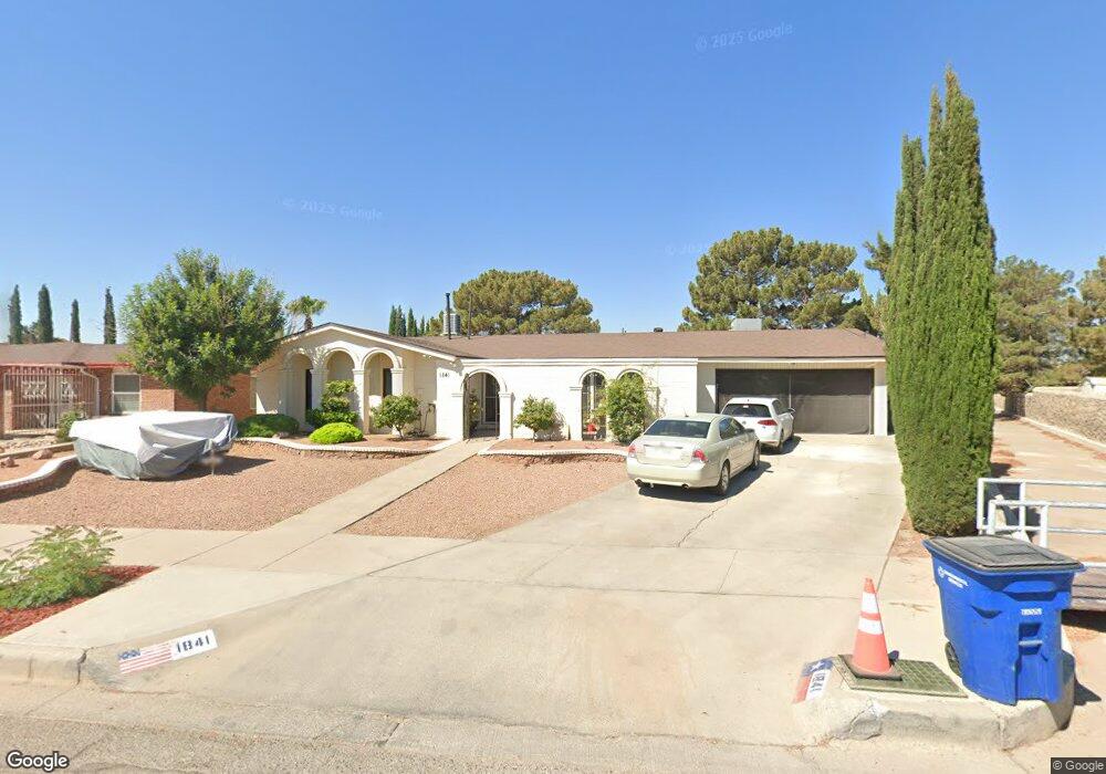
1841 Tommy Aaron Dr El Paso, TX 79936
Vista Del Sol NeighborhoodEstimated Value: $295,247 - $324,000
--
Bed
3
Baths
2,270
Sq Ft
$136/Sq Ft
Est. Value
About This Home
This home is located at 1841 Tommy Aaron Dr, El Paso, TX 79936 and is currently estimated at $308,812, approximately $136 per square foot. 1841 Tommy Aaron Dr is a home located in El Paso County with nearby schools including Tierra Del Sol Elementary School, J M Hanks High School, and EL PASO LEADERSHIP ACADEMY - MIDDLE EAST.
Ownership History
Date
Name
Owned For
Owner Type
Purchase Details
Closed on
May 29, 2003
Sold by
Rivera Mirabal Julieta and Mirabal Jose Solomon
Bought by
Garcia Rogelio and Beltran Arlene
Current Estimated Value
Home Financials for this Owner
Home Financials are based on the most recent Mortgage that was taken out on this home.
Original Mortgage
$125,504
Outstanding Balance
$53,163
Interest Rate
5.56%
Mortgage Type
Purchase Money Mortgage
Estimated Equity
$255,649
Purchase Details
Closed on
Dec 21, 1994
Sold by
Hardy Thomas Edward and Hardy Cecilia Dolores
Bought by
Mirabal Jose Solomon
Home Financials for this Owner
Home Financials are based on the most recent Mortgage that was taken out on this home.
Original Mortgage
$81,000
Interest Rate
9.07%
Mortgage Type
Assumption
Create a Home Valuation Report for This Property
The Home Valuation Report is an in-depth analysis detailing your home's value as well as a comparison with similar homes in the area
Home Values in the Area
Average Home Value in this Area
Purchase History
| Date | Buyer | Sale Price | Title Company |
|---|---|---|---|
| Garcia Rogelio | -- | -- | |
| Mirabal Jose Solomon | -- | -- |
Source: Public Records
Mortgage History
| Date | Status | Borrower | Loan Amount |
|---|---|---|---|
| Open | Garcia Rogelio | $125,504 | |
| Previous Owner | Mirabal Jose Solomon | $81,000 |
Source: Public Records
Tax History Compared to Growth
Tax History
| Year | Tax Paid | Tax Assessment Tax Assessment Total Assessment is a certain percentage of the fair market value that is determined by local assessors to be the total taxable value of land and additions on the property. | Land | Improvement |
|---|---|---|---|---|
| 2025 | $4,035 | $239,925 | -- | -- |
| 2024 | $4,035 | $218,114 | -- | -- |
| 2023 | $4,035 | $198,285 | $0 | $0 |
| 2022 | $4,162 | $180,259 | $0 | $0 |
| 2021 | $4,782 | $192,162 | $33,171 | $158,991 |
| 2020 | $4,225 | $133,752 | $30,109 | $103,643 |
| 2018 | $4,096 | $131,715 | $30,109 | $101,606 |
| 2017 | $3,815 | $124,796 | $30,109 | $94,687 |
| 2016 | $3,493 | $114,275 | $30,109 | $84,166 |
| 2015 | $2,774 | $114,275 | $30,109 | $84,166 |
| 2014 | $2,774 | $117,220 | $30,109 | $87,111 |
Source: Public Records
Map
Nearby Homes
- 1868 Tom Bolt Dr
- 1817 Hugh Royer Place
- 1913 Seagull Dr
- 1804 Jerry Abbott St
- 1739 Jerry Abbott St
- 1901 Bobby Jones Dr
- 11204 Bob Mitchell Dr
- 2001 Bobby Jones Dr Unit A
- 1703 Robert Wynn St
- 2009 Bobby Jones Dr Unit B
- 11016 Bob Stone Dr
- 11012 Bob Stone Dr
- 11013 Bob Stone Dr
- 1700 Jerry Abbott St
- 1617 Tommy Aaron Dr
- 2604 Anise Dr
- 1607 Tommy Aaron Dr
- 2101 E Glen Dr
- 11157 Leo Collins Dr
- 11262 Enid Wilson Ln
- 1837 Tommy Aaron Dr
- 1845 Tommy Aaron Dr
- 1832 Tom Bolt Dr
- 1836 Tom Bolt Dr
- 1828 Tom Bolt Dr
- 1833 Tommy Aaron Dr
- 1840 Tom Bolt Dr
- 1824 Tom Bolt Dr
- 1849 Tommy Aaron Dr
- 1844 Tom Bolt Dr
- 1829 Tommy Aaron Dr
- 1820 Tom Bolt Dr
- 1853 Tommy Aaron Dr
- 1831 Tom Bolt Dr
- 1827 Tom Bolt Dr
- 1848 Tom Bolt Dr
- 1835 Tom Bolt Dr
- 1825 Tommy Aaron Dr
- 1823 Tom Bolt Dr
- 1837 Tom Bolt Dr