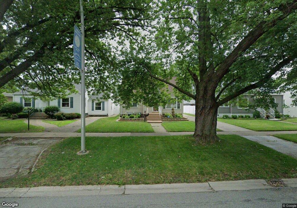
18417 Burnham Ave Lansing, IL 60438
Estimated Value: $187,341 - $274,000
3
Beds
1
Bath
1,596
Sq Ft
$148/Sq Ft
Est. Value
About This Home
This home is located at 18417 Burnham Ave, Lansing, IL 60438 and is currently estimated at $236,085, approximately $147 per square foot. 18417 Burnham Ave is a home located in Cook County with nearby schools including Coolidge Elementary School, Memorial Jr High School, and Thornton Fractnl So High School.
Ownership History
Date
Name
Owned For
Owner Type
Purchase Details
Closed on
Aug 29, 2024
Sold by
Newcomer Maria and Marshall Michael J
Bought by
Oliver Tashawnt
Current Estimated Value
Home Financials for this Owner
Home Financials are based on the most recent Mortgage that was taken out on this home.
Original Mortgage
$270,630
Outstanding Balance
$266,726
Interest Rate
6.73%
Mortgage Type
New Conventional
Estimated Equity
-$30,641
Purchase Details
Closed on
Jul 25, 2016
Sold by
Keen Michael A and Keen Jaynellen
Bought by
Newcorner Maria
Home Financials for this Owner
Home Financials are based on the most recent Mortgage that was taken out on this home.
Original Mortgage
$108,300
Interest Rate
4.12%
Mortgage Type
New Conventional
Create a Home Valuation Report for This Property
The Home Valuation Report is an in-depth analysis detailing your home's value as well as a comparison with similar homes in the area
Home Values in the Area
Average Home Value in this Area
Purchase History
We collect this data history from publicly available records. To have your information removed, we recommend requesting removal directly through your county’s website.
| Date | Buyer | Sale Price | Title Company |
|---|---|---|---|
| Oliver Tashawnt | $279,000 | Fidelity National Title | |
| Newcorner Maria | $114,000 | Chicago Title Insurance Comp |
Source: Public Records
Mortgage History
We collect this data history from publicly available records. To have your information removed, we recommend requesting removal directly through your county’s website.
| Date | Status | Borrower | Loan Amount |
|---|---|---|---|
| Open | Oliver Tashawnt | $270,630 | |
| Previous Owner | Newcorner Maria | $108,300 |
Source: Public Records
Tax History
| Year | Tax Paid | Tax Assessment Tax Assessment Total Assessment is a certain percentage of the fair market value that is determined by local assessors to be the total taxable value of land and additions on the property. | Land | Improvement |
|---|---|---|---|---|
| 2025 | $4,302 | $11,213 | $1,719 | $9,494 |
| 2024 | $4,302 | $11,213 | $1,719 | $9,494 |
| 2023 | $2,528 | $11,213 | $1,719 | $9,494 |
| 2022 | $2,528 | $6,285 | $1,484 | $4,801 |
| 2021 | $2,908 | $6,931 | $1,484 | $5,447 |
| 2020 | $2,792 | $6,931 | $1,484 | $5,447 |
| 2019 | $2,892 | $7,480 | $1,250 | $6,230 |
| 2018 | $2,836 | $7,480 | $1,250 | $6,230 |
| 2017 | $2,887 | $7,480 | $1,250 | $6,230 |
| 2016 | $3,258 | $7,706 | $1,171 | $6,535 |
| 2015 | $2,982 | $7,706 | $1,171 | $6,535 |
| 2014 | $2,960 | $7,706 | $1,171 | $6,535 |
| 2013 | $2,828 | $8,122 | $1,171 | $6,951 |
Source: Public Records
Map
Nearby Homes
- 18315 Burnham Ave Unit 204
- 18289 Burnham Ave
- 3250 186th St
- 3235 186th St
- 3310 186th St
- 18263 Greenbay Ave
- 3359 Ann St
- 3051 183rd St
- 3256 Otto St
- 3333 186th St
- 18508 Chicago Ave
- 3225 Otto St
- 18449 Ridgewood Ave
- 18514 Ridgewood Ave
- 18409 Oakwood Ave
- 18655 Sherman St
- 18724 Sherman St
- 18644 William St
- 18237 Oakwood Ave
- 19510 Burnham Ave
- 18417 Burnham Ave
- 18421 Burnham Ave
- 18413 Burnham Ave
- 18413 Burnham Ave
- 18425 Burnham Ave
- 18425 Burnham Ave
- 18409 Burnham Ave
- 18433 Burnham Ave
- 18433 Burnham Ave
- 18418 Walter St
- 18424 Walter St
- 18416 Walter St
- 3217 Ann St
- 18441 Burnham Ave
- 18441 Burnham Ave
- 18441 Burnham Ave
- 18401 Burnham Ave
- 18428 Walter St
- 3221 Ann St
- 18434 Walter St
Your Personal Tour Guide
Ask me questions while you tour the home.