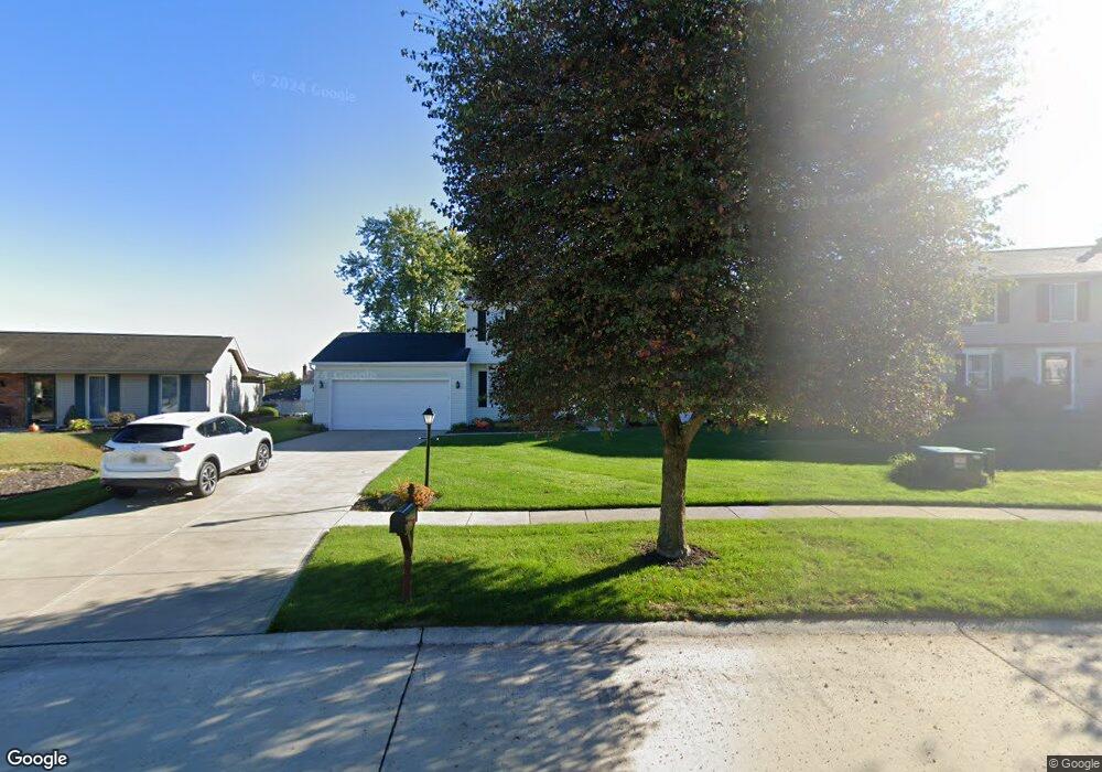
18419 Butternut Cir Strongsville, OH 44136
Estimated Value: $379,840 - $405,000
4
Beds
3
Baths
2,194
Sq Ft
$180/Sq Ft
Est. Value
About This Home
This home is located at 18419 Butternut Cir, Strongsville, OH 44136 and is currently estimated at $394,960, approximately $180 per square foot. 18419 Butternut Cir is a home located in Cuyahoga County with nearby schools including Strongsville High School, Royal Redeemer Lutheran School, and Sts Joseph & John Interparochial School.
Ownership History
Date
Name
Owned For
Owner Type
Purchase Details
Closed on
Apr 5, 1990
Sold by
Ludwig Gary R
Bought by
Tocci Dennis
Current Estimated Value
Purchase Details
Closed on
Jul 20, 1988
Sold by
Trail Richard E
Bought by
Ludwig Gary R
Purchase Details
Closed on
Jan 30, 1985
Sold by
Melillo Donald J
Bought by
Trail Richard E
Purchase Details
Closed on
Jan 20, 1984
Sold by
Parenti James S
Bought by
Melillo Donald J
Purchase Details
Closed on
Jul 1, 1981
Bought by
Parenti James S
Purchase Details
Closed on
Nov 12, 1980
Bought by
Newbury Group Inc
Purchase Details
Closed on
Jan 1, 1979
Bought by
North East Land Co
Create a Home Valuation Report for This Property
The Home Valuation Report is an in-depth analysis detailing your home's value as well as a comparison with similar homes in the area
Home Values in the Area
Average Home Value in this Area
Purchase History
| Date | Buyer | Sale Price | Title Company |
|---|---|---|---|
| Tocci Dennis | $141,000 | -- | |
| Ludwig Gary R | $127,000 | -- | |
| Trail Richard E | $97,500 | -- | |
| Melillo Donald J | $95,500 | -- | |
| Parenti James S | $103,900 | -- | |
| Newbury Group Inc | $23,500 | -- | |
| North East Land Co | -- | -- |
Source: Public Records
Tax History Compared to Growth
Tax History
| Year | Tax Paid | Tax Assessment Tax Assessment Total Assessment is a certain percentage of the fair market value that is determined by local assessors to be the total taxable value of land and additions on the property. | Land | Improvement |
|---|---|---|---|---|
| 2024 | $4,910 | $104,580 | $22,610 | $81,970 |
| 2023 | $5,282 | $84,360 | $22,300 | $62,060 |
| 2022 | $5,244 | $84,350 | $22,300 | $62,060 |
| 2021 | $5,202 | $84,350 | $22,300 | $62,060 |
| 2020 | $4,819 | $69,130 | $18,270 | $50,860 |
| 2019 | $4,678 | $197,500 | $52,200 | $145,300 |
| 2018 | $4,178 | $69,130 | $18,270 | $50,860 |
| 2017 | $4,187 | $63,110 | $14,600 | $48,510 |
| 2016 | $4,153 | $63,110 | $14,600 | $48,510 |
| 2015 | $4,211 | $63,110 | $14,600 | $48,510 |
| 2014 | $4,211 | $63,110 | $14,600 | $48,510 |
Source: Public Records
Map
Nearby Homes
- 14132 Walking Stick Way
- 14558 Drake Rd
- 13448 Compass Point Dr
- 13335 Tradewinds Dr
- 18987 Laurell Cir
- 19252 Hidden Woods Ln
- 14292 Trenton Ave
- 19297 Hunt Rd
- 14985 Camden Cir
- 18229 Howe Rd
- 19813 Cross Trail S
- 17130 Golden Star Dr
- 15188 Trails Landing
- 19694 Benbow Rd
- 19740 Benbow Rd
- 3137 Blackburn Ln
- 15604-REAR Boston Rd
- 106 Briarleigh Dr
- 15772 Boston Rd
- 18680 Bennett Rd
- 18381 Butternut Cir
- 18457 Butternut Cir
- 13943 Walking Stick Way
- 13929 Walking Stick Way
- 18343 Butternut Cir
- 18495 Butternut Cir
- 13985 Walking Stick Way
- 13915 Walking Stick Way
- 18456 Butternut Cir
- 13999 Walking Stick Way
- 18532 Butternut Cir
- 18533 Butternut Cir
- 14027 Walking Stick Way
- 13942 E Bend Dr
- 18344 Butternut Cir
- 13980 E Bend Dr
- 13904 E Bend Dr
- 18570 Butternut Cir
- 14093 Walking Stick Way
- 18571 Butternut Cir