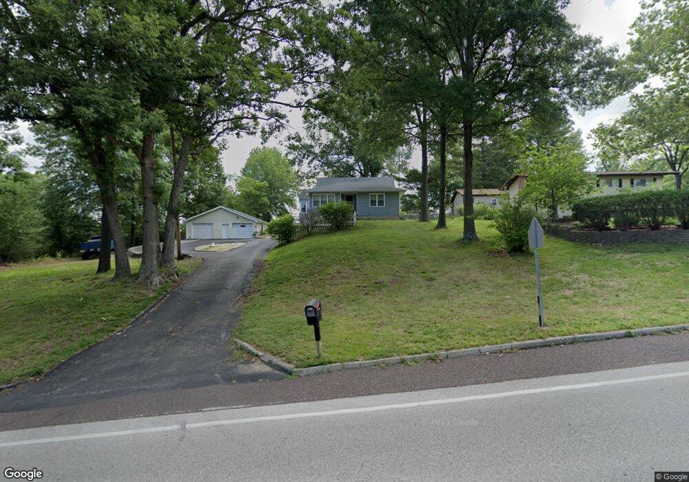
1842 Missouri State Rd Arnold, MO 63010
Estimated Value: $222,873 - $256,000
3
Beds
2
Baths
1,201
Sq Ft
$201/Sq Ft
Est. Value
About This Home
This home is located at 1842 Missouri State Rd, Arnold, MO 63010 and is currently estimated at $241,468, approximately $201 per square foot. 1842 Missouri State Rd is a home located in Jefferson County with nearby schools including Clyde Hamrick Elementary School, Ridgewood Middle School, and Fox Senior High School.
Ownership History
Date
Name
Owned For
Owner Type
Purchase Details
Closed on
Sep 24, 2008
Sold by
Dohack Christopher J and Dohack Terri K
Bought by
Roberts David Paul and Roberts Laurine E
Current Estimated Value
Home Financials for this Owner
Home Financials are based on the most recent Mortgage that was taken out on this home.
Original Mortgage
$171,311
Outstanding Balance
$114,218
Interest Rate
6.57%
Mortgage Type
FHA
Estimated Equity
$127,250
Purchase Details
Closed on
Mar 16, 2001
Sold by
Martin Robert H
Bought by
Lockwood Carla D
Home Financials for this Owner
Home Financials are based on the most recent Mortgage that was taken out on this home.
Original Mortgage
$125,950
Interest Rate
6.95%
Mortgage Type
FHA
Purchase Details
Closed on
May 19, 1997
Sold by
Arnold Community Christian Church
Bought by
Martin Robert H
Create a Home Valuation Report for This Property
The Home Valuation Report is an in-depth analysis detailing your home's value as well as a comparison with similar homes in the area
Home Values in the Area
Average Home Value in this Area
Purchase History
| Date | Buyer | Sale Price | Title Company |
|---|---|---|---|
| Roberts David Paul | -- | Investors Title Co | |
| Lockwood Carla D | -- | Commonwealth Title | |
| Martin Robert H | -- | Commonwealth Title |
Source: Public Records
Mortgage History
| Date | Status | Borrower | Loan Amount |
|---|---|---|---|
| Open | Roberts David Paul | $171,311 | |
| Previous Owner | Lockwood Carla D | $125,950 |
Source: Public Records
Tax History
| Year | Tax Paid | Tax Assessment Tax Assessment Total Assessment is a certain percentage of the fair market value that is determined by local assessors to be the total taxable value of land and additions on the property. | Land | Improvement |
|---|---|---|---|---|
| 2025 | $1,217 | $18,700 | $2,800 | $15,900 |
| 2024 | $1,217 | $17,400 | $2,800 | $14,600 |
| 2023 | $1,217 | $17,400 | $2,800 | $14,600 |
| 2022 | $1,240 | $17,400 | $2,800 | $14,600 |
| 2021 | $1,241 | $17,400 | $2,800 | $14,600 |
| 2020 | $1,180 | $15,700 | $2,500 | $13,200 |
| 2019 | $1,184 | $15,700 | $2,500 | $13,200 |
| 2018 | $1,176 | $15,700 | $2,500 | $13,200 |
| 2017 | $1,194 | $15,700 | $2,500 | $13,200 |
| 2016 | $1,015 | $14,300 | $2,500 | $11,800 |
| 2015 | $1,017 | $14,300 | $2,500 | $11,800 |
| 2013 | -- | $13,600 | $2,300 | $11,300 |
Source: Public Records
Map
Nearby Homes
- 1713 Rhythm Ln
- 1806 Melody Ln
- 1561 Archer Dr
- 1522 Berry Ct
- 1915 Key West Dr
- 2061 Ridgeway Dr
- 1859 Engle Dr
- 1924 Jennifer Lynn Ln
- 1402 Scenic Dr
- 1973 Ronnie
- 1627 Trinity Cir
- 1963 Maple Ln
- 2121 Blossom Ln
- 0000 Botanical Dr
- 2107 Henley Woods Dr
- 2282 Benton Dr
- 2558 Frederitzi Ln
- 1035 Sable Ln
- 3301 Lark Dr
- 2766 Harmony Hills Dr
- 3 Anthony Ct
- 354 Oak Ridge Pkwy
- 5 Anthony Ct
- 1 Anthony Ct
- 352 Oak Ridge Pkwy
- 359 Oak Ridge Pkwy
- 1845 Missouri State Rd
- 357 Oak Ridge Pkwy
- 1826 Missouri State Rd
- 355 Oak Ridge Pkwy
- 348 Oak Ridge Pkwy
- 7 Anthony Ct
- 346 Oak Ridge Pkwy
- 351 Oak Ridge Pkwy
- 349 Oak Ridge Pkwy
- 1811 Holiday Valley Dr
- 6 Anthony Ct
- 1851 Missouri State Rd
- 5 Crosswinds Dr
- 1820 Missouri State Rd
Your Personal Tour Guide
Ask me questions while you tour the home.