Estimated Value: $224,000 - $377,615
4
Beds
1
Bath
1,224
Sq Ft
$246/Sq Ft
Est. Value
About This Home
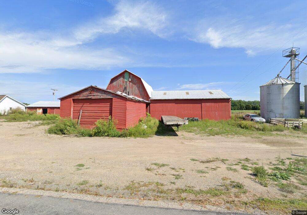
This home is located at 1842 Simmons Rd, Mason, MI 48854 and is currently estimated at $300,808, approximately $245 per square foot. 1842 Simmons Rd is a home located in Ingham County with nearby schools including Mason High School.
Ownership History
Date
Name
Owned For
Owner Type
Purchase Details
Closed on
Jan 22, 2004
Sold by
Force Stanley W and Force Letty L
Bought by
Austin Donald L
Current Estimated Value
Home Financials for this Owner
Home Financials are based on the most recent Mortgage that was taken out on this home.
Original Mortgage
$204,000
Outstanding Balance
$95,270
Interest Rate
5.88%
Mortgage Type
Purchase Money Mortgage
Estimated Equity
$205,538
Purchase Details
Closed on
Nov 7, 2003
Sold by
Force Wilson and Force Pauline
Bought by
Force Stanley W and Force Letty L
Home Financials for this Owner
Home Financials are based on the most recent Mortgage that was taken out on this home.
Original Mortgage
$185,000
Interest Rate
1.9%
Mortgage Type
Balloon
Create a Home Valuation Report for This Property
The Home Valuation Report is an in-depth analysis detailing your home's value as well as a comparison with similar homes in the area
Home Values in the Area
Average Home Value in this Area
Purchase History
| Date | Buyer | Sale Price | Title Company |
|---|---|---|---|
| Austin Donald L | $250,000 | -- | |
| Force Stanley W | $131,255 | -- |
Source: Public Records
Mortgage History
| Date | Status | Borrower | Loan Amount |
|---|---|---|---|
| Open | Austin Donald L | $204,000 | |
| Previous Owner | Force Stanley W | $185,000 |
Source: Public Records
Tax History Compared to Growth
Tax History
| Year | Tax Paid | Tax Assessment Tax Assessment Total Assessment is a certain percentage of the fair market value that is determined by local assessors to be the total taxable value of land and additions on the property. | Land | Improvement |
|---|---|---|---|---|
| 2025 | $5,135 | $188,700 | $73,700 | $115,000 |
| 2024 | $30 | $179,100 | $71,200 | $107,900 |
| 2023 | $4,771 | $164,700 | $71,200 | $93,500 |
| 2022 | $4,521 | $151,400 | $62,800 | $88,600 |
| 2021 | $4,430 | $150,700 | $56,200 | $94,500 |
| 2020 | $4,322 | $141,300 | $56,200 | $85,100 |
| 2019 | $4,193 | $132,500 | $56,200 | $76,300 |
| 2018 | $4,131 | $111,900 | $43,100 | $68,800 |
| 2017 | $3,673 | $111,900 | $43,100 | $68,800 |
| 2016 | -- | $109,100 | $39,700 | $69,400 |
| 2015 | -- | $105,600 | $79,305 | $26,295 |
| 2014 | -- | $107,300 | $79,300 | $28,000 |
Source: Public Records
Map
Nearby Homes
- 1234 Lamb Rd
- 990 Windjammer Ct
- 2995 Harper Rd
- 411 Bubbling Springs Ct
- 871 Dart Rd
- 0 Sanctuary
- 2004 Timberview Dr
- 32 Aviemore Dr Unit 32
- 3555 Breezy Point Dr
- 1572 Wenonah Dr
- 3588 Autumnwood Ln
- 3215 Sandhill Rd
- 202 Stratford Dr
- 2073 Birch Bluff Dr
- 3660 Powderhorn Dr
- 3624 W Arbutus Dr
- 12 Atrium Dr
- 2083 Fox Hollow Dr
- 3578 Stagecoach Dr
- 117 Lawton St
- 0 Simmons Lot H
- 0000 Simmons Parcel E F Rd
- 0 Simmons Parcel A Rd
- 00 Simmons Parcel C Rd
- 0 Rd Unit 277671
- 000 Simmons Parcel Rd N
- 1736 Simmons Rd
- 0 Dobie Rd Unit 228304
- 0 Dobie Rd Unit 214474
- 0 Dobie Rd Unit 215391
- 0 Dobie Rd Unit 630000214474
- 0 Dobie Rd Unit 630000241069
- 0 Dobie Rd Unit L58513
- 0 Dobie Rd Unit L69064
- 0 Dobie Rd Unit L75628
- 0 Dobie Rd Unit L245363
- 0 Dobie Rd Unit 245636
- 0 Dobie Rd Unit 72335
- 0 Dobie Rd Unit 72338
- 0 Dobie Rd Unit 83520