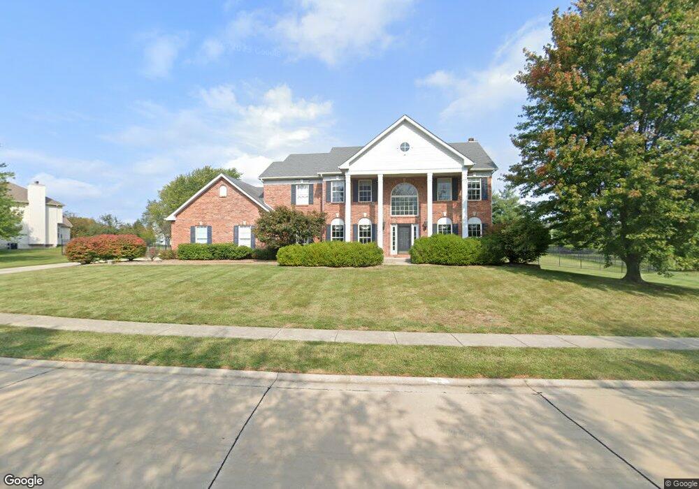
1843 Messinger Trail Belleville, IL 62226
Estimated Value: $479,000 - $606,000
4
Beds
4
Baths
3,100
Sq Ft
$176/Sq Ft
Est. Value
About This Home
This home is located at 1843 Messinger Trail, Belleville, IL 62226 and is currently estimated at $544,449, approximately $175 per square foot. 1843 Messinger Trail is a home located in St. Clair County with nearby schools including Whiteside Elementary School, Whiteside Middle School, and Elite Scholars STEAM Academy.
Ownership History
Date
Name
Owned For
Owner Type
Purchase Details
Closed on
Dec 9, 2011
Sold by
Horton Jeffrey J and Horton Angelique D
Bought by
Burns Michael R and Burns Linda K
Current Estimated Value
Home Financials for this Owner
Home Financials are based on the most recent Mortgage that was taken out on this home.
Original Mortgage
$280,000
Interest Rate
4.25%
Mortgage Type
Purchase Money Mortgage
Create a Home Valuation Report for This Property
The Home Valuation Report is an in-depth analysis detailing your home's value as well as a comparison with similar homes in the area
Home Values in the Area
Average Home Value in this Area
Purchase History
| Date | Buyer | Sale Price | Title Company |
|---|---|---|---|
| Burns Michael R | $332,500 | Freedom Title |
Source: Public Records
Mortgage History
| Date | Status | Borrower | Loan Amount |
|---|---|---|---|
| Closed | Burns Michael R | $280,000 |
Source: Public Records
Tax History
| Year | Tax Paid | Tax Assessment Tax Assessment Total Assessment is a certain percentage of the fair market value that is determined by local assessors to be the total taxable value of land and additions on the property. | Land | Improvement |
|---|---|---|---|---|
| 2024 | $10,318 | $164,330 | $27,100 | $137,230 |
| 2023 | $9,593 | $143,054 | $26,725 | $116,329 |
| 2022 | $8,312 | $130,286 | $24,340 | $105,946 |
| 2021 | $8,136 | $124,939 | $23,341 | $101,598 |
| 2020 | $7,870 | $116,354 | $21,737 | $94,617 |
| 2019 | $7,872 | $120,215 | $23,735 | $96,480 |
| 2018 | $7,705 | $117,146 | $23,129 | $94,017 |
| 2017 | $7,770 | $114,028 | $22,513 | $91,515 |
| 2016 | $7,734 | $110,098 | $21,737 | $88,361 |
| 2014 | $6,722 | $104,490 | $23,910 | $80,580 |
| 2013 | $7,653 | $104,490 | $23,910 | $80,580 |
Source: Public Records
Map
Nearby Homes
- 517 E Waters Edge Dr
- 3434 Whistling Cove
- 15 Sandpiper Dr
- 1022 Barteau Dr
- 40 Clinton Hill Dr
- 1232 Carleton Ln
- 1214 Carleton Ln
- 4285 Red Field Dr
- 330 Radcliff Rd
- 5194 Depaul Dr
- 4480 Biverton Dr
- 2277 Wellington Dr
- 9 Lake Christine Dr
- 5231 Duke Dr
- 984 Northwestern Ave
- 739 Oxen Dr
- 3804 Tanbark Dr
- 6 & 10 Country Hill Ln
- 5352 Tulane Ct
- 2011 Lebanon Ave
- 1849 Messinger Trail
- 1837 Messinger Trail
- 4091 Clintonview Ct
- 4094 Edmar Ct
- 1903 Messinger Trail
- 4110 Old Schoolhouse Ct
- 4104 Old Schoolhouse Ct
- 4095 Edmar Ct
- 4114 Old Schoolhouse Ct
- 1902 Messinger Trail
- 4085 Clintonview Ct
- 4088 Edmar Ct
- 4089 Edmar Ct
- 4116 Old Schoolhouse Ct
- 1830 Messinger Trail
- 1909 Messinger Trail
- 4086 Clintonview Ct
- 4074 Clinton View Ct
- 4079 Clintonview Ct
- 1908 Messinger Trail
Your Personal Tour Guide
Ask me questions while you tour the home.