
Seller's Agent in 2026
Daniel Weber
Sally Bowman Real Estate
(612) 669-0302
1 in this area
105 Total Sales
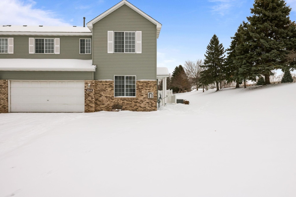


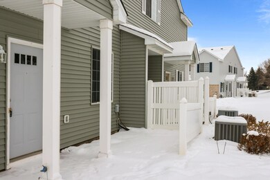
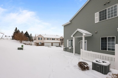
A Townhome that has it all. 3 Spacious Bedrooms, End unit with Patio and Green Space, New Granite Countertops with Large 2 Tier breakfast bar, fireplace, new flooring, paint and lighting throughout, new stainless steel kitchen appliances. Upstairs walk thru primary bath is big. New roof and siding and soo much more. Worth seeing for sure.
| Date | Type | Sale Price | Title Company |
|---|---|---|---|
| Warranty Deed | $279,900 | Legacy Title | |
| Warranty Deed | $190,000 | Legacy Title | |
| Warranty Deed | $116,000 | -- | |
| Warranty Deed | $131,200 | -- |
| Date | Status | Loan Amount | Loan Type |
|---|---|---|---|
| Open | $271,503 | New Conventional | |
| Previous Owner | $111,302 | FHA |
| Date | Event | Price | List to Sale | Price per Sq Ft |
|---|---|---|---|---|
| 02/11/2026 02/11/26 | Sold | $279,900 | 0.0% | $179 / Sq Ft |
| 01/20/2026 01/20/26 | Pending | -- | -- | -- |
| 12/12/2025 12/12/25 | For Sale | $279,900 | -- | $179 / Sq Ft |
| Year | Tax Paid | Tax Assessment Tax Assessment Total Assessment is a certain percentage of the fair market value that is determined by local assessors to be the total taxable value of land and additions on the property. | Land | Improvement |
|---|---|---|---|---|
| 2025 | $2,446 | $252,600 | $76,100 | $176,500 |
| 2024 | $2,488 | $241,000 | $72,400 | $168,600 |
| 2023 | $2,548 | $237,400 | $71,000 | $166,400 |
| 2022 | $2,524 | $239,100 | $72,700 | $166,400 |
| 2021 | $2,192 | $204,700 | $57,000 | $147,700 |
| 2020 | $2,372 | $195,800 | $47,300 | $148,500 |
| 2019 | $2,252 | $186,600 | $45,000 | $141,600 |
| 2018 | $2,026 | $0 | $0 | $0 |
| 2016 | $1,842 | $0 | $0 | $0 |
| 2014 | -- | $0 | $0 | $0 |
Seller's Agent in 2026
Daniel Weber
Sally Bowman Real Estate
(612) 669-0302
1 in this area
105 Total Sales
Buyer's Agent in 2026
Ryan Olson
Pemberton RE
(612) 280-9870
6 in this area
76 Total Sales
Source: NorthstarMLS
MLS Number: 6825987
APN: 27-265-081-0
Disclaimer: Certain information contained herein is derived from information provided by parties other than Homes.com. All information provided is deemed reliable, but is not guaranteed to be accurate and should be independently verified.
![]() Based on information submitted to the MLS GRID. All data is obtained from various sources and may not have been verified by broker or MLS GRID. Supplied Open House Information is subject to change without notice. All information should be independently reviewed and verified for accuracy. Properties may or may not be listed by the office/agent presenting the information. Some IDX listings have been excluded from this website.
Based on information submitted to the MLS GRID. All data is obtained from various sources and may not have been verified by broker or MLS GRID. Supplied Open House Information is subject to change without notice. All information should be independently reviewed and verified for accuracy. Properties may or may not be listed by the office/agent presenting the information. Some IDX listings have been excluded from this website.
Based on information submitted to the MLS GRID
Ask me questions while you tour the home.