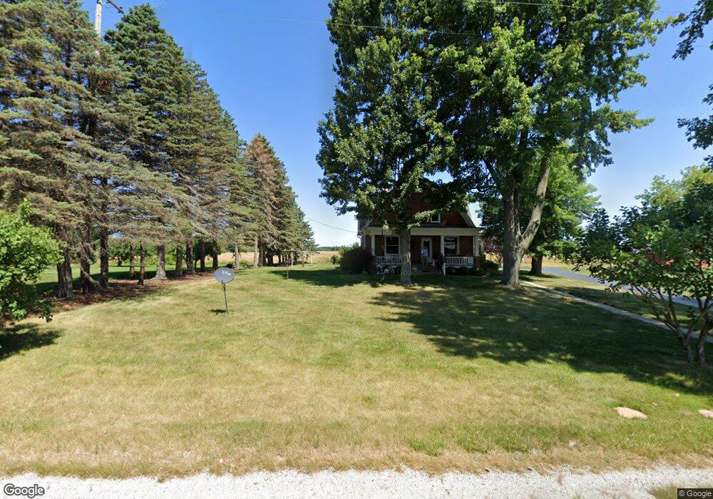
1844 W River Rd Midland, MI 48642
Estimated Value: $219,675 - $255,000
Studio
--
Bath
1,890
Sq Ft
$123/Sq Ft
Est. Value
About This Home
This home is located at 1844 W River Rd, Midland, MI 48642 and is currently estimated at $231,669, approximately $122 per square foot. 1844 W River Rd is a home with nearby schools including Auburn Elementary School, Western Middle School, and Bay City Western High School.
Ownership History
Date
Name
Owned For
Owner Type
Purchase Details
Closed on
Jan 20, 2017
Sold by
Vogtmann Luanne C
Bought by
Menz Andrew and Menz Emily
Current Estimated Value
Home Financials for this Owner
Home Financials are based on the most recent Mortgage that was taken out on this home.
Original Mortgage
$108,000
Outstanding Balance
$53,813
Interest Rate
4.13%
Mortgage Type
New Conventional
Estimated Equity
$177,856
Purchase Details
Closed on
Feb 10, 2012
Sold by
Buechler Aron E and Buechler Rita C
Bought by
Buechler Aron E and Aron E Buechler Revocable Trust
Purchase Details
Closed on
Aug 20, 1997
Sold by
Vogtmann Leonard J and Vogtmann Luanne C
Bought by
Vogtmann Luanne C
Create a Home Valuation Report for This Property
The Home Valuation Report is an in-depth analysis detailing your home's value as well as a comparison with similar homes in the area
Purchase History
| Date | Buyer | Sale Price | Title Company |
|---|---|---|---|
| Menz Andrew | $135,000 | None Available | |
| Buechler Aron E | -- | None Available | |
| Vogtmann Luanne C | -- | -- | |
| Vogtmann, Luanne C Trust | -- | -- |
Source: Public Records
Mortgage History
| Date | Status | Borrower | Loan Amount |
|---|---|---|---|
| Open | Menz Andrew | $108,000 |
Source: Public Records
Tax History
| Year | Tax Paid | Tax Assessment Tax Assessment Total Assessment is a certain percentage of the fair market value that is determined by local assessors to be the total taxable value of land and additions on the property. | Land | Improvement |
|---|---|---|---|---|
| 2025 | $1,503 | $89,300 | $0 | $0 |
| 2024 | $1,460 | $76,300 | $0 | $0 |
| 2023 | $1,390 | $73,200 | $0 | $0 |
| 2022 | $2,280 | $68,400 | $0 | $0 |
| 2021 | $2,131 | $64,800 | $14,500 | $50,300 |
| 2020 | $2,183 | $62,450 | $14,500 | $47,950 |
| 2019 | $1,993 | $58,450 | $0 | $0 |
| 2018 | $1,948 | $55,700 | $0 | $0 |
| 2017 | $1,365 | $55,650 | $0 | $0 |
| 2016 | $1,350 | $39,950 | $0 | $39,950 |
| 2015 | $1,307 | $39,900 | $0 | $39,900 |
| 2014 | $1,307 | $43,600 | $0 | $43,600 |
Source: Public Records
Map
Nearby Homes
- 2082 W Parish Rd
- 4949 S Garfield Rd
- 0 W Beaver Rd
- 2258 S Nine Mile Rd
- 1324 Townline 14 Rd
- Lot B N Waldo
- Lot A N Waldo
- 234 N Garfield Rd
- 4455 N Ehlers Rd
- 2407 8 Mile Rd Unit 19
- 2454 Pajot Rd Unit 38
- 1404 Rumbaugh Ln
- 2444 Pajot Rd Unit 40
- 2437 Pajot Rd Unit 69
- 2458 E Birch Dr Unit 92
- 0 S Carter Unit 50201132
- 0 S Carter Unit 50201440
- 2406 Beech Dr
- 3697 S 11 Mile Rd
- 3121 Apple Ridge Ct
- 1845 W River Rd
- 1879 W River Rd
- 1797 W River Rd
- 1889 W River Rd
- 1785 W River Rd
- 1905 W River Rd
- 1740 W River Rd
- 1511 Carter Rd
- 1559 Carter Rd
- 1514 Carter Rd
- 1391 Carter Rd
- 1365 Carter Rd
- 1347 S Carter Rd
- 1347 Carter Rd
- 1659 Carter Rd
- 1319 Carter Rd
- 1318 Carter Rd
- 1313 Carter Rd
- 1308 Carter Rd
- 1309 Carter Rd
Your Personal Tour Guide
Ask me questions while you tour the home.