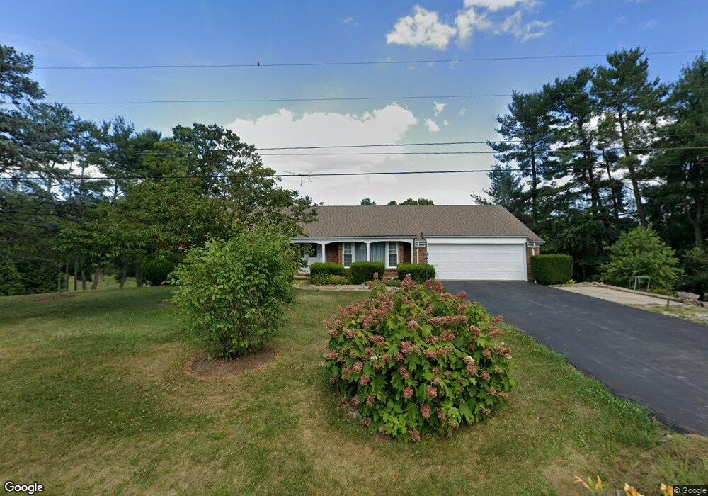
1844 Wayland Dr Winchester, VA 22601
Estimated Value: $506,821 - $575,000
4
Beds
4
Baths
3,812
Sq Ft
$143/Sq Ft
Est. Value
About This Home
This home is located at 1844 Wayland Dr, Winchester, VA 22601 and is currently estimated at $543,455, approximately $142 per square foot. 1844 Wayland Dr is a home located in Frederick County with nearby schools including Orchard View Elementary School, James Wood Middle School, and James Wood High School.
Ownership History
Date
Name
Owned For
Owner Type
Purchase Details
Closed on
Jul 18, 2024
Sold by
Haggerty Christopher L and Haggerty Luz N
Bought by
Haggerty Living Trust and Haggerty
Current Estimated Value
Purchase Details
Closed on
May 14, 2004
Sold by
Kropff Clement A
Bought by
Haggerty Christopher
Home Financials for this Owner
Home Financials are based on the most recent Mortgage that was taken out on this home.
Original Mortgage
$240,000
Interest Rate
5.47%
Mortgage Type
New Conventional
Create a Home Valuation Report for This Property
The Home Valuation Report is an in-depth analysis detailing your home's value as well as a comparison with similar homes in the area
Home Values in the Area
Average Home Value in this Area
Purchase History
| Date | Buyer | Sale Price | Title Company |
|---|---|---|---|
| Haggerty Living Trust | -- | None Listed On Document | |
| Haggerty Christopher | $300,000 | -- |
Source: Public Records
Mortgage History
| Date | Status | Borrower | Loan Amount |
|---|---|---|---|
| Previous Owner | Haggerty Christopher | $240,000 |
Source: Public Records
Tax History Compared to Growth
Tax History
| Year | Tax Paid | Tax Assessment Tax Assessment Total Assessment is a certain percentage of the fair market value that is determined by local assessors to be the total taxable value of land and additions on the property. | Land | Improvement |
|---|---|---|---|---|
| 2025 | $2,341 | $487,740 | $59,000 | $428,740 |
| 2024 | $1,055 | $413,800 | $54,500 | $359,300 |
| 2023 | $2,110 | $413,800 | $54,500 | $359,300 |
| 2022 | $2,248 | $368,600 | $93,500 | $275,100 |
| 2021 | $2,248 | $368,600 | $93,500 | $275,100 |
| 2020 | $2,016 | $330,500 | $93,500 | $237,000 |
| 2019 | $2,016 | $330,500 | $93,500 | $237,000 |
| 2018 | $1,878 | $307,900 | $93,500 | $214,400 |
| 2017 | $1,847 | $307,900 | $93,500 | $214,400 |
| 2016 | $1,700 | $283,300 | $81,000 | $202,300 |
| 2015 | $1,586 | $283,300 | $81,000 | $202,300 |
| 2014 | $793 | $268,700 | $81,000 | $187,700 |
Source: Public Records
Map
Nearby Homes
- 101 Dutton Place
- 107 Okeefe Dr
- 428 Westside Station Dr
- 420 Westside Station Dr
- 419 Westside Station Dr
- 1020 Breckinridge Ln
- 106 Homer Dr
- 1504 Brookdale Ct
- 1517 Brookdale Ct
- 1721 Amherst St
- 823 Armistead St
- 1415 Ramseur Ln
- 1419 Ramseur Ln
- 1332 Ramseur Ln
- 801 Armistead St
- 1819 Reese Ct
- 1818 Blythe Way
- 1810 Blythe Way
- 1822 Blythe Way
- 1814 Blythe Way
- 1832 Wayland Dr
- 1856 Wayland Dr
- 1853 Wayland Dr
- 1849 Wayland Dr
- 1820 Wayland Dr
- 1868 Wayland Dr
- 1881 Wayland
- 105 Weitzell Place
- 104 Dutton Place
- 1808 Wayland Dr
- 102 Cambridge Place
- 1880 Wayland Dr
- 104 Weitzell Place
- 619 Merrimans Ln
- 105 Dutton Place
- 106 Weitzell Place
- 108 Cambridge Place
- 101 Cambridge Place
- 1889 Wayland Dr
- 617 Merrimans Ln