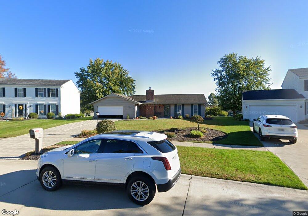
18457 Butternut Cir Strongsville, OH 44136
Estimated Value: $347,000 - $389,000
3
Beds
2
Baths
2,148
Sq Ft
$172/Sq Ft
Est. Value
About This Home
This home is located at 18457 Butternut Cir, Strongsville, OH 44136 and is currently estimated at $370,457, approximately $172 per square foot. 18457 Butternut Cir is a home located in Cuyahoga County with nearby schools including Strongsville High School, Royal Redeemer Lutheran School, and Sts Joseph & John Interparochial School.
Ownership History
Date
Name
Owned For
Owner Type
Purchase Details
Closed on
Sep 10, 1987
Sold by
Milia Matthew and Rebecca Ann
Bought by
Novak James S and Novak Diana L
Current Estimated Value
Purchase Details
Closed on
Feb 28, 1986
Sold by
Richard Lee W
Bought by
Milia Matthew and Rebecca Ann
Purchase Details
Closed on
Oct 26, 1984
Sold by
Hosko James Joseph
Bought by
Richard Lee W
Purchase Details
Closed on
Oct 1, 1980
Bought by
Hosko James Joseph
Purchase Details
Closed on
Aug 27, 1979
Bought by
Hunting Valley Builders Inc
Purchase Details
Closed on
Jan 1, 1979
Bought by
North East Land Co
Create a Home Valuation Report for This Property
The Home Valuation Report is an in-depth analysis detailing your home's value as well as a comparison with similar homes in the area
Home Values in the Area
Average Home Value in this Area
Purchase History
| Date | Buyer | Sale Price | Title Company |
|---|---|---|---|
| Novak James S | $105,000 | -- | |
| Milia Matthew | $88,000 | -- | |
| Richard Lee W | $96,000 | -- | |
| Hosko James Joseph | $88,900 | -- | |
| Hunting Valley Builders Inc | -- | -- | |
| North East Land Co | -- | -- |
Source: Public Records
Tax History Compared to Growth
Tax History
| Year | Tax Paid | Tax Assessment Tax Assessment Total Assessment is a certain percentage of the fair market value that is determined by local assessors to be the total taxable value of land and additions on the property. | Land | Improvement |
|---|---|---|---|---|
| 2024 | $4,836 | $103,005 | $22,925 | $80,080 |
| 2023 | $5,131 | $81,940 | $22,540 | $59,400 |
| 2022 | $5,093 | $81,940 | $22,540 | $59,400 |
| 2021 | $5,053 | $81,940 | $22,540 | $59,400 |
| 2020 | $4,682 | $67,170 | $18,480 | $48,690 |
| 2019 | $4,545 | $191,900 | $52,800 | $139,100 |
| 2018 | $4,074 | $67,170 | $18,480 | $48,690 |
| 2017 | $4,098 | $61,780 | $14,770 | $47,010 |
| 2016 | $4,065 | $61,780 | $14,770 | $47,010 |
| 2015 | $4,123 | $61,780 | $14,770 | $47,010 |
| 2014 | $4,123 | $61,780 | $14,770 | $47,010 |
Source: Public Records
Map
Nearby Homes
- 14132 Walking Stick Way
- 14558 Drake Rd
- 13448 Compass Point Dr
- 13335 Tradewinds Dr
- 18987 Laurell Cir
- 19252 Hidden Woods Ln
- 14292 Trenton Ave
- 19297 Hunt Rd
- 14985 Camden Cir
- 18229 Howe Rd
- 19813 Cross Trail S
- 17130 Golden Star Dr
- 15188 Trails Landing
- 19694 Benbow Rd
- 19740 Benbow Rd
- 3137 Blackburn Ln
- 15604-REAR Boston Rd
- 106 Briarleigh Dr
- 15772 Boston Rd
- 18680 Bennett Rd
- 18419 Butternut Cir
- 18495 Butternut Cir
- 13985 Walking Stick Way
- 13999 Walking Stick Way
- 18381 Butternut Cir
- 18533 Butternut Cir
- 14027 Walking Stick Way
- 13943 Walking Stick Way
- 18532 Butternut Cir
- 18456 Butternut Cir
- 13929 Walking Stick Way
- 14093 Walking Stick Way
- 18343 Butternut Cir
- 18571 Butternut Cir
- 14131 Walking Stick Way
- 13915 Walking Stick Way
- 18570 Butternut Cir
- 18344 Butternut Cir
- 14169 Walking Stick Way
- 13942 E Bend Dr