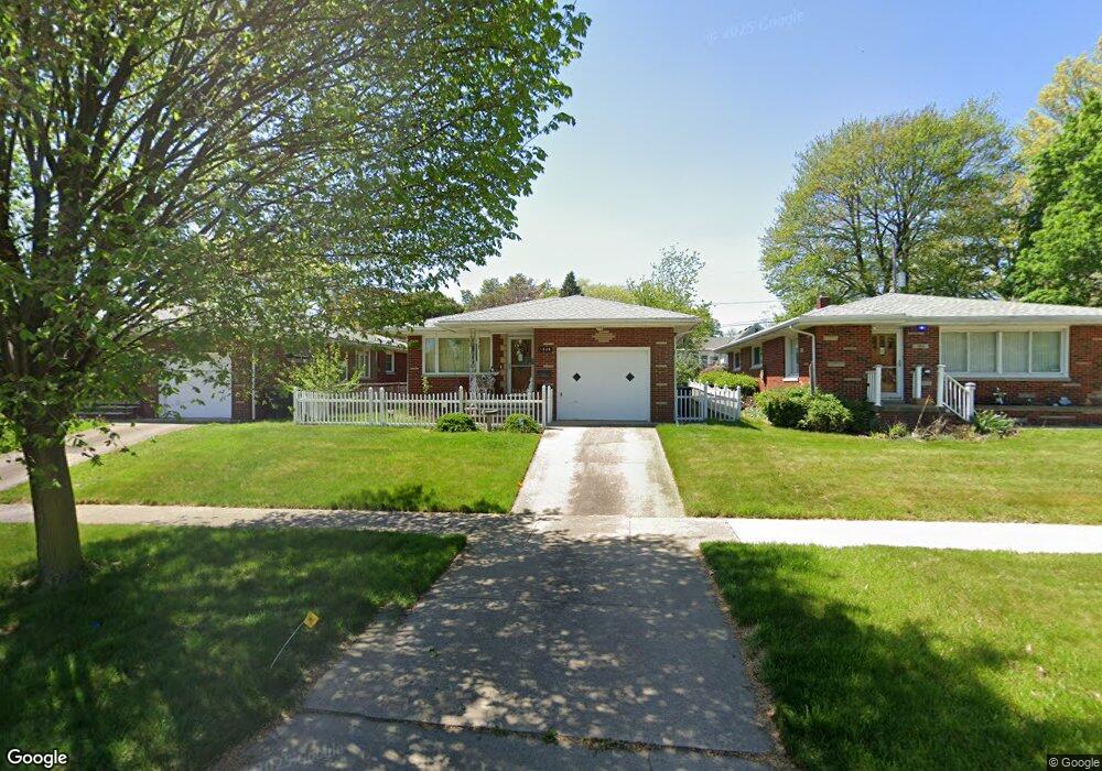
1846 Brown St Akron, OH 44301
Firestone Park NeighborhoodEstimated Value: $154,000 - $168,000
3
Beds
2
Baths
1,096
Sq Ft
$145/Sq Ft
Est. Value
About This Home
This home is located at 1846 Brown St, Akron, OH 44301 and is currently estimated at $159,084, approximately $145 per square foot. 1846 Brown St is a home located in Summit County with nearby schools including Kenmore Garfield Community Learning Center, Main Preparatory Academy, and Eagle Elementary.
Ownership History
Date
Name
Owned For
Owner Type
Purchase Details
Closed on
Mar 26, 2009
Sold by
Dean Lillian M
Bought by
Williamson Frederick G and Williamson Patricia L
Current Estimated Value
Home Financials for this Owner
Home Financials are based on the most recent Mortgage that was taken out on this home.
Original Mortgage
$60,000
Outstanding Balance
$38,496
Interest Rate
5.22%
Mortgage Type
Purchase Money Mortgage
Estimated Equity
$120,588
Create a Home Valuation Report for This Property
The Home Valuation Report is an in-depth analysis detailing your home's value as well as a comparison with similar homes in the area
Home Values in the Area
Average Home Value in this Area
Purchase History
| Date | Buyer | Sale Price | Title Company |
|---|---|---|---|
| Williamson Frederick G | $75,000 | Bond & Associates Title Agen |
Source: Public Records
Mortgage History
| Date | Status | Borrower | Loan Amount |
|---|---|---|---|
| Open | Williamson Frederick G | $60,000 |
Source: Public Records
Tax History
| Year | Tax Paid | Tax Assessment Tax Assessment Total Assessment is a certain percentage of the fair market value that is determined by local assessors to be the total taxable value of land and additions on the property. | Land | Improvement |
|---|---|---|---|---|
| 2024 | $1,889 | $43,995 | $8,099 | $35,896 |
| 2023 | $1,889 | $43,995 | $8,099 | $35,896 |
| 2022 | $1,613 | $31,882 | $5,870 | $26,012 |
| 2021 | $1,614 | $31,882 | $5,870 | $26,012 |
| 2020 | $1,590 | $31,880 | $5,870 | $26,010 |
| 2019 | $1,626 | $30,270 | $5,870 | $24,400 |
| 2018 | $1,605 | $30,270 | $5,870 | $24,400 |
| 2017 | $1,630 | $30,270 | $5,870 | $24,400 |
| 2016 | $1,631 | $30,270 | $5,870 | $24,400 |
| 2015 | $1,630 | $30,270 | $5,870 | $24,400 |
| 2014 | $1,617 | $30,270 | $5,870 | $24,400 |
| 2013 | $1,601 | $30,510 | $5,870 | $24,640 |
Source: Public Records
Map
Nearby Homes
- 1810 Carter Ave
- 1878 Carter Ave Unit 1880
- 502 E Woodsdale Ave
- 1905 Carter Ave Unit 1907
- 367 Wayne Ave
- 1726 Coventry St
- 634 Prentiss Ave
- 1835 Thornapple Ave
- 231 E Dresden Ave
- 1612 Oakwood Ave
- 1646 Highview Ave
- 1595 Redwood Ave
- 248 E Catawba Ave
- 457 S Firestone Blvd
- 244 E Catawba Ave
- 1620 Highview Ave
- 695 Cooper Ave
- 0 Woodview Dr
- 2069 Penguin Ave
- 106 Selden Ave
- 1850 Brown St
- 1840 Brown St
- 1836 Brown St
- 449 E Woodsdale Ave
- 1837 Carter Ave
- 1847 Carter Ave
- 1832 Brown St
- 1829 Carter Ave
- 1828 Brown St
- 1824 Brown St
- 1813 Carter Ave
- 1840 Carter Ave
- 1840 Carter Ave
- 1859 Carter Ave
- 1811 Carter Ave
- 1818 Brown St
- 1818 Brown St
- 1846 Carter Ave
- 1824 Carter Ave
- 1860 Carter Ave
Your Personal Tour Guide
Ask me questions while you tour the home.