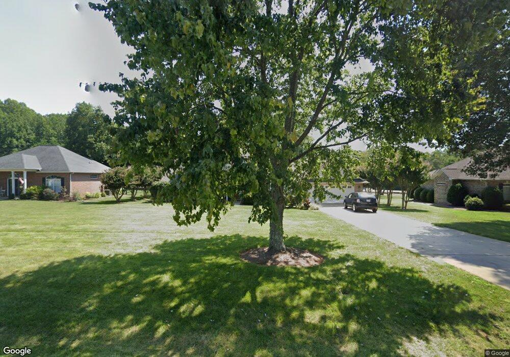
1847 Cameron Heights Cir Denver, NC 28037
Estimated Value: $391,000 - $452,000
3
Beds
2
Baths
1,546
Sq Ft
$271/Sq Ft
Est. Value
About This Home
This home is located at 1847 Cameron Heights Cir, Denver, NC 28037 and is currently estimated at $418,823, approximately $270 per square foot. 1847 Cameron Heights Cir is a home located in Lincoln County with nearby schools including St. James Elementary School, East Lincoln Middle School, and East Lincoln High School.
Ownership History
Date
Name
Owned For
Owner Type
Purchase Details
Closed on
Oct 26, 2022
Sold by
Connie Y Bodsford Revocable Trust
Bought by
Cummings Dana B
Current Estimated Value
Purchase Details
Closed on
Mar 30, 2011
Sold by
Bodsford Connie Y
Bought by
Bodsford Connie Y
Purchase Details
Closed on
Apr 13, 1998
Bought by
Bodsford William G and Bodsford Connie Y
Purchase Details
Closed on
Sep 23, 1996
Bought by
Mitchell Michael E and Mitchell Gail C
Create a Home Valuation Report for This Property
The Home Valuation Report is an in-depth analysis detailing your home's value as well as a comparison with similar homes in the area
Home Values in the Area
Average Home Value in this Area
Purchase History
| Date | Buyer | Sale Price | Title Company |
|---|---|---|---|
| Cummings Dana B | $197,500 | -- | |
| Bodsford Connie Y | -- | None Available | |
| Bodsford William G | $142,000 | -- | |
| Mitchell Michael E | $135,000 | -- |
Source: Public Records
Tax History Compared to Growth
Tax History
| Year | Tax Paid | Tax Assessment Tax Assessment Total Assessment is a certain percentage of the fair market value that is determined by local assessors to be the total taxable value of land and additions on the property. | Land | Improvement |
|---|---|---|---|---|
| 2025 | $2,405 | $375,038 | $44,000 | $331,038 |
| 2024 | $2,375 | $375,038 | $44,000 | $331,038 |
| 2023 | $2,370 | $375,038 | $44,000 | $331,038 |
| 2022 | $1,800 | $232,702 | $54,000 | $178,702 |
| 2021 | $1,846 | $232,702 | $54,000 | $178,702 |
| 2020 | $1,622 | $232,702 | $54,000 | $178,702 |
| 2019 | $1,622 | $232,702 | $54,000 | $178,702 |
| 2018 | $1,470 | $195,541 | $48,500 | $147,041 |
| 2017 | $1,369 | $195,541 | $48,500 | $147,041 |
| 2016 | $1,283 | $184,037 | $48,500 | $135,537 |
| 2015 | $1,400 | $184,037 | $48,500 | $135,537 |
| 2014 | $1,333 | $182,336 | $48,500 | $133,836 |
Source: Public Records
Map
Nearby Homes
- 8260 Graham Rd
- 1751 Knights Dr
- 1925 Cameron Heights Cir
- 8150 Malibu Pointe Ln
- 1959 Rock Springs Cir
- 7958 Unity Church Rd
- 8194 Mallard Rd
- 2325 Perry Rd
- 8188 Normandy Rd
- 8111 Rainier Dr
- 0 Rufus Rd
- 8110 Squirrel Hill Ln
- 1515 N Nc 16 Business Hwy
- 2656 Norman Isle Dr
- 7184 Indigo Way
- 6273 Ashton Park Dr
- 6242 Ashton Park Dr
- 2121 Regatta Ln Unit 209
- 2494 Cherry Ln
- 8473 Bing Cherry Dr
- 1855 Cameron Heights Cir
- 1837 Cameron Heights Cir
- 1837 Cameron Heights Cir Unit 41
- 1829 Cameron Heights Cir
- 1865 Cameron Heights Cir
- 1844 Cameron Heights Cir
- 1719 Lancelot Ln
- 1856 Cameron Heights Cir
- 1866 Cameron Heights Cir
- 8314 Graham Rd
- 1819 Cameron Heights Cir
- 1877 Cameron Heights Cir
- 8320 Graham Rd
- 1729 Lancelot Ln
- 1876 Cameron Heights Cir
- 1809 Cameron Heights Cir
- 1887 Cameron Heights Cir
- 1735 Lancelot Ln
- 7982 King Arthurs Ct
- 1880 Cameron Heights Cir