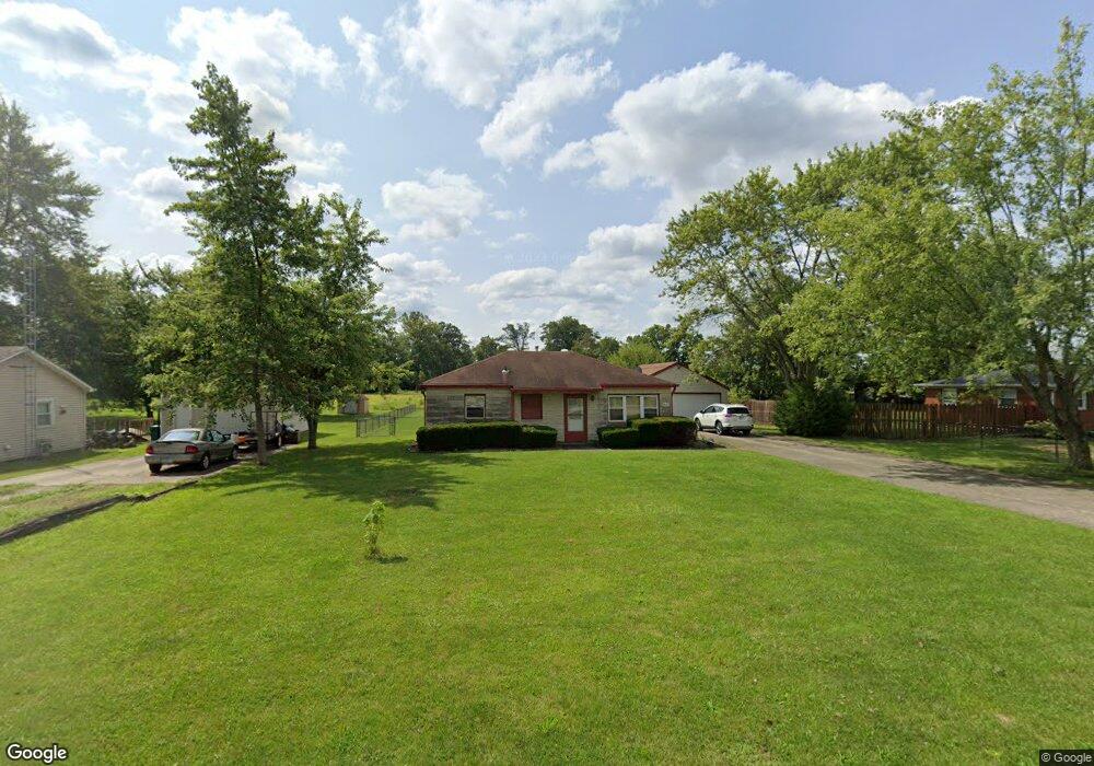
1847 E 400 N Greenfield, IN 46140
Estimated Value: $134,000 - $197,000
2
Beds
1
Bath
936
Sq Ft
$178/Sq Ft
Est. Value
About This Home
This home is located at 1847 E 400 N, Greenfield, IN 46140 and is currently estimated at $166,552, approximately $177 per square foot. 1847 E 400 N is a home located in Hancock County with nearby schools including Maxwell Intermediate School, Eden Elementary School, and Greenfield Central Junior High School.
Ownership History
Date
Name
Owned For
Owner Type
Purchase Details
Closed on
Apr 22, 2014
Sold by
Marlett Carl M
Bought by
Held Andrew M
Current Estimated Value
Home Financials for this Owner
Home Financials are based on the most recent Mortgage that was taken out on this home.
Original Mortgage
$63,822
Outstanding Balance
$47,858
Interest Rate
4.37%
Mortgage Type
FHA
Estimated Equity
$118,694
Purchase Details
Closed on
Feb 26, 2009
Sold by
Logsdon James E
Bought by
Marlett Carl M
Home Financials for this Owner
Home Financials are based on the most recent Mortgage that was taken out on this home.
Original Mortgage
$46,736
Interest Rate
5.09%
Mortgage Type
FHA
Purchase Details
Closed on
Aug 11, 2008
Sold by
Logsdon Jmaes E
Bought by
Logsdon James E and Logsdon Peggy L
Home Financials for this Owner
Home Financials are based on the most recent Mortgage that was taken out on this home.
Original Mortgage
$112,817
Interest Rate
6.55%
Mortgage Type
FHA
Create a Home Valuation Report for This Property
The Home Valuation Report is an in-depth analysis detailing your home's value as well as a comparison with similar homes in the area
Home Values in the Area
Average Home Value in this Area
Purchase History
| Date | Buyer | Sale Price | Title Company |
|---|---|---|---|
| Held Andrew M | -- | None Available | |
| Marlett Carl M | -- | -- | |
| Logsdon James E | -- | -- |
Source: Public Records
Mortgage History
| Date | Status | Borrower | Loan Amount |
|---|---|---|---|
| Open | Held Andrew M | $63,822 | |
| Previous Owner | Marlett Carl M | $46,736 | |
| Previous Owner | Logsdon James E | $112,817 |
Source: Public Records
Tax History
| Year | Tax Paid | Tax Assessment Tax Assessment Total Assessment is a certain percentage of the fair market value that is determined by local assessors to be the total taxable value of land and additions on the property. | Land | Improvement |
|---|---|---|---|---|
| 2024 | $704 | $131,200 | $41,300 | $89,900 |
| 2023 | $719 | $122,300 | $41,300 | $81,000 |
| 2022 | $326 | $85,600 | $20,600 | $65,000 |
| 2021 | $314 | $82,600 | $20,600 | $62,000 |
| 2020 | $278 | $77,800 | $20,600 | $57,200 |
| 2019 | $258 | $75,200 | $20,600 | $54,600 |
| 2018 | $267 | $75,300 | $20,600 | $54,700 |
| 2017 | $271 | $73,000 | $20,600 | $52,400 |
| 2016 | $295 | $71,800 | $20,000 | $51,800 |
| 2014 | $324 | $68,400 | $22,700 | $45,700 |
| 2013 | -- | $68,400 | $22,700 | $45,700 |
Source: Public Records
Map
Nearby Homes
- 3904 N State Road 9
- 3598 N State Road 9
- 852 E 400 N
- 2374 E Water Wheel Dr
- 786 E 400 N
- 4045 N 50 E
- 108 S Center St
- 3513 N 300 E
- 2367 Collins Way
- 5695 N Red Oak Dr
- 5426 N 300 E
- 00 Fields Blvd
- 2420 Fir Dr
- 1616 Colorado Spruce Way
- 2412 Fir Dr
- 2415 Fir Dr
- 1631 Colorado Spruce Way
- 2403 Fir Dr
- 2345 Fir Dr
- 1643 Colorado Spruce Way
Your Personal Tour Guide
Ask me questions while you tour the home.