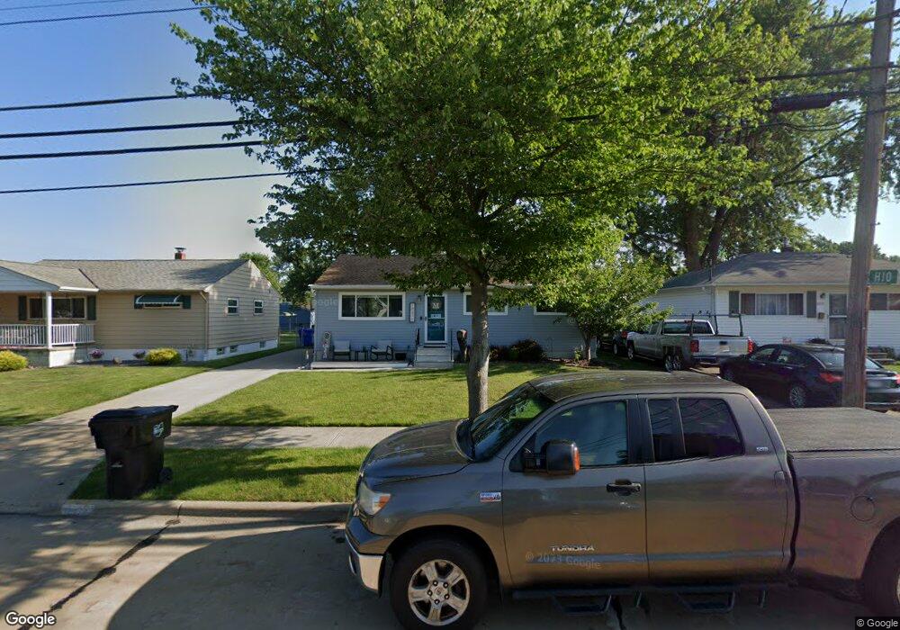
18470 Merece Dr Brookpark, OH 44142
Estimated Value: $178,123 - $227,000
3
Beds
1
Bath
988
Sq Ft
$204/Sq Ft
Est. Value
About This Home
This home is located at 18470 Merece Dr, Brookpark, OH 44142 and is currently estimated at $202,031, approximately $204 per square foot. 18470 Merece Dr is a home located in Cuyahoga County with nearby schools including Berea-Midpark Middle School, Berea-Midpark High School, and The Academy of St. Bartholomew.
Ownership History
Date
Name
Owned For
Owner Type
Purchase Details
Closed on
May 13, 2009
Sold by
Kinsner Ronald A and Kinsner Reginald A
Bought by
Mcelwee Donald P and Mcelwee Jaclyn A
Current Estimated Value
Home Financials for this Owner
Home Financials are based on the most recent Mortgage that was taken out on this home.
Original Mortgage
$110,953
Outstanding Balance
$68,195
Interest Rate
4.83%
Mortgage Type
FHA
Estimated Equity
$133,836
Purchase Details
Closed on
Aug 19, 2008
Sold by
Carlile Karen and Wolf Kevin
Bought by
Kinsner Ronald A and Kinsner Reginald A
Purchase Details
Closed on
Aug 14, 2008
Sold by
Estate Of Janet C Wolf
Bought by
Wolf Eugene
Purchase Details
Closed on
Sep 12, 2002
Sold by
Wolf Eugene V
Bought by
Wolf Eugene and The Eugene V Wolf Trust
Purchase Details
Closed on
Jan 1, 1975
Bought by
Wolf Eugene and Wolf Janet C
Create a Home Valuation Report for This Property
The Home Valuation Report is an in-depth analysis detailing your home's value as well as a comparison with similar homes in the area
Home Values in the Area
Average Home Value in this Area
Purchase History
| Date | Buyer | Sale Price | Title Company |
|---|---|---|---|
| Mcelwee Donald P | $113,000 | Cleveland Home Title | |
| Kinsner Ronald A | $59,900 | Title Access Llc | |
| Wolf Eugene | -- | Title Access Llc | |
| Wolf Eugene | -- | Title Access Llc | |
| Wolf Eugene | -- | -- | |
| Wolf Eugene | -- | -- |
Source: Public Records
Mortgage History
| Date | Status | Borrower | Loan Amount |
|---|---|---|---|
| Open | Mcelwee Donald P | $110,953 |
Source: Public Records
Tax History
| Year | Tax Paid | Tax Assessment Tax Assessment Total Assessment is a certain percentage of the fair market value that is determined by local assessors to be the total taxable value of land and additions on the property. | Land | Improvement |
|---|---|---|---|---|
| 2025 | $2,592 | $51,695 | $11,655 | $40,040 |
| 2024 | $2,608 | $51,695 | $11,655 | $40,040 |
| 2023 | $2,682 | $44,040 | $10,050 | $33,990 |
| 2022 | $2,664 | $44,030 | $10,050 | $33,990 |
| 2021 | $2,648 | $44,030 | $10,050 | $33,990 |
| 2020 | $2,389 | $34,970 | $7,980 | $26,990 |
| 2019 | $2,318 | $99,900 | $22,800 | $77,100 |
| 2018 | $2,146 | $34,970 | $7,980 | $26,990 |
| 2017 | $2,149 | $30,070 | $6,900 | $23,170 |
| 2016 | $2,131 | $30,070 | $6,900 | $23,170 |
| 2015 | $2,105 | $30,070 | $6,900 | $23,170 |
| 2014 | $2,105 | $31,650 | $7,250 | $24,400 |
Source: Public Records
Map
Nearby Homes
- 6490 Grosse Dr
- 6577 Liberty Bell Dr Unit C20
- 6755 Benedict Dr
- 6728 Benedict Dr
- 6016 Gilmere Dr
- 6748 Benedict Dr
- 6752 Benedict Dr
- 6744 Benedict Dr
- 6720 Benedict Dr
- 6724 Benedict Dr
- 6188 Barbara Ln
- 6448 Delores Blvd
- 6330 Ledgebrook Dr
- 6377 Ledgebrook Dr
- 6386 Sandfield Dr
- 6330 Sandfield Dr
- 15995 Paulding Blvd
- 6689 Fry Rd
- 16460 Heather Ln
- 6707 Woodruff Ct
- 18490 Merece Dr
- 18450 Merece Dr
- 18510 Merece Dr
- 18430 Merece Dr
- 18469 Kalvin Dr
- 18489 Kalvin Dr
- 18449 Kalvin Dr
- 18410 Merece Dr
- 18530 Merece Dr
- 6402 Hio Dr
- 18509 Kalvin Dr
- 18429 Kalvin Dr
- 6401 Hio Dr
- 18409 Kalvin Dr
- 18529 Kalvin Dr
- 6408 Hio Dr
- 18374 Merece Dr
- 18550 Merece Dr
- 18373 Kalvin Dr
- 18549 Kalvin Dr
Your Personal Tour Guide
Ask me questions while you tour the home.