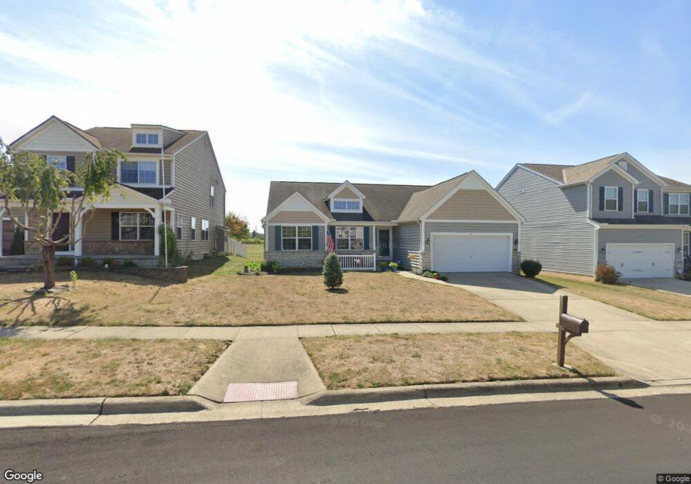
1848 Declaration Dr W Lancaster, OH 43130
Estimated Value: $328,508 - $441,000
3
Beds
2
Baths
2,046
Sq Ft
$183/Sq Ft
Est. Value
About This Home
This home is located at 1848 Declaration Dr W, Lancaster, OH 43130 and is currently estimated at $374,877, approximately $183 per square foot. 1848 Declaration Dr W is a home located in Fairfield County with nearby schools including Thomas Ewing Junior High School, Lancaster High School, and St Bernadette Elementary School.
Ownership History
Date
Name
Owned For
Owner Type
Purchase Details
Closed on
Jul 30, 2010
Sold by
Slade Luman C and Slade Jeanette C
Bought by
Jarolimek Cheryll L
Current Estimated Value
Home Financials for this Owner
Home Financials are based on the most recent Mortgage that was taken out on this home.
Original Mortgage
$105,000
Outstanding Balance
$68,998
Interest Rate
4.81%
Mortgage Type
Purchase Money Mortgage
Estimated Equity
$305,879
Purchase Details
Closed on
Mar 1, 2006
Sold by
Diyanni Brothers Inc
Bought by
Slade Luman C and Slade Jeanette C
Purchase Details
Closed on
Sep 29, 2004
Sold by
Dbi Land Co Llc
Bought by
Diyanni Brothers Inc
Create a Home Valuation Report for This Property
The Home Valuation Report is an in-depth analysis detailing your home's value as well as a comparison with similar homes in the area
Home Values in the Area
Average Home Value in this Area
Purchase History
| Date | Buyer | Sale Price | Title Company |
|---|---|---|---|
| Jarolimek Cheryll L | $185,000 | None Available | |
| Slade Luman C | $192,000 | None Available | |
| Diyanni Brothers Inc | -- | Valmerland Title Agency |
Source: Public Records
Mortgage History
| Date | Status | Borrower | Loan Amount |
|---|---|---|---|
| Open | Jarolimek Cheryll L | $105,000 |
Source: Public Records
Tax History
| Year | Tax Paid | Tax Assessment Tax Assessment Total Assessment is a certain percentage of the fair market value that is determined by local assessors to be the total taxable value of land and additions on the property. | Land | Improvement |
|---|---|---|---|---|
| 2025 | $7,000 | $104,940 | $24,020 | $80,920 |
| 2024 | $7,000 | $77,860 | $6,550 | $71,310 |
| 2023 | $2,832 | $77,860 | $6,550 | $71,310 |
| 2022 | $2,843 | $77,860 | $6,550 | $71,310 |
| 2021 | $2,463 | $63,190 | $6,550 | $56,640 |
| 2020 | $2,360 | $63,190 | $6,550 | $56,640 |
| 2019 | $2,244 | $63,190 | $6,550 | $56,640 |
| 2018 | $2,409 | $63,780 | $7,430 | $56,350 |
| 2017 | $2,410 | $64,440 | $5,460 | $58,980 |
| 2016 | $2,347 | $64,440 | $5,460 | $58,980 |
| 2015 | $2,320 | $61,810 | $5,460 | $56,350 |
| 2014 | $2,210 | $61,810 | $5,460 | $56,350 |
| 2013 | $2,210 | $61,810 | $5,460 | $56,350 |
Source: Public Records
Map
Nearby Homes
- 2021 Rainbow Dr NE
- 0 Tiki Ln
- 1205 Sheridan Dr
- 1722 Red Oak Dr NE
- 1289 Rainbow Dr NE
- 0 Old Millersport Rd NE Unit Tract 11
- 0 Old Millersport Rd NE Unit Tract 10
- 0 Old Millersport Rd NE Unit 225010386
- 0 Old Millersport Rd NE Unit Tract 8
- 0 Ridgewood Way NE
- 2485 Sheridan Dr
- 1101 Beechwood Dr NE
- 1167 Ridge Rd NE
- 1489 Pine View Dr Unit 71489
- 2161 William T Cir
- 1352 Epworth Forest Dr
- 1589 Stone Glen Dr Unit 1589
- 1725 Pleasantview Dr
- 3055 Meadowbrook Dr NE
- 1370 Lynn Dr
- 1848 Declaration Dr
- 1842 Declaration Dr W
- 1854 Declaration Dr
- 1854 Declaration Dr W
- 1836 Declaration Dr W
- 1900 Declaration Dr
- 1855 Independence Blvd
- 1855 Declaration Dr W
- 1896 Independence Blvd
- 1828 Declaration Dr W
- 1908 Declaration Dr
- 1835 Declaration Dr W
- 1858 Independence Blvd
- 1863 Independence Blvd
- 1835 Declaration Dr
- 1827 Declaration Dr
- 1814 Declaration Dr
- 1827 Declaration Dr W
- 1866 Independence Blvd
- 1802 Declaration Dr W
Your Personal Tour Guide
Ask me questions while you tour the home.