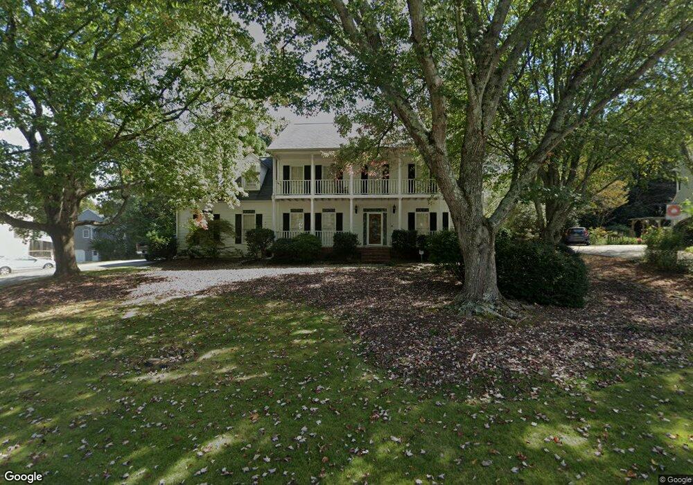
1848 Kenion Point Snellville, GA 30078
Gwinnett Place NeighborhoodEstimated Value: $505,707 - $571,000
4
Beds
3
Baths
3,267
Sq Ft
$166/Sq Ft
Est. Value
About This Home
This home is located at 1848 Kenion Point, Snellville, GA 30078 and is currently estimated at $543,927, approximately $166 per square foot. 1848 Kenion Point is a home located in Gwinnett County with nearby schools including Craig Elementary School, Alton C. Crews Middle School, and Brookwood High School.
Ownership History
Date
Name
Owned For
Owner Type
Purchase Details
Closed on
Jan 6, 2009
Sold by
Saybolt Stephen
Bought by
Heath Richard B and Heath Jeannie R
Current Estimated Value
Home Financials for this Owner
Home Financials are based on the most recent Mortgage that was taken out on this home.
Original Mortgage
$160,000
Outstanding Balance
$105,218
Interest Rate
5.95%
Mortgage Type
New Conventional
Estimated Equity
$438,709
Purchase Details
Closed on
Apr 29, 2004
Sold by
Webb Lee
Bought by
Saybolt Stephen
Home Financials for this Owner
Home Financials are based on the most recent Mortgage that was taken out on this home.
Original Mortgage
$32,535
Interest Rate
4.7%
Mortgage Type
Unknown
Purchase Details
Closed on
May 21, 1993
Sold by
Messick Kenneth L
Bought by
Webb Lee
Home Financials for this Owner
Home Financials are based on the most recent Mortgage that was taken out on this home.
Original Mortgage
$150,000
Interest Rate
7.42%
Create a Home Valuation Report for This Property
The Home Valuation Report is an in-depth analysis detailing your home's value as well as a comparison with similar homes in the area
Home Values in the Area
Average Home Value in this Area
Purchase History
| Date | Buyer | Sale Price | Title Company |
|---|---|---|---|
| Heath Richard B | $249,000 | -- | |
| Saybolt Stephen | $216,900 | -- | |
| Webb Lee | $193,000 | -- |
Source: Public Records
Mortgage History
| Date | Status | Borrower | Loan Amount |
|---|---|---|---|
| Open | Heath Richard B | $160,000 | |
| Previous Owner | Saybolt Stephen | $32,535 | |
| Previous Owner | Saybolt Stephen | $173,520 | |
| Previous Owner | Webb Lee | $150,000 |
Source: Public Records
Tax History Compared to Growth
Tax History
| Year | Tax Paid | Tax Assessment Tax Assessment Total Assessment is a certain percentage of the fair market value that is determined by local assessors to be the total taxable value of land and additions on the property. | Land | Improvement |
|---|---|---|---|---|
| 2024 | $5,393 | $173,520 | $36,000 | $137,520 |
| 2023 | $5,393 | $199,560 | $37,600 | $161,960 |
| 2022 | $5,538 | $182,120 | $35,200 | $146,920 |
| 2021 | $4,724 | $139,200 | $26,000 | $113,200 |
| 2020 | $4,751 | $139,200 | $26,000 | $113,200 |
| 2019 | $4,611 | $139,200 | $26,000 | $113,200 |
| 2018 | $4,620 | $139,200 | $26,000 | $113,200 |
| 2016 | $3,442 | $93,400 | $16,000 | $77,400 |
| 2015 | $3,477 | $93,400 | $16,000 | $77,400 |
| 2014 | -- | $86,560 | $16,000 | $70,560 |
Source: Public Records
Map
Nearby Homes
- 1107 Hardwyck Pass
- 1870 Milfield Cir
- 543 Grassmeade Way
- 1935 Wenton Place
- 1195 Haverhill Trail
- 2061 Vicarage Ln
- 2071 Havenview Ct
- 1249 Heritage Hills Cir
- 1237 Heritage Hills Cir
- 969 Flowers Crossing
- 1336 Janmar Rd
- 825 Connell Ln
- 971 Providence Dr Unit 3
- 1520 Providence Dr
- 1810 Talbot Ct
- 1620 Brook Ivy Dr
- 1035 Bridgewater Walk
- 2045 Milfield Cir
- 1858 Kenion Point Unit 2
- 0 Kenion Point SW Unit 7013417
- 0 Kenion Point SW
- 1150 Belgrave Bend Unit 1
- 1151 Belgrave Bend
- 0 Milfield Cir Unit 7125594
- 0 Milfield Cir Unit 3157537
- 0 Milfield Cir Unit 8832458
- 0 Milfield Cir Unit 8815775
- 0 Milfield Cir Unit 8723292
- 0 Milfield Cir Unit 8096975
- 0 Milfield Cir Unit 8780995
- 0 Milfield Cir Unit 8248696
- 0 Milfield Cir Unit 8199758
- 0 Milfield Cir Unit 7489241
- 0 Milfield Cir Unit 3048556
- 0 Milfield Cir
- 2055 Milfield Cir
- 1839 Kenion Point Unit 2