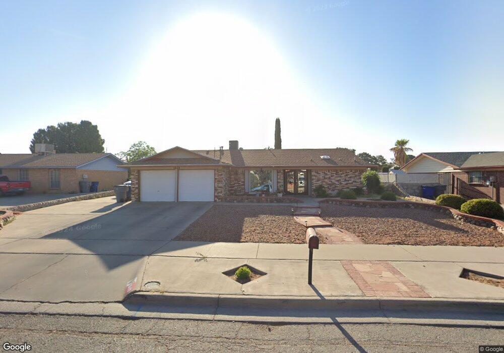
1848 Mike Hill Dr El Paso, TX 79936
Vista Del Sol NeighborhoodEstimated Value: $245,000 - $286,000
3
Beds
2
Baths
1,667
Sq Ft
$155/Sq Ft
Est. Value
About This Home
This home is located at 1848 Mike Hill Dr, El Paso, TX 79936 and is currently estimated at $257,780, approximately $154 per square foot. 1848 Mike Hill Dr is a home located in El Paso County with nearby schools including Tierra Del Sol Elementary School, J M Hanks High School, and EL PASO LEADERSHIP ACADEMY - MIDDLE EAST.
Ownership History
Date
Name
Owned For
Owner Type
Purchase Details
Closed on
Dec 6, 2010
Sold by
Loera Adrian M
Bought by
Loera Deborah
Current Estimated Value
Purchase Details
Closed on
Oct 17, 2002
Sold by
Mcmurtrie Scott E and Archuletta Jenna S
Bought by
Loera Adrian M
Home Financials for this Owner
Home Financials are based on the most recent Mortgage that was taken out on this home.
Original Mortgage
$86,630
Outstanding Balance
$36,239
Interest Rate
6.13%
Mortgage Type
FHA
Estimated Equity
$221,541
Create a Home Valuation Report for This Property
The Home Valuation Report is an in-depth analysis detailing your home's value as well as a comparison with similar homes in the area
Home Values in the Area
Average Home Value in this Area
Purchase History
| Date | Buyer | Sale Price | Title Company |
|---|---|---|---|
| Loera Deborah | -- | None Available | |
| Loera Adrian M | -- | -- |
Source: Public Records
Mortgage History
| Date | Status | Borrower | Loan Amount |
|---|---|---|---|
| Open | Loera Adrian M | $86,630 | |
| Closed | Loera Deborah | $0 |
Source: Public Records
Tax History Compared to Growth
Tax History
| Year | Tax Paid | Tax Assessment Tax Assessment Total Assessment is a certain percentage of the fair market value that is determined by local assessors to be the total taxable value of land and additions on the property. | Land | Improvement |
|---|---|---|---|---|
| 2025 | $3,953 | $233,280 | -- | -- |
| 2024 | $3,953 | $212,073 | -- | -- |
| 2023 | $3,702 | $192,794 | $0 | $0 |
| 2022 | $5,443 | $175,267 | $0 | $0 |
| 2021 | $5,179 | $159,334 | $30,451 | $128,883 |
| 2020 | $4,914 | $155,584 | $27,640 | $127,944 |
| 2018 | $4,691 | $150,854 | $27,640 | $123,214 |
| 2017 | $4,335 | $141,823 | $27,640 | $114,183 |
| 2016 | $3,947 | $129,136 | $27,640 | $101,496 |
| 2015 | $3,129 | $129,136 | $27,640 | $101,496 |
| 2014 | $3,129 | $130,964 | $27,640 | $103,324 |
Source: Public Records
Map
Nearby Homes
- 1868 Tom Bolt Dr
- 1817 Hugh Royer Place
- 1913 Seagull Dr
- 1901 Bobby Jones Dr
- 2001 Bobby Jones Dr Unit A
- 2009 Bobby Jones Dr Unit B
- 11016 Bob Stone Dr
- 11012 Bob Stone Dr
- 11013 Bob Stone Dr
- 2604 Anise Dr
- 1804 Jerry Abbott St
- 1739 Jerry Abbott St
- 1844 Jack Nicklaus Dr Unit 1846
- 11204 Bob Mitchell Dr
- 2308 Tom Watson Ct
- 11008 Johnny Miller Dr
- 2101 E Glen Dr
- 2348 Sea Side Dr
- 1703 Robert Wynn St
- 11157 Leo Collins Dr
- 1844 Mike Hill Dr
- 1852 Mike Hill Dr
- 1851 Tom Bolt Dr
- 1847 Tom Bolt Dr
- 1840 Mike Hill Dr
- 1855 Tom Bolt Dr
- 1856 Mike Hill Dr
- 1849 Mike Hill Dr
- 1843 Tom Bolt Dr
- 1853 Mike Hill Dr
- 1845 Mike Hill Dr
- 1859 Tom Bolt Dr
- 1857 Mike Hill Dr
- 1836 Mike Hill Dr
- 1860 Mike Hill Dr
- 1839 Tom Bolt Dr
- 1841 Mike Hill Dr
- 1841 Mike Hill Dr Unit 1
- 1861 Mike Hill Dr
- 1863 Tom Bolt Dr