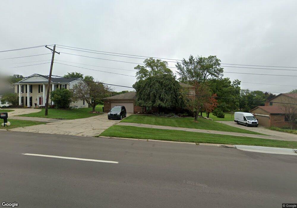
1848 N Adams Rd Rochester Hills, MI 48306
Estimated Value: $549,040 - $633,000
4
Beds
3
Baths
2,975
Sq Ft
$197/Sq Ft
Est. Value
About This Home
This home is located at 1848 N Adams Rd, Rochester Hills, MI 48306 and is currently estimated at $585,510, approximately $196 per square foot. 1848 N Adams Rd is a home located in Oakland County with nearby schools including Brewster Elementary School, Van Hoosen Middle School, and Rochester Adams High School.
Ownership History
Date
Name
Owned For
Owner Type
Purchase Details
Closed on
Oct 16, 2006
Sold by
Duncan Edward D and Duncan Clara Jones
Bought by
Duncan Edward D and Duncan Clara Jones
Current Estimated Value
Home Financials for this Owner
Home Financials are based on the most recent Mortgage that was taken out on this home.
Original Mortgage
$300,000
Outstanding Balance
$178,917
Interest Rate
6.45%
Mortgage Type
New Conventional
Estimated Equity
$406,593
Purchase Details
Closed on
Aug 7, 1996
Sold by
Duncan Edward D
Bought by
Duncan Edward D
Purchase Details
Closed on
May 15, 1996
Sold by
Madden Robert W
Bought by
Duncan Edward D
Home Financials for this Owner
Home Financials are based on the most recent Mortgage that was taken out on this home.
Original Mortgage
$150,000
Interest Rate
7.97%
Create a Home Valuation Report for This Property
The Home Valuation Report is an in-depth analysis detailing your home's value as well as a comparison with similar homes in the area
Home Values in the Area
Average Home Value in this Area
Purchase History
| Date | Buyer | Sale Price | Title Company |
|---|---|---|---|
| Duncan Edward D | -- | None Available | |
| Duncan Edward D | -- | -- | |
| Duncan Edward D | $197,000 | -- |
Source: Public Records
Mortgage History
| Date | Status | Borrower | Loan Amount |
|---|---|---|---|
| Open | Duncan Edward D | $300,000 | |
| Previous Owner | Duncan Edward D | $150,000 |
Source: Public Records
Tax History Compared to Growth
Tax History
| Year | Tax Paid | Tax Assessment Tax Assessment Total Assessment is a certain percentage of the fair market value that is determined by local assessors to be the total taxable value of land and additions on the property. | Land | Improvement |
|---|---|---|---|---|
| 2022 | $2,142 | $191,690 | $0 | $0 |
| 2018 | $3,554 | $165,360 | $0 | $0 |
| 2017 | $3,481 | $163,020 | $0 | $0 |
| 2015 | -- | $145,680 | $0 | $0 |
| 2014 | -- | $123,460 | $0 | $0 |
| 2011 | -- | $98,590 | $0 | $0 |
Source: Public Records
Map
Nearby Homes
- 2935 Woodford Cir
- 1609 Kilburn Rd N
- 3273 Salem Dr
- 5826 Murfield Dr
- 5724 Murfield Dr
- 3377 Charlwood Dr
- 1906 Independence Ct
- 2821 Addison Cir S
- 1515 Chevy Circuit
- 3674 Merriweather Ln
- 3185 Saint James Ct
- 5700 Rolling Hills Dr
- 1102 Cobridge Dr
- 5350 Brewster Rd
- 2750 Castlemartin Ct Unit 22
- 2794 Castlemartin Ct
- 4070 Blue Heron Dr
- 3582 Tremonte Cir S Unit 276
- 3577 Oakmonte Blvd
- 3522 Oakmonte Blvd Unit 115
- 1860 N Adams Rd
- 1836 N Adams Rd
- 1872 N Adams Rd
- 1824 N Adams Rd
- 3175 Salem Dr
- 1973 Kilburn Rd N Unit Bldg-Unit
- 1973 Kilburn Rd N
- 1967 Kilburn Rd N
- 3181 Salem Dr
- 3020 Saratoga Dr
- 1812 N Adams Rd
- 2897 Kilburn Ct
- 3187 Salem Dr
- 1961 Kilburn Rd N
- 1955 Kilburn Rd N
- 3193 Salem Dr
- 3030 Saratoga Dr
- 3015 Kilburn Rd W
- 2888 Kilburn Ct
- 2885 Kilburn Ct