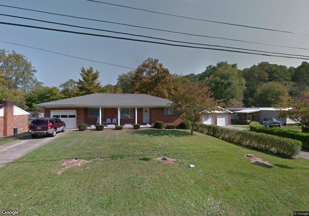
1848 State Route 243 Ironton, OH 45638
Estimated Value: $142,000 - $151,000
3
Beds
2
Baths
1,461
Sq Ft
$100/Sq Ft
Est. Value
About This Home
This home is located at 1848 State Route 243, Ironton, OH 45638 and is currently estimated at $145,905, approximately $99 per square foot. 1848 State Route 243 is a home located in Lawrence County with nearby schools including Dawson-Bryant Elementary School, Dawson-Bryant Middle School, and Dawson-Bryant High School.
Ownership History
Date
Name
Owned For
Owner Type
Purchase Details
Closed on
Jul 24, 2002
Sold by
Hamilton Melissa Mae and Hamilton G
Bought by
Jenkins Glendon Scott
Current Estimated Value
Purchase Details
Closed on
Nov 8, 2001
Bought by
Hamilton Melissa Mae and Hamilton G
Purchase Details
Closed on
Mar 16, 2000
Sold by
Jenkins Glendon and Jenkins Janet
Bought by
Jenkins, Glendon Life Est
Create a Home Valuation Report for This Property
The Home Valuation Report is an in-depth analysis detailing your home's value as well as a comparison with similar homes in the area
Home Values in the Area
Average Home Value in this Area
Purchase History
| Date | Buyer | Sale Price | Title Company |
|---|---|---|---|
| Jenkins Glendon Scott | $40,000 | -- | |
| Hamilton Melissa Mae | -- | -- | |
| Jenkins, Glendon Life Est | -- | -- |
Source: Public Records
Tax History Compared to Growth
Tax History
| Year | Tax Paid | Tax Assessment Tax Assessment Total Assessment is a certain percentage of the fair market value that is determined by local assessors to be the total taxable value of land and additions on the property. | Land | Improvement |
|---|---|---|---|---|
| 2024 | -- | $35,270 | $1,010 | $34,260 |
| 2023 | $998 | $35,270 | $1,010 | $34,260 |
| 2022 | $995 | $35,270 | $1,010 | $34,260 |
| 2021 | $899 | $31,890 | $880 | $31,010 |
| 2020 | $914 | $31,890 | $880 | $31,010 |
| 2019 | $911 | $31,890 | $880 | $31,010 |
| 2018 | $925 | $32,020 | $880 | $31,140 |
| 2017 | $923 | $32,020 | $880 | $31,140 |
| 2016 | $852 | $32,020 | $880 | $31,140 |
| 2015 | $902 | $31,300 | $880 | $30,420 |
| 2014 | $890 | $31,300 | $880 | $30,420 |
| 2013 | $889 | $31,300 | $880 | $30,420 |
Source: Public Records
Map
Nearby Homes
- 156 Township Road 181
- 2088 State Route 243
- 342 Township Road 296
- 103 Carrico Dr
- 119 Remy St
- 519 Lane St
- 514 Lane St
- 135 Lane St
- 805 1/2 High St
- 125 Center St
- 309 High St
- 309 High St Unit LAO-5
- 0 Carter Ave
- 1824 Carter Ave
- 0 18th Street & Central Ave
- 2135 Central Ave
- 0 Central Ave
- 0 Central & Mlk
- 0 27th Block of Carter Ave
- 2829 Carter Ave
- 1833 State Route 243
- 1879 State Route 243
- 45 Township Road 102
- 1856 State Route 243
- 1891 State Route 243
- 24 Township Road 1051
- 77 Township Road 102
- 64 Township Road 102
- 1784 State Route 243
- 1884 State Route 243
- 54 Township Road 300
- 1912 State Route 243
- 64 Township Road 181
- 64 64 Twp Rd 181
- 103 Township Road 102
- 1921 State Route 243
- 90 Township Road 300
- 25 Township Road 181
- 1902 State Route 243
- 1930 State Route 243