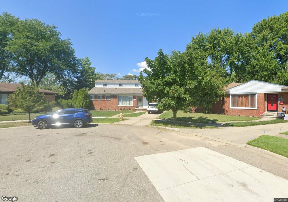
18485 Michael Ave Eastpointe, MI 48021
Estimated Value: $228,000 - $271,000
4
Beds
3
Baths
1,666
Sq Ft
$147/Sq Ft
Est. Value
About This Home
This home is located at 18485 Michael Ave, Eastpointe, MI 48021 and is currently estimated at $245,308, approximately $147 per square foot. 18485 Michael Ave is a home located in Macomb County with nearby schools including Forest Park Elementary School, Eastpointe Middle School, and Reach Charter Academy.
Ownership History
Date
Name
Owned For
Owner Type
Purchase Details
Closed on
Oct 5, 2016
Sold by
Secondino Nina V
Bought by
Morgan Jennifer R
Current Estimated Value
Purchase Details
Closed on
May 20, 2011
Sold by
Fannie Mae
Bought by
Morgan Jennifer R and Secondino Nina V
Purchase Details
Closed on
Jul 23, 2010
Sold by
Nadon Mark A and Nadon Lisa A
Bought by
Federal National Mortgage Association
Purchase Details
Closed on
Jul 12, 1996
Sold by
Skiles J and Skiles J
Bought by
Nadon M and Nadon L
Create a Home Valuation Report for This Property
The Home Valuation Report is an in-depth analysis detailing your home's value as well as a comparison with similar homes in the area
Home Values in the Area
Average Home Value in this Area
Purchase History
| Date | Buyer | Sale Price | Title Company |
|---|---|---|---|
| Morgan Jennifer R | -- | None Listed On Document | |
| Morgan Jennifer R | $45,000 | Etitle Agency Inc | |
| Federal National Mortgage Association | $29,300 | None Available | |
| Nadon M | $105,000 | -- |
Source: Public Records
Tax History Compared to Growth
Tax History
| Year | Tax Paid | Tax Assessment Tax Assessment Total Assessment is a certain percentage of the fair market value that is determined by local assessors to be the total taxable value of land and additions on the property. | Land | Improvement |
|---|---|---|---|---|
| 2025 | $4,976 | $116,500 | $0 | $0 |
| 2024 | $3,902 | $109,600 | $0 | $0 |
| 2023 | $3,191 | $99,000 | $0 | $0 |
| 2022 | $2,341 | $84,900 | $0 | $0 |
| 2021 | $2,305 | $71,400 | $0 | $0 |
| 2020 | $2,201 | $74,900 | $0 | $0 |
| 2019 | $3,488 | $65,800 | $0 | $0 |
| 2018 | $2,580 | $44,070 | $0 | $0 |
| 2017 | $2,326 | $37,330 | $4,040 | $33,290 |
| 2016 | $2,644 | $37,330 | $0 | $0 |
| 2015 | $1,819 | $32,540 | $0 | $0 |
| 2013 | $1,863 | $31,180 | $0 | $0 |
Source: Public Records
Map
Nearby Homes
- 24296 Roxana Ave
- 24336 Warrington Ct
- 24301 Kelly Rd
- 18240 Stephens Dr
- 24504 Marine Ave
- 24821 Almond Ave
- 23329 Roxana Ave
- 23805 Raven Ave
- 23311 Courtland Ave
- 24648 Wilmot Ave
- 24880 Warrington Ave
- 23805 Johnston Ave
- 23038 Rosalind Ave
- 23785 Schroeder Ave
- 23373 Wilmot Ave
- 24834 Raven Ave
- 23080 Marine Ave
- 22839 Almond Ave
- 24893 Raven Ave
- 24883 Wilmot Ave
- 24266 Roxana Ave
- 24256 Roxana Ave
- 18495 Michael Ave
- 24276 Roxana Ave
- 24246 Roxana Ave
- 18484 Michael Ave
- 18505 Michael Ave
- 18494 Courtland Ct
- 24236 Roxana Ave
- 18494 Michael Ave
- 24226 Roxana Ave
- 18515 Michael Ave
- 18484 Courtland Ct
- 18504 Michael Ave
- 18504 Courtland Ct
- 18514 Michael Ave
- 18525 Michael Ave
- 18485 Courtland Ct
- 18475 Stephens Dr
- 18485 Stephens Dr