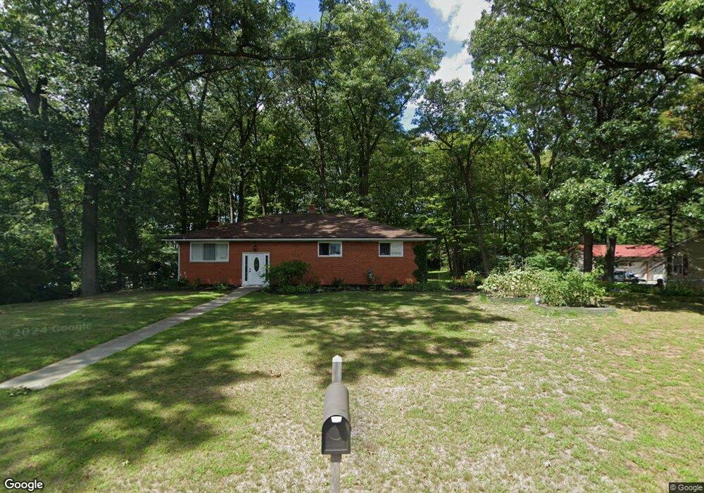
18486 Emit Rd Riverview, MI 48193
Estimated Value: $320,000 - $413,000
3
Beds
3
Baths
2,560
Sq Ft
$138/Sq Ft
Est. Value
About This Home
This home is located at 18486 Emit Rd, Riverview, MI 48193 and is currently estimated at $352,081, approximately $137 per square foot. 18486 Emit Rd is a home located in Wayne County with nearby schools including Gudith Elementary School, Brownstown Middle School, and Patrick Henry Middle School.
Ownership History
Date
Name
Owned For
Owner Type
Purchase Details
Closed on
Jun 27, 2011
Sold by
Alton & Alene Clark Revocable Living Tru
Bought by
Uram John M
Current Estimated Value
Home Financials for this Owner
Home Financials are based on the most recent Mortgage that was taken out on this home.
Original Mortgage
$81,000
Outstanding Balance
$56,040
Interest Rate
4.63%
Mortgage Type
New Conventional
Estimated Equity
$296,041
Purchase Details
Closed on
Jul 16, 2007
Sold by
Clark Alton J and Clark Alene T
Bought by
Clark Alton J
Create a Home Valuation Report for This Property
The Home Valuation Report is an in-depth analysis detailing your home's value as well as a comparison with similar homes in the area
Home Values in the Area
Average Home Value in this Area
Purchase History
| Date | Buyer | Sale Price | Title Company |
|---|---|---|---|
| Uram John M | $90,000 | None Available | |
| Clark Alton J | -- | None Available |
Source: Public Records
Mortgage History
| Date | Status | Borrower | Loan Amount |
|---|---|---|---|
| Open | Uram John M | $81,000 |
Source: Public Records
Tax History
| Year | Tax Paid | Tax Assessment Tax Assessment Total Assessment is a certain percentage of the fair market value that is determined by local assessors to be the total taxable value of land and additions on the property. | Land | Improvement |
|---|---|---|---|---|
| 2025 | $2,532 | $172,700 | $0 | $0 |
| 2024 | $2,354 | $149,600 | $0 | $0 |
| 2023 | $2,245 | $148,200 | $0 | $0 |
| 2022 | $4,185 | $141,000 | $0 | $0 |
| 2021 | $3,888 | $124,200 | $0 | $0 |
| 2020 | $3,823 | $111,000 | $0 | $0 |
| 2019 | $3,794 | $93,700 | $0 | $0 |
| 2018 | $1,962 | $82,000 | $0 | $0 |
| 2017 | $3,535 | $110,900 | $0 | $0 |
| 2016 | $3,658 | $82,100 | $0 | $0 |
| 2015 | $7,494 | $80,700 | $0 | $0 |
| 2013 | $7,260 | $78,000 | $0 | $0 |
| 2012 | -- | $73,900 | $27,800 | $46,100 |
Source: Public Records
Map
Nearby Homes
- 18298 Alvaro Ave
- 17860 Bagnoli St Unit 434
- 23089 Suffield Ln
- 17849 Patrick St
- 22448 Armstrong Ave
- 22507 Doncaster Ave
- 23504 Matts Dr Unit 66
- 23604 Matts Dr Unit 63
- 23626 Valley Dr Unit 130
- 23675 Maple Ln Unit 141
- 17528 Cedar Grove
- 23654 Pine Dr Unit 201
- 17501 Cedar Grove Unit 181
- 17459 Willow Grove Unit 223
- 22337 Steppe Ln
- 23633 Hickory Dr Unit 211
- 23697 Hickory Dr Unit 219
- 0000 Sibley Rd
- 17494 Willow Grove Unit 235
- 23686 Hickory Dr Unit 260
Your Personal Tour Guide
Ask me questions while you tour the home.