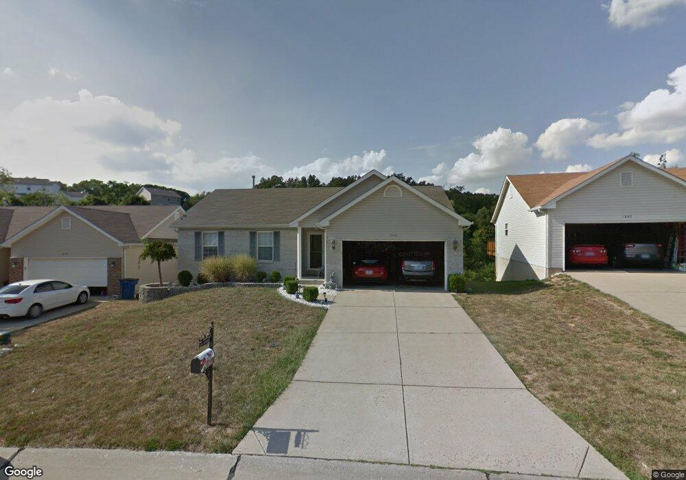
1849 Crosshaven Dr High Ridge, MO 63049
Estimated Value: $300,000 - $327,000
--
Bed
--
Bath
1,328
Sq Ft
$235/Sq Ft
Est. Value
About This Home
This home is located at 1849 Crosshaven Dr, High Ridge, MO 63049 and is currently estimated at $311,733, approximately $234 per square foot. 1849 Crosshaven Dr is a home located in Jefferson County with nearby schools including Northwest High School, Messenger Christian School, and St. Anthony School.
Ownership History
Date
Name
Owned For
Owner Type
Purchase Details
Closed on
Mar 10, 2003
Sold by
Charles F Vatteroff Construction Co
Bought by
Petersen David R and Petersen Grace M
Current Estimated Value
Home Financials for this Owner
Home Financials are based on the most recent Mortgage that was taken out on this home.
Original Mortgage
$53,000
Outstanding Balance
$22,751
Interest Rate
5.86%
Estimated Equity
$288,982
Create a Home Valuation Report for This Property
The Home Valuation Report is an in-depth analysis detailing your home's value as well as a comparison with similar homes in the area
Home Values in the Area
Average Home Value in this Area
Purchase History
| Date | Buyer | Sale Price | Title Company |
|---|---|---|---|
| Petersen David R | -- | Multiple |
Source: Public Records
Mortgage History
| Date | Status | Borrower | Loan Amount |
|---|---|---|---|
| Open | Petersen David R | $53,000 |
Source: Public Records
Tax History Compared to Growth
Tax History
| Year | Tax Paid | Tax Assessment Tax Assessment Total Assessment is a certain percentage of the fair market value that is determined by local assessors to be the total taxable value of land and additions on the property. | Land | Improvement |
|---|---|---|---|---|
| 2025 | $2,274 | $33,500 | $7,700 | $25,800 |
| 2024 | $2,274 | $31,500 | $7,700 | $23,800 |
| 2023 | $2,274 | $31,500 | $7,700 | $23,800 |
| 2022 | $2,085 | $29,000 | $5,200 | $23,800 |
| 2021 | $2,072 | $29,000 | $5,200 | $23,800 |
| 2020 | $1,895 | $25,900 | $4,600 | $21,300 |
| 2019 | $1,893 | $25,900 | $4,600 | $21,300 |
| 2018 | $1,918 | $25,900 | $4,600 | $21,300 |
| 2017 | $1,753 | $25,900 | $4,600 | $21,300 |
| 2016 | $1,625 | $23,800 | $4,400 | $19,400 |
| 2015 | $1,669 | $23,800 | $4,400 | $19,400 |
| 2013 | -- | $23,600 | $4,400 | $19,200 |
Source: Public Records
Map
Nearby Homes
- 0 Mikel Ln
- 1641 S Golden Cir
- 4856 E Golden Cir
- 172 Brandy Mill Cir Unit 4D
- 168 Brandy Mill Cir Unit 5B
- 4685 Brennan Woods Dr
- 0 Glick Rd Unit MIS25042566
- 2132 Ridgedale Dr
- 152 Brandy Mill Cir Unit 9G
- 2300 Appaloosa Trail
- 2149 Linnus Dr
- 2135 Linnus Dr
- 907 Palomino Path
- 2341 Gloucester Rd
- 5012 Oak Bluff Dr
- 1275 Meadow Trail Ln
- 2436 Hillsboro Valley Park Rd
- 1500 Gravois Rd
- 709 Heatherstone Dr
- 944 San Luis Dr
- 1845 Crosshaven Dr
- 1853 Crosshaven Dr
- 1846 Crosshaven Dr
- 1857 Crosshaven Dr
- 1841 Crosshaven Dr
- 1854 Crosshaven Dr
- 1837 Crosshaven Dr
- 1858 Crosshaven Dr
- 1862 Crosshaven Dr
- 1833 Crosshaven Dr
- 1865 Crosshaven Dr
- 1866 Crosshaven Dr
- 1687 Irish Sea
- 1869 Crosshaven Dr
- 1829 Crosshaven Dr
- 1691 Irish Sea
- 1683 Irish Sea
- 1695 Irish Sea
- 1873 Crosshaven Dr
- 1872 Crosshaven Dr