Estimated Value: $491,000 - $542,000
4
Beds
2
Baths
1,528
Sq Ft
$340/Sq Ft
Est. Value
About This Home
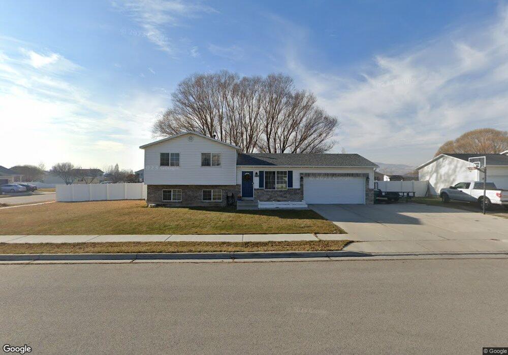
This home is located at 1849 N 2060 W, Lehi, UT 84043 and is currently estimated at $520,067, approximately $340 per square foot. 1849 N 2060 W is a home located in Utah County with nearby schools including North Point Elementary School, Willowcreek Middle School, and Lehi High School.
Ownership History
Date
Name
Owned For
Owner Type
Purchase Details
Closed on
Jun 5, 2020
Sold by
Anderson Jesse L
Bought by
Anderson Jesse L and Anderson Chelsea
Current Estimated Value
Home Financials for this Owner
Home Financials are based on the most recent Mortgage that was taken out on this home.
Original Mortgage
$134,000
Outstanding Balance
$118,781
Interest Rate
3.2%
Mortgage Type
Credit Line Revolving
Estimated Equity
$401,286
Purchase Details
Closed on
Apr 18, 2011
Sold by
Fannie Mae
Bought by
Anderson Benjamin and Anderson Megan M
Home Financials for this Owner
Home Financials are based on the most recent Mortgage that was taken out on this home.
Original Mortgage
$128,000
Interest Rate
4.83%
Mortgage Type
New Conventional
Purchase Details
Closed on
Aug 25, 2010
Sold by
Kantaris Dwayne
Bought by
Federal National Mortgage Association
Purchase Details
Closed on
Aug 23, 2006
Sold by
Bodell Samuel D and Bodell Brandie D
Bought by
Kantaris Dwayne
Home Financials for this Owner
Home Financials are based on the most recent Mortgage that was taken out on this home.
Original Mortgage
$162,800
Interest Rate
6.7%
Mortgage Type
Purchase Money Mortgage
Purchase Details
Closed on
Oct 11, 2001
Sold by
Shock Tracy G and Shock Martina
Bought by
Bodell Samuel D and Bodell Brandie D
Home Financials for this Owner
Home Financials are based on the most recent Mortgage that was taken out on this home.
Original Mortgage
$143,966
Interest Rate
6.88%
Purchase Details
Closed on
Apr 13, 2000
Sold by
Bronson Julie
Bought by
Shock Tracy G and Shock Martina
Purchase Details
Closed on
Jan 6, 2000
Sold by
Scadden Jason D and Bronson Julie
Bought by
Bronson Julie
Purchase Details
Closed on
Jun 22, 1999
Sold by
Salisbury Development Llc
Bought by
Scadden Jason D and Scadden Julie B
Home Financials for this Owner
Home Financials are based on the most recent Mortgage that was taken out on this home.
Original Mortgage
$114,075
Interest Rate
7.01%
Mortgage Type
Seller Take Back
Purchase Details
Closed on
Jun 16, 1999
Sold by
Salisbury Development Llc
Bought by
Scadden Jason D and Scadden Julie B
Home Financials for this Owner
Home Financials are based on the most recent Mortgage that was taken out on this home.
Original Mortgage
$114,075
Interest Rate
7.01%
Mortgage Type
Seller Take Back
Create a Home Valuation Report for This Property
The Home Valuation Report is an in-depth analysis detailing your home's value as well as a comparison with similar homes in the area
Home Values in the Area
Average Home Value in this Area
Purchase History
| Date | Buyer | Sale Price | Title Company |
|---|---|---|---|
| Anderson Jesse L | -- | Artisan Title | |
| Anderson Benjamin | -- | Empire Land Title Inc | |
| Federal National Mortgage Association | $168,845 | Lsi Title Agency Inc | |
| Kantaris Dwayne | -- | Eagle Pointe Title Insuranc | |
| Bodell Samuel D | -- | Associated Title Company | |
| Shock Tracy G | -- | Atlas Title | |
| Bronson Julie | -- | Provo Land Title Company | |
| Scadden Jason D | -- | Provo Land Title Company | |
| Scadden Jason D | -- | Provo Land Title Company |
Source: Public Records
Mortgage History
| Date | Status | Borrower | Loan Amount |
|---|---|---|---|
| Open | Anderson Jesse L | $134,000 | |
| Closed | Anderson Benjamin | $128,000 | |
| Previous Owner | Kantaris Dwayne | $162,800 | |
| Previous Owner | Bodell Samuel D | $143,966 | |
| Previous Owner | Scadden Jason D | $114,075 | |
| Closed | Bodell Samuel D | $5,758 |
Source: Public Records
Tax History Compared to Growth
Tax History
| Year | Tax Paid | Tax Assessment Tax Assessment Total Assessment is a certain percentage of the fair market value that is determined by local assessors to be the total taxable value of land and additions on the property. | Land | Improvement |
|---|---|---|---|---|
| 2025 | $2,013 | $468,600 | $209,400 | $259,200 |
| 2024 | $2,013 | $235,565 | $0 | $0 |
| 2023 | $1,857 | $235,950 | $0 | $0 |
| 2022 | $2,026 | $249,590 | $0 | $0 |
| 2021 | $1,788 | $333,000 | $121,200 | $211,800 |
| 2020 | $1,685 | $310,100 | $112,200 | $197,900 |
| 2019 | $1,505 | $288,000 | $112,200 | $175,800 |
| 2018 | $1,419 | $256,700 | $100,100 | $156,600 |
| 2017 | $1,372 | $132,000 | $0 | $0 |
| 2016 | $1,334 | $119,020 | $0 | $0 |
| 2015 | $1,286 | $108,955 | $0 | $0 |
| 2014 | $1,150 | $96,855 | $0 | $0 |
Source: Public Records
Map
Nearby Homes
- 1896 N 2230 W
- 1970 N 2090 St W
- Palisade Plan at Pioneer Meadows
- Silver Lake Plan at Pioneer Meadows
- Summit Plan at Pioneer Meadows
- Huntington Plan at Pioneer Meadows
- 1542 N 1900 W
- 2012 N 2040 W
- 1990 N 2040 W
- 2013 N 2040 W
- 1968 N 2040 W
- 1991 N 2040 St W
- 1969 N 2040 St W
- 1898 W Pointe Meadow Loop
- 4380 W Bergen Ln
- 2191 N 2350 W
- 2209 W Swift Fox Way Unit 271
- 2184 W Cape Fox Way N Unit 220
- 1060 N Canvasback Dr Unit 405
- 1488 N 1700 W