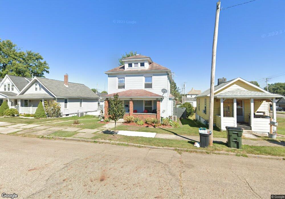
185 5th St SE Brewster, OH 44613
Estimated Value: $145,000 - $178,000
4
Beds
2
Baths
1,408
Sq Ft
$117/Sq Ft
Est. Value
About This Home
This home is located at 185 5th St SE, Brewster, OH 44613 and is currently estimated at $164,717, approximately $116 per square foot. 185 5th St SE is a home located in Stark County with nearby schools including Fairless Elementary School, Fairless Middle School, and Fairless High School.
Ownership History
Date
Name
Owned For
Owner Type
Purchase Details
Closed on
Jun 3, 2011
Sold by
Schott Linda M and Severini Mary A
Bought by
Chahid Rachid and Chahid Melissa A
Current Estimated Value
Home Financials for this Owner
Home Financials are based on the most recent Mortgage that was taken out on this home.
Original Mortgage
$68,103
Outstanding Balance
$47,343
Interest Rate
4.81%
Mortgage Type
Purchase Money Mortgage
Estimated Equity
$117,374
Purchase Details
Closed on
Jan 12, 2008
Sold by
Severini Madelyn and Jordan Dennis C
Bought by
Severni Mary A
Create a Home Valuation Report for This Property
The Home Valuation Report is an in-depth analysis detailing your home's value as well as a comparison with similar homes in the area
Purchase History
We collect this data history from publicly available records. To have your information removed, we recommend requesting removal directly through your county’s website.
| Date | Buyer | Sale Price | Title Company |
|---|---|---|---|
| Chahid Rachid | $65,800 | Attorney | |
| Severni Mary A | -- | Attorney |
Source: Public Records
Mortgage History
We collect this data history from publicly available records. To have your information removed, we recommend requesting removal directly through your county’s website.
| Date | Status | Borrower | Loan Amount |
|---|---|---|---|
| Open | Chahid Rachid | $68,103 |
Source: Public Records
Tax History
| Year | Tax Paid | Tax Assessment Tax Assessment Total Assessment is a certain percentage of the fair market value that is determined by local assessors to be the total taxable value of land and additions on the property. | Land | Improvement |
|---|---|---|---|---|
| 2025 | -- | $41,270 | $7,320 | $33,950 |
| 2024 | $671 | $41,270 | $7,320 | $33,950 |
| 2023 | $1,281 | $28,110 | $6,300 | $21,810 |
| 2022 | $1,220 | $28,110 | $6,300 | $21,810 |
| 2021 | $1,224 | $28,110 | $6,300 | $21,810 |
| 2020 | $1,181 | $25,380 | $5,600 | $19,780 |
| 2019 | $1,156 | $25,380 | $5,600 | $19,780 |
Source: Public Records
Map
Nearby Homes
- 326 Park Dr SE
- 275 4th St SW
- 425 2nd St SE
- 418 Jackson Ave NE
- 134 Harmon Ave NE
- 12159 Lawndell Rd SW
- 0 Justus Ave SW Unit 5206394
- 13095 Navarre Rd SW
- 0 Day Ave SW Unit 5157660
- 0 Pigeon Run Ave SW Unit 5194670
- 0 Pigeon Run Ave SW Unit 5194534
- 0 Pigeon Run Ave SW Unit 5194517
- 0 Pigeon Run Ave SW Unit 5194524
- 0 Pigeon Run Ave SW Unit 5194675
- 0 Pigeon Run Ave SW Unit 5194680
- 0 Pigeon Run Ave SW Unit 5194514
- 0 Pigeon Run Ave SW Unit 5194519
- 0 Pigeon Run Ave SW Unit 5194532
- 0 Pigeon Run Ave SW Unit 5194684
- 14177 Millersburg Rd SW
- 177 5th St SE
- 193 5th St SE
- 173 5th St SE
- 176 4th St SE
- 176 4th St SE Unit Rear
- 205 5th St SE
- 192 4th St SE
- 121 5th St SE
- 170 4th St SE
- 219 5th St SE
- 180 4th St SE
- 160 4th St SE
- 186 5th St SE
- 434 Cleveland Ave SE
- 178 5th St SE
- 160 5th St SE
- 135 5th St SE
- 152 4th St SE
- 206 5th St SE
- 406 Cleveland Ave SE
Your Personal Tour Guide
Ask me questions while you tour the home.