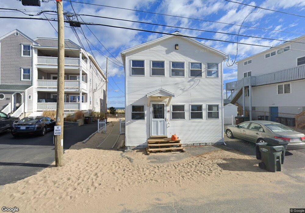
185 Atlantic Ave Unit 1 Salisbury, MA 01952
Estimated Value: $381,000 - $960,000
3
Beds
1
Bath
788
Sq Ft
$715/Sq Ft
Est. Value
About This Home
This home is located at 185 Atlantic Ave Unit 1, Salisbury, MA 01952 and is currently estimated at $563,178, approximately $714 per square foot. 185 Atlantic Ave Unit 1 is a home located in Essex County with nearby schools including Triton Regional High School.
Ownership History
Date
Name
Owned For
Owner Type
Purchase Details
Closed on
Jan 27, 2010
Sold by
Osullivan Jonathan
Bought by
Mmo Realty Llc
Current Estimated Value
Purchase Details
Closed on
Jan 21, 2005
Sold by
Osullivan Jonathan
Bought by
Osullivan Jonathan
Home Financials for this Owner
Home Financials are based on the most recent Mortgage that was taken out on this home.
Original Mortgage
$222,000
Interest Rate
5.64%
Create a Home Valuation Report for This Property
The Home Valuation Report is an in-depth analysis detailing your home's value as well as a comparison with similar homes in the area
Home Values in the Area
Average Home Value in this Area
Purchase History
| Date | Buyer | Sale Price | Title Company |
|---|---|---|---|
| Mmo Realty Llc | -- | -- | |
| Osullivan Jonathan | -- | -- | |
| Osullivan Jonathan | -- | -- |
Source: Public Records
Mortgage History
| Date | Status | Borrower | Loan Amount |
|---|---|---|---|
| Previous Owner | Osullivan Jonathan | $222,000 |
Source: Public Records
Tax History Compared to Growth
Tax History
| Year | Tax Paid | Tax Assessment Tax Assessment Total Assessment is a certain percentage of the fair market value that is determined by local assessors to be the total taxable value of land and additions on the property. | Land | Improvement |
|---|---|---|---|---|
| 2025 | $4,276 | $424,200 | $0 | $424,200 |
| 2024 | $3,992 | $382,000 | $0 | $382,000 |
| 2023 | $4,261 | $361,200 | $0 | $361,200 |
| 2022 | $4,089 | $336,300 | $0 | $336,300 |
| 2021 | $3,902 | $317,500 | $0 | $317,500 |
| 2020 | $3,512 | $306,500 | $0 | $306,500 |
| 2019 | $2,709 | $209,600 | $0 | $209,600 |
| 2018 | $2,544 | $198,200 | $0 | $198,200 |
| 2017 | $2,497 | $192,000 | $0 | $192,000 |
| 2016 | $2,241 | $192,000 | $0 | $192,000 |
| 2015 | $2,037 | $173,400 | $0 | $173,400 |
Source: Public Records
Map
Nearby Homes
- 141 Atlantic Ave
- 116 Railroad Ave
- 114 Railroad Ave
- 52 Brissette Ave
- 103 Railroad Ave
- 10 Meadowview Ln Unit B
- 16 N End Blvd Unit 10
- 16 N End Blvd Unit 8
- 16 N End Blvd Unit 3
- 16 N End Blvd Unit 12
- 16 N End Blvd Unit 5
- 38-40 Central Ave
- 45 Old County Rd Unit 1
- 170 Beach Rd Unit 52
- 98 Central Ave
- 2 Old County Rd Unit 13
- 2 Old County Rd Unit 11
- 2 Old County Rd Unit 10
- 2 Old County Rd Unit 7
- 2 Old County Rd Unit 15
- 185 Atlantic Ave Unit 2
- 185 Atlantic Ave Unit 1 & 2
- 185 Atlantic Ave
- 183 Atlantic Ave Unit 2
- 183 Atlantic Ave Unit 1
- 187 Atlantic Ave
- 187 Atlantic Ave Unit 1
- 187 Atlantic Ave Unit 2
- 189 Atlantic Ave
- 181 Atlantic Ave
- 191 Atlantic Ave
- 179 Atlantic Ave
- 177 Atlantic Ave
- 173 Atlantic Ave
- 175 Atlantic Ave
- 171 Atlantic Ave
- 167 Atlantic Ave
- 163 Atlantic Ave
- 165 Atlantic Ave
- 197 Atlantic Ave