
Seller's Agent in 2025
Tonjia Landreth
Bridge City Realty, LLC
(423) 595-2125
2 in this area
125 Total Sales
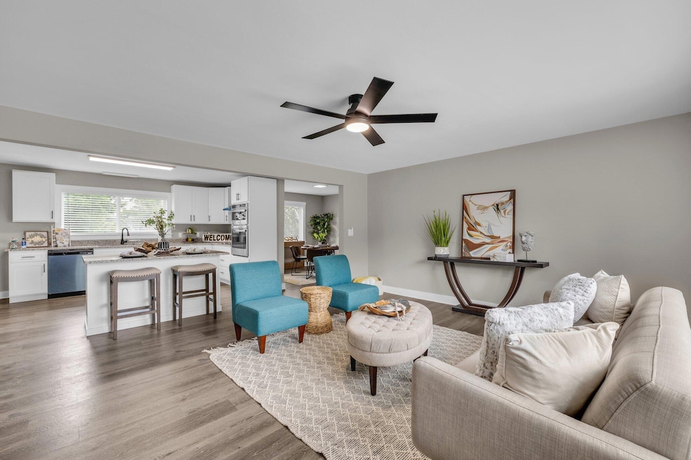
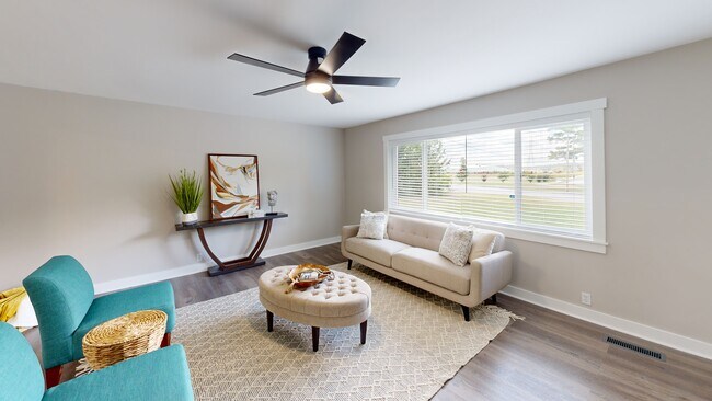


This beautifully remodeled 4-bedroom, 2-bath home sits on a spacious 0.73 acre lot and features fresh paint, new LVP flooring, granite countertops, and all new appliances, including a drop-in cooktop, built-in microwave and oven, and a sleek stainless steel mounted range hood. The kitchen and bathrooms boast brand new cabinets, while the primary bathroom offers a new stand-up shower and the shared bathroom features a new tub-shower combo for added comfort and convenience. Additional upgrades include new gutters, stylish new light fixtures throughout, convenient laundry hookups, and a one-car garage for added storage and security. Enjoy a generous yard and a location close to shopping, dining, and everyday amenities in Catoosa County, making this move-in ready home the perfect blend of comfort, style, and convenience. Schedule your tour today!
Last Agent to Sell the Property
Bridge City Realty, LLC License #288428 Listed on: 06/16/2025
| Date | Type | Sale Price | Title Company |
|---|---|---|---|
| Warranty Deed | $329,000 | -- | |
| Deed | -- | -- | |
| Deed | $68,000 | -- | |
| Deed | $73,500 | -- | |
| Deed | $90,000 | -- |
| Date | Status | Loan Amount | Loan Type |
|---|---|---|---|
| Open | $323,040 | New Conventional |
| Date | Event | Price | List to Sale | Price per Sq Ft |
|---|---|---|---|---|
| 08/21/2025 08/21/25 | Sold | $329,000 | +3.1% | $211 / Sq Ft |
| 08/07/2025 08/07/25 | Pending | -- | -- | -- |
| 07/14/2025 07/14/25 | Price Changed | $319,000 | -3.0% | $205 / Sq Ft |
| 06/27/2025 06/27/25 | Price Changed | $329,000 | -2.9% | $211 / Sq Ft |
| 06/16/2025 06/16/25 | For Sale | $339,000 | -- | $218 / Sq Ft |
| Year | Tax Paid | Tax Assessment Tax Assessment Total Assessment is a certain percentage of the fair market value that is determined by local assessors to be the total taxable value of land and additions on the property. | Land | Improvement |
|---|---|---|---|---|
| 2024 | $1,868 | $71,018 | $10,432 | $60,586 |
| 2023 | $1,445 | $54,923 | $10,432 | $44,491 |
| 2022 | $1,234 | $43,937 | $10,432 | $33,505 |
| 2021 | $1,170 | $43,937 | $10,432 | $33,505 |
| 2020 | $1,095 | $37,088 | $10,432 | $26,656 |
| 2019 | $1,106 | $37,088 | $10,432 | $26,656 |
| 2018 | $1,056 | $33,698 | $7,042 | $26,656 |
| 2017 | $1,096 | $34,967 | $7,042 | $27,925 |
| 2016 | $1,097 | $33,510 | $7,042 | $26,468 |
| 2015 | -- | $33,510 | $7,042 | $26,468 |
| 2014 | -- | $33,510 | $7,042 | $26,468 |
| 2013 | -- | $33,510 | $7,041 | $26,468 |
Seller's Agent in 2025
Tonjia Landreth
Bridge City Realty, LLC
(423) 595-2125
2 in this area
125 Total Sales
Seller Co-Listing Agent in 2025
Blake Harmon
Bridge City Realty, LLC
(423) 648-6242
1 in this area
14 Total Sales
Buyer's Agent in 2025
Megan Hutchinson
Keller Williams Realty
(629) 395-0923
1 in this area
10 Total Sales
Source: Greater Chattanooga REALTORS®
MLS Number: 1514870
APN: 0002H-001
Disclaimer: Certain information contained herein is derived from information provided by parties other than Homes.com. All information provided is deemed reliable, but is not guaranteed to be accurate and should be independently verified.
![]() IDX information is provided exclusively for consumers’ personal, noncommercial use, that it may not be used for any purpose other than to identify prospective properties consumers may be interested in purchasing.
IDX information is provided exclusively for consumers’ personal, noncommercial use, that it may not be used for any purpose other than to identify prospective properties consumers may be interested in purchasing.
Data is deemed reliable but is not guaranteed accurate by the MLS.
Ten-X does not display the entire MLS of Chattanooga, Inc. database on this website. The listings of some real estate brokerage firms have been excluded. Some or all of the listings displayed may not belong to the firm whose website is being visited
Copyright© 2025 by Chattanooga Association of REALTORS®