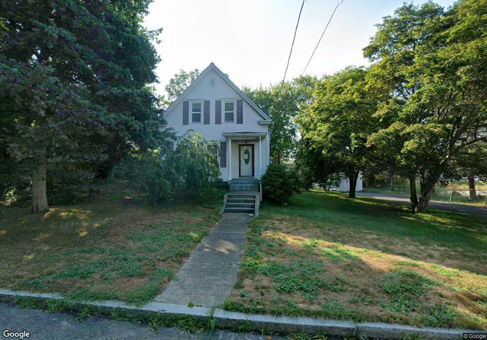
185 Dean St Taunton, MA 02780
Estimated Value: $421,000 - $481,000
4
Beds
2
Baths
1,278
Sq Ft
$352/Sq Ft
Est. Value
About This Home
This home is located at 185 Dean St, Taunton, MA 02780 and is currently estimated at $449,829, approximately $351 per square foot. 185 Dean St is a home located in Bristol County with nearby schools including Elizabeth Pole School, Taunton High School, and John F. Parker Middle School.
Ownership History
Date
Name
Owned For
Owner Type
Purchase Details
Closed on
Feb 28, 2022
Sold by
Martins Celso A and Martins Elzira V
Bought by
Martins Ft
Current Estimated Value
Purchase Details
Closed on
Apr 19, 1991
Sold by
Lowe John A and Lowe Roberta
Bought by
Martins Celso A and Martins Elzira
Home Financials for this Owner
Home Financials are based on the most recent Mortgage that was taken out on this home.
Original Mortgage
$80,000
Interest Rate
9.4%
Mortgage Type
Purchase Money Mortgage
Create a Home Valuation Report for This Property
The Home Valuation Report is an in-depth analysis detailing your home's value as well as a comparison with similar homes in the area
Home Values in the Area
Average Home Value in this Area
Purchase History
| Date | Buyer | Sale Price | Title Company |
|---|---|---|---|
| Martins Ft | -- | None Available | |
| Martins Celso A | $90,000 | -- |
Source: Public Records
Mortgage History
| Date | Status | Borrower | Loan Amount |
|---|---|---|---|
| Previous Owner | Martins Celso A | $10,000 | |
| Previous Owner | Martins Celso A | $68,500 | |
| Previous Owner | Martins Celso A | $80,000 |
Source: Public Records
Tax History Compared to Growth
Tax History
| Year | Tax Paid | Tax Assessment Tax Assessment Total Assessment is a certain percentage of the fair market value that is determined by local assessors to be the total taxable value of land and additions on the property. | Land | Improvement |
|---|---|---|---|---|
| 2025 | $4,226 | $386,300 | $94,900 | $291,400 |
| 2024 | $3,735 | $333,800 | $94,900 | $238,900 |
| 2023 | $3,661 | $303,800 | $94,900 | $208,900 |
| 2022 | $3,514 | $266,600 | $79,100 | $187,500 |
| 2021 | $3,380 | $238,000 | $71,900 | $166,100 |
| 2020 | $3,164 | $212,900 | $71,900 | $141,000 |
| 2019 | $3,031 | $192,300 | $71,900 | $120,400 |
| 2018 | $2,941 | $187,100 | $71,600 | $115,500 |
| 2017 | $2,649 | $168,600 | $67,900 | $100,700 |
| 2016 | $2,570 | $163,900 | $65,900 | $98,000 |
| 2015 | $2,534 | $168,800 | $66,700 | $102,100 |
| 2014 | $2,443 | $167,200 | $63,700 | $103,500 |
Source: Public Records
Map
Nearby Homes
- 0 S Main St Unit 73443212
- 152 Forgeriver
- 208 S Main St
- 110 Dean St Unit 102
- 215 Longmeadow Rd Unit 604
- 215 Longmeadow Rd Unit 403
- 28 Barbara Rd
- 55 Donna Terrace
- 78 Arlington St Unit 1
- 78 Arlington St Unit 3
- 78 Arlington St Unit 2
- 26 Maynard St Unit A
- 11 Williams St
- 30 Buffington St
- 176 School St
- 165 King James Blvd
- 12 Chestnut St Unit A
- 23 Johnson St Unit A
- 23 Johnson St Unit C
- 14 Wilbur St
- 189 Dean St
- 1 South St W
- 1 South St W Unit 2
- 178 S Main St
- 0 S Main St Unit 70855467
- 0 S Main St Unit 72031992
- 0 S Main St Unit 73241933
- 0 S Main St Unit 73165141
- 0 S Main St Unit 72936401
- 170 Dean St
- 5 South St W
- 168 Dean St
- 2 South St W
- 172 Dean St Unit 9
- 172 Dean St Unit 8
- 172 Dean St Unit 7
- 172 Dean St Unit 6
- 172 Dean St Unit 5
- 172 Dean St Unit 4
- 172 Dean St Unit 3