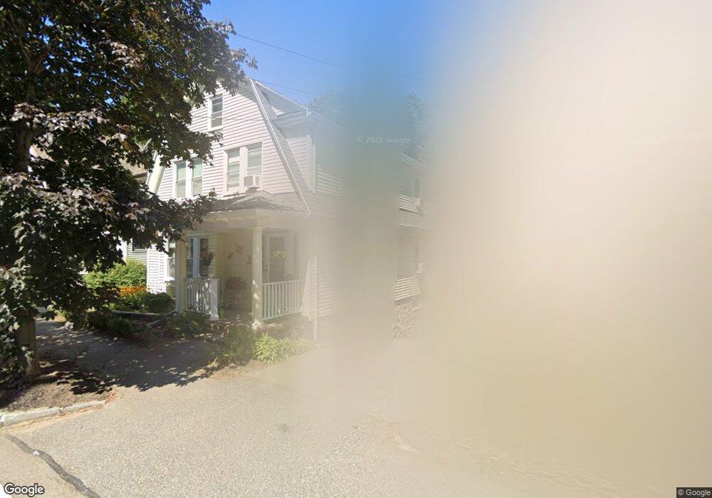
185 Eliot St Milton, MA 02186
Columbine Cliffs NeighborhoodEstimated Value: $921,000 - $979,000
4
Beds
2
Baths
2,040
Sq Ft
$468/Sq Ft
Est. Value
About This Home
This home is located at 185 Eliot St, Milton, MA 02186 and is currently estimated at $955,451, approximately $468 per square foot. 185 Eliot St is a home located in Norfolk County with nearby schools including Milton High School, Conservatory Lab Upper School, and Saint John Paul II Catholic Academy.
Ownership History
Date
Name
Owned For
Owner Type
Purchase Details
Closed on
Jan 8, 2025
Sold by
Casey Linda B and Casey Sean I
Bought by
Casey Ft and Casey
Current Estimated Value
Purchase Details
Closed on
May 14, 1999
Sold by
Mcdermott Marie J
Bought by
Casey Sean I and Casey Linda B
Create a Home Valuation Report for This Property
The Home Valuation Report is an in-depth analysis detailing your home's value as well as a comparison with similar homes in the area
Home Values in the Area
Average Home Value in this Area
Purchase History
| Date | Buyer | Sale Price | Title Company |
|---|---|---|---|
| Casey Ft | -- | None Available | |
| Casey Ft | -- | None Available | |
| Casey Sean I | $170,000 | -- |
Source: Public Records
Mortgage History
| Date | Status | Borrower | Loan Amount |
|---|---|---|---|
| Previous Owner | Casey Sean I | $193,000 | |
| Previous Owner | Casey Sean I | $210,000 |
Source: Public Records
Tax History Compared to Growth
Tax History
| Year | Tax Paid | Tax Assessment Tax Assessment Total Assessment is a certain percentage of the fair market value that is determined by local assessors to be the total taxable value of land and additions on the property. | Land | Improvement |
|---|---|---|---|---|
| 2025 | $8,581 | $773,800 | $439,000 | $334,800 |
| 2024 | $8,455 | $774,300 | $418,100 | $356,200 |
| 2023 | $8,639 | $757,800 | $398,400 | $359,400 |
| 2022 | $8,453 | $677,900 | $398,400 | $279,500 |
| 2021 | $8,066 | $614,300 | $348,100 | $266,200 |
| 2020 | $7,775 | $592,600 | $333,500 | $259,100 |
| 2019 | $7,582 | $575,300 | $323,800 | $251,500 |
| 2018 | $7,108 | $514,700 | $264,300 | $250,400 |
| 2017 | $6,650 | $490,400 | $251,800 | $238,600 |
| 2016 | $5,696 | $421,900 | $188,800 | $233,100 |
| 2015 | $5,646 | $405,000 | $173,700 | $231,300 |
Source: Public Records
Map
Nearby Homes
- 131 Eliot St Unit 312
- 131 Eliot St Unit 408
- 131 Eliot St Unit 305
- 4 School St
- 8-14R Temple St
- 32-32R Temple St
- 67 Idaho St
- 21A High St Unit 2
- 1245 Adams St Unit B406
- 1245 Adams St Unit B210
- 333 Eliot St
- 20 Herrick Dr
- 56 Oakridge St
- 23 Maryknoll St
- 32 Columbine Rd
- 290 Central Ave
- 36 Oakridge St
- 30 Pleasant Hill Ave Unit 32
- 10 Briarcliff Terrace
- 22 Branchfield St Unit D4
- 183 Eliot St
- 191 Eliot St
- 195 Eliot St
- 177 Eliot St
- 184 Eliot St
- 190 Eliot St
- 178 Eliot St
- 178 Eliot St Unit 2
- 201 Eliot St
- 171 Eliot St Unit 173
- 198 Eliot St
- 169 Eliot St
- 169 Eliot St Unit 169
- 169 Eliot St Unit 1
- 167 Eliot St Unit 169
- 167 Eliot St Unit 1
- 41 Maple St Unit 43
- 172 Eliot St Unit 172A
- 172 Eliot St
- 172 Eliot St Unit 1