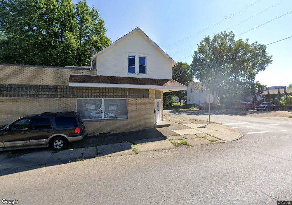
185 Glessner Ave Mansfield, OH 44903
Estimated Value: $36,262 - $39,000
4
Beds
4
Baths
3,920
Sq Ft
$10/Sq Ft
Est. Value
About This Home
This home is located at 185 Glessner Ave, Mansfield, OH 44903 and is currently estimated at $37,316, approximately $9 per square foot. 185 Glessner Ave is a home with nearby schools including St. Peter's Elementary/Montessori School, Discovery School, and St. Peter's Junior High / High School.
Ownership History
Date
Name
Owned For
Owner Type
Purchase Details
Closed on
Apr 4, 2025
Sold by
Mills Douglas Paul
Bought by
Simpson Homes Llc
Current Estimated Value
Purchase Details
Closed on
Mar 29, 2019
Sold by
Smith Randy
Bought by
Mills Douglas Paul
Home Financials for this Owner
Home Financials are based on the most recent Mortgage that was taken out on this home.
Original Mortgage
$27,000
Interest Rate
4.3%
Mortgage Type
New Conventional
Purchase Details
Closed on
May 14, 1991
Sold by
Siciliano Lucy F
Bought by
Smith Randy
Create a Home Valuation Report for This Property
The Home Valuation Report is an in-depth analysis detailing your home's value as well as a comparison with similar homes in the area
Home Values in the Area
Average Home Value in this Area
Purchase History
| Date | Buyer | Sale Price | Title Company |
|---|---|---|---|
| Simpson Homes Llc | $36,000 | Chicago Title | |
| Mills Douglas Paul | $27,000 | Southern Title | |
| Smith Randy | $40,000 | -- |
Source: Public Records
Mortgage History
| Date | Status | Borrower | Loan Amount |
|---|---|---|---|
| Previous Owner | Mills Douglas Paul | $27,000 |
Source: Public Records
Tax History
| Year | Tax Paid | Tax Assessment Tax Assessment Total Assessment is a certain percentage of the fair market value that is determined by local assessors to be the total taxable value of land and additions on the property. | Land | Improvement |
|---|---|---|---|---|
| 2025 | $77 | $12,070 | $3,030 | $9,040 |
| 2024 | $77 | $12,070 | $3,030 | $9,040 |
| 2023 | $106 | $30,670 | $3,030 | $27,640 |
| 2022 | $537 | $9,450 | $2,460 | $6,990 |
| 2021 | $541 | $9,450 | $2,460 | $6,990 |
| 2020 | $553 | $9,450 | $2,460 | $6,990 |
| 2019 | $1,711 | $19,960 | $3,170 | $16,790 |
| 2018 | $777 | $9,100 | $3,170 | $5,930 |
| 2017 | $763 | $9,100 | $3,170 | $5,930 |
| 2016 | $775 | $9,100 | $3,170 | $5,930 |
| 2015 | $775 | $9,100 | $3,170 | $5,930 |
| 2014 | $737 | $9,100 | $3,170 | $5,930 |
| 2012 | $1,453 | $18,760 | $3,170 | $15,590 |
Source: Public Records
Map
Nearby Homes
- 120 Distl Ave
- 172 Crouse St
- 135 Wood St
- 183 Carpenter Rd
- 74 & 78 Lexington Ave
- 212 S Main St
- 286 S Main St
- 157 Marion Ave
- 0 Cline Ave Hedeen Abbeyfeale Unit 9066362
- 219 Lexington Ave
- 22 Small Ave
- 51 Lind Ave
- 27 Dunbilt Ct
- 273 Hammond Ave
- 394 S Main St
- 30 Douglas Ave
- 245 W 4th St
- 167 S Adams St
- 320 Bartley Ave
- 0 Lot #23128 Unit 9069815
- 181 Glessner Ave
- 195 Glessner Ave
- 186 Glessner Ave
- 209 Sturges Ave
- 208 Sturges Ave
- 176 Hemlock Ave
- 175 Glessner Ave
- 182 Arthur Ave
- 180 Glessner Ave
- 215 Sturges Ave
- 167 Glessner Ave
- 174 Arthur Ave
- 165 Glessner Ave
- 175 Sturges Ave
- 221 Sturges Ave
- 218 Sturges Ave
- 170 Glessner Ave
- 164 Glessner Ave Unit 166
- 168 Arthur Ave Unit 170
- 217 Glessner Ave
Your Personal Tour Guide
Ask me questions while you tour the home.