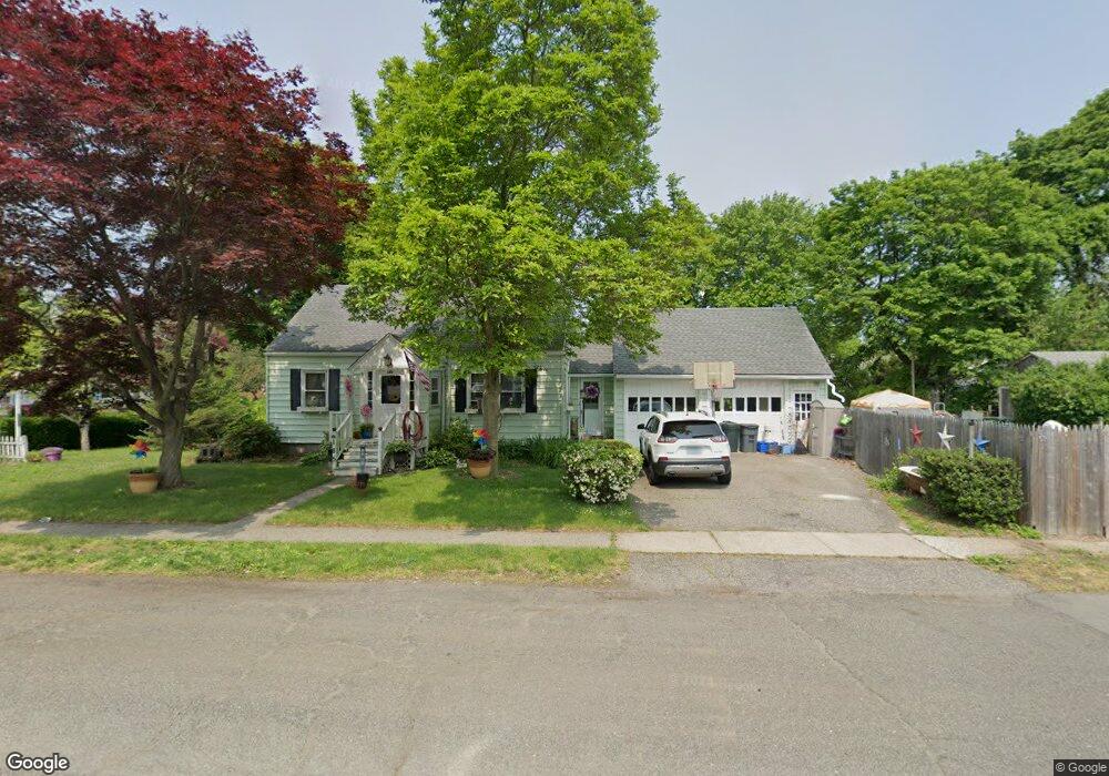
185 Greystone Rd Bridgeport, CT 06610
North Bridgeport NeighborhoodEstimated Value: $362,000 - $400,668
3
Beds
2
Baths
1,327
Sq Ft
$288/Sq Ft
Est. Value
About This Home
This home is located at 185 Greystone Rd, Bridgeport, CT 06610 and is currently estimated at $381,917, approximately $287 per square foot. 185 Greystone Rd is a home located in Fairfield County with nearby schools including Hooker School, Harding High School, and Christian Heritage School.
Ownership History
Date
Name
Owned For
Owner Type
Purchase Details
Closed on
Aug 26, 1993
Sold by
Brown Raymond
Bought by
Ploff Robert
Current Estimated Value
Home Financials for this Owner
Home Financials are based on the most recent Mortgage that was taken out on this home.
Original Mortgage
$94,900
Interest Rate
7.06%
Mortgage Type
Unknown
Create a Home Valuation Report for This Property
The Home Valuation Report is an in-depth analysis detailing your home's value as well as a comparison with similar homes in the area
Home Values in the Area
Average Home Value in this Area
Purchase History
| Date | Buyer | Sale Price | Title Company |
|---|---|---|---|
| Ploff Robert | $95,000 | -- | |
| Ploff Robert | $95,000 | -- |
Source: Public Records
Mortgage History
| Date | Status | Borrower | Loan Amount |
|---|---|---|---|
| Open | Ploff Robert | $43,835 | |
| Closed | Ploff Robert | $93,800 | |
| Closed | Ploff Robert | $94,900 |
Source: Public Records
Tax History
| Year | Tax Paid | Tax Assessment Tax Assessment Total Assessment is a certain percentage of the fair market value that is determined by local assessors to be the total taxable value of land and additions on the property. | Land | Improvement |
|---|---|---|---|---|
| 2025 | $5,960 | $137,170 | $65,420 | $71,750 |
| 2024 | $5,960 | $137,170 | $65,420 | $71,750 |
| 2023 | $5,960 | $137,170 | $65,420 | $71,750 |
| 2022 | $5,960 | $137,170 | $65,420 | $71,750 |
| 2021 | $5,960 | $137,170 | $65,420 | $71,750 |
| 2020 | $6,098 | $112,950 | $53,670 | $59,280 |
| 2019 | $6,098 | $112,950 | $53,670 | $59,280 |
| 2018 | $6,141 | $112,950 | $53,670 | $59,280 |
| 2017 | $6,141 | $112,950 | $53,670 | $59,280 |
| 2016 | $6,141 | $112,950 | $53,670 | $59,280 |
| 2015 | $5,627 | $133,340 | $52,440 | $80,900 |
| 2014 | $5,627 | $133,340 | $52,440 | $80,900 |
Source: Public Records
Map
Nearby Homes
- 3699 Broadbridge Ave Unit 330
- 3699 Broadbridge Ave Unit 101
- 11 Knollcrest Dr
- 72 Broadmere Rd
- 119 Jennings Ave
- 120 Huntington Turnpike Unit 202
- 211 Louisiana Ave Unit D
- 11 Nob Hill Cir
- 132 Virginia Ave Unit 132
- 261 Pennsylvania Ave
- 2322 Nichols Ave
- 186 Louisiana Ave Unit D
- 1679 Nichols Ave
- 2803 Broadbridge Ave
- 33 Louisiana Ave Unit 35
- 1285 Success Ave
- 285 Hillcrest Rd
- 250 Dayton Rd
- 207 Hillcrest Rd
- 60 Quail Trail
- 249 Lynne Place
- 205 Greystone Rd
- 291 Lynne Place
- 112 Emerald St
- 235 Lynne Place
- 250 Lynne Place
- 200 Greystone Rd
- 276 Lynne Place
- 98 Emerald St
- 226 Greystone Rd
- 210 Greystone Rd
- 135 Greystone Rd
- 305 Lynne Place
- 390 Fairfax Rd
- 221 Lynne Place
- 82 Emerald St
- 306 Lynne Place
- 380 Fairfax Rd
- 321 Lynne Place
- 216 Lynne Place
Your Personal Tour Guide
Ask me questions while you tour the home.