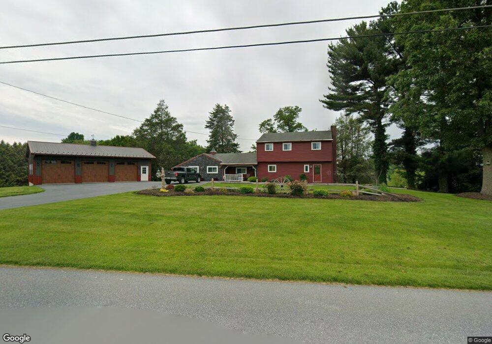
185 Grubb Ave Lebanon, PA 17046
Estimated Value: $420,774 - $458,000
3
Beds
2
Baths
1,652
Sq Ft
$266/Sq Ft
Est. Value
About This Home
This home is located at 185 Grubb Ave, Lebanon, PA 17046 and is currently estimated at $439,444, approximately $266 per square foot. 185 Grubb Ave is a home located in Lebanon County with nearby schools including Union Canal Elementary School, Cedar Crest Middle School, and Cedar Crest High School.
Ownership History
Date
Name
Owned For
Owner Type
Purchase Details
Closed on
Apr 22, 2019
Sold by
Buchter Russel B and Buchter Deanne M
Bought by
Mays Bruce T
Current Estimated Value
Home Financials for this Owner
Home Financials are based on the most recent Mortgage that was taken out on this home.
Original Mortgage
$220,800
Outstanding Balance
$143,715
Interest Rate
4.4%
Mortgage Type
New Conventional
Estimated Equity
$295,729
Purchase Details
Closed on
May 8, 2017
Sold by
Arnold Edward L
Bought by
Buchter Russel B and Buchter Deanne M
Home Financials for this Owner
Home Financials are based on the most recent Mortgage that was taken out on this home.
Original Mortgage
$175,000
Interest Rate
4.23%
Mortgage Type
New Conventional
Purchase Details
Closed on
Sep 23, 2015
Sold by
Brandt Fredrick A and Brandt Robert A
Bought by
Arnold Edward L
Create a Home Valuation Report for This Property
The Home Valuation Report is an in-depth analysis detailing your home's value as well as a comparison with similar homes in the area
Home Values in the Area
Average Home Value in this Area
Purchase History
| Date | Buyer | Sale Price | Title Company |
|---|---|---|---|
| Mays Bruce T | $276,000 | None Available | |
| Buchter Russel B | $255,000 | None Available | |
| Arnold Edward L | $275,000 | Attorney |
Source: Public Records
Mortgage History
| Date | Status | Borrower | Loan Amount |
|---|---|---|---|
| Open | Mays Bruce T | $220,800 | |
| Previous Owner | Buchter Russel B | $175,000 |
Source: Public Records
Tax History Compared to Growth
Tax History
| Year | Tax Paid | Tax Assessment Tax Assessment Total Assessment is a certain percentage of the fair market value that is determined by local assessors to be the total taxable value of land and additions on the property. | Land | Improvement |
|---|---|---|---|---|
| 2025 | $6,053 | $244,200 | $106,500 | $137,700 |
| 2024 | $5,522 | $244,200 | $106,500 | $137,700 |
| 2023 | $5,522 | $244,200 | $106,500 | $137,700 |
| 2022 | $5,371 | $244,200 | $106,500 | $137,700 |
| 2021 | $5,113 | $244,200 | $106,500 | $137,700 |
| 2020 | $4,662 | $244,200 | $106,500 | $137,700 |
| 2019 | $4,481 | $224,300 | $106,500 | $117,800 |
| 2018 | $4,397 | $224,300 | $106,500 | $117,800 |
| 2017 | $1,189 | $224,300 | $106,500 | $117,800 |
| 2016 | $4,295 | $224,300 | $106,500 | $117,800 |
| 2015 | -- | $224,300 | $106,500 | $117,800 |
| 2014 | -- | $224,300 | $106,500 | $117,800 |
Source: Public Records
Map
Nearby Homes
- 46 Carol Ann Dr
- 559 Bella May Cir
- 27 Penny Ln
- 01 Bella May Cir
- 00 Bella May Cir
- 604 Liliana Dr
- 604 Lilliana Dr
- 609 Lilliana Dr
- Northfield Plan at Sweetbriar 55+ Living - Sweetbriar 55+Living
- Stonecroft Plan at Sweetbriar 55+ Living - Sweetbriar 55+Living
- Madison Plan at Sweetbriar 55+ Living - Sweetbriar 55+Living
- Perry Plan at Sweetbriar 55+ Living - Sweetbriar 55+Living
- Morrison Plan at Sweetbriar 55+ Living - Sweetbriar 55+Living
- Atworth Plan at Sweetbriar 55+ Living - Sweetbriar 55+Living
- Hartford Plan at Sweetbriar 55+ Living - Sweetbriar 55+Living
- Norton Plan at Sweetbriar 55+ Living - Sweetbriar 55+Living
- Magnolia Plan at Sweetbriar 55+ Living - Sweetbriar 55+Living
- 98 Northcrest Acres
- Huntington Plan at Briar Ridge
- 834 Kimmerlings Rd