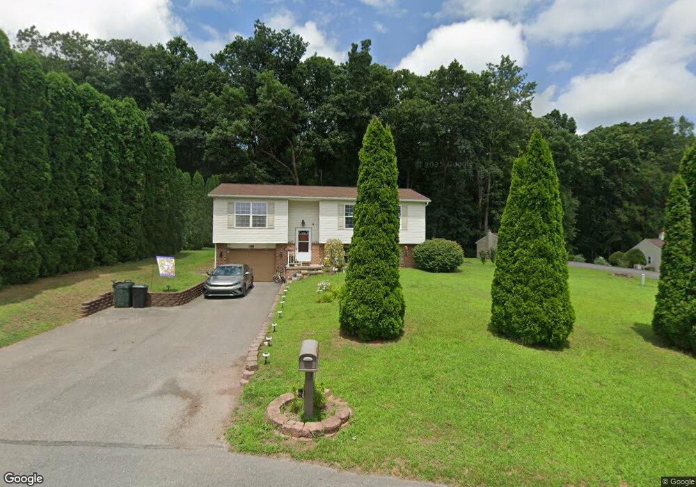
185 Lenker Dr Williamstown, PA 17098
Estimated Value: $172,000 - $241,142
3
Beds
1
Bath
996
Sq Ft
$218/Sq Ft
Est. Value
About This Home
This home is located at 185 Lenker Dr, Williamstown, PA 17098 and is currently estimated at $217,286, approximately $218 per square foot. 185 Lenker Dr is a home located in Dauphin County with nearby schools including Williams Valley Elementary School and Williams Valley Junior/Senior High School.
Ownership History
Date
Name
Owned For
Owner Type
Purchase Details
Closed on
Jul 28, 2004
Sold by
Lenker Donald M
Bought by
Rudy Jerry A
Current Estimated Value
Home Financials for this Owner
Home Financials are based on the most recent Mortgage that was taken out on this home.
Original Mortgage
$105,050
Outstanding Balance
$53,230
Interest Rate
6.33%
Mortgage Type
FHA
Estimated Equity
$164,056
Create a Home Valuation Report for This Property
The Home Valuation Report is an in-depth analysis detailing your home's value as well as a comparison with similar homes in the area
Home Values in the Area
Average Home Value in this Area
Purchase History
| Date | Buyer | Sale Price | Title Company |
|---|---|---|---|
| Rudy Jerry A | $105,900 | -- |
Source: Public Records
Mortgage History
| Date | Status | Borrower | Loan Amount |
|---|---|---|---|
| Open | Rudy Jerry A | $105,050 |
Source: Public Records
Tax History Compared to Growth
Tax History
| Year | Tax Paid | Tax Assessment Tax Assessment Total Assessment is a certain percentage of the fair market value that is determined by local assessors to be the total taxable value of land and additions on the property. | Land | Improvement |
|---|---|---|---|---|
| 2025 | $3,328 | $106,600 | $14,800 | $91,800 |
| 2024 | $3,046 | $106,600 | $14,800 | $91,800 |
| 2023 | $2,928 | $106,600 | $14,800 | $91,800 |
| 2022 | $2,817 | $106,600 | $14,800 | $91,800 |
| 2021 | $2,738 | $106,600 | $14,800 | $91,800 |
| 2020 | $2,738 | $106,600 | $14,800 | $91,800 |
| 2019 | $2,738 | $106,600 | $14,800 | $91,800 |
| 2018 | $2,738 | $106,600 | $14,800 | $91,800 |
| 2017 | $2,738 | $106,600 | $14,800 | $91,800 |
| 2016 | $0 | $106,600 | $14,800 | $91,800 |
| 2015 | -- | $106,600 | $14,800 | $91,800 |
| 2014 | -- | $106,600 | $14,800 | $91,800 |
Source: Public Records
Map
Nearby Homes
- 1254 W Broad St
- 429 W Market St
- 416 W Market St
- 215 W Market St
- 127 and 129 E Market St
- 144 East St
- 111 E Market St
- 128 E Market St
- 210 E Broad St
- 311 Vine St
- 344 E Broad St
- 9701 United States Route 209
- 453 E Market St
- 457 E Market St
- 0 Maple St Unit PADA2051736
- 599 E Market St
- 534 Pottsville St
- 420 Walnut St
- 211 Oak St
- 770 Main St