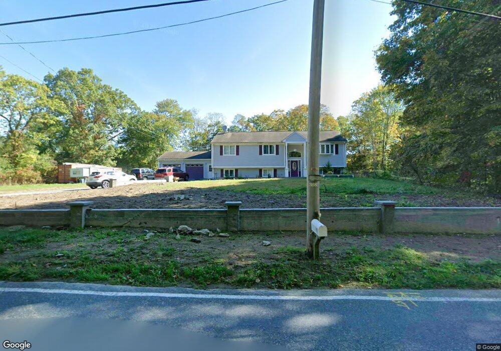
185 Pine St Rehoboth, MA 02769
Estimated Value: $477,000 - $794,000
3
Beds
3
Baths
2,693
Sq Ft
$257/Sq Ft
Est. Value
About This Home
This home is located at 185 Pine St, Rehoboth, MA 02769 and is currently estimated at $692,225, approximately $257 per square foot. 185 Pine St is a home located in Bristol County with nearby schools including Dighton-Rehoboth Regional High School and Cedar Brook School.
Ownership History
Date
Name
Owned For
Owner Type
Purchase Details
Closed on
Mar 26, 2021
Sold by
Dagraca Daniel
Bought by
Neves Daniel S and Monteiro Sara M
Current Estimated Value
Home Financials for this Owner
Home Financials are based on the most recent Mortgage that was taken out on this home.
Original Mortgage
$232,750
Outstanding Balance
$208,277
Interest Rate
2.73%
Mortgage Type
Purchase Money Mortgage
Estimated Equity
$483,948
Purchase Details
Closed on
Jul 30, 2018
Sold by
Neves Daniel S
Bought by
Dagraca Daniel
Home Financials for this Owner
Home Financials are based on the most recent Mortgage that was taken out on this home.
Original Mortgage
$290,000
Interest Rate
4.6%
Mortgage Type
New Conventional
Purchase Details
Closed on
Sep 26, 2017
Sold by
Neves Carlota B and Neves Daniel S
Bought by
Neves Daniel S
Create a Home Valuation Report for This Property
The Home Valuation Report is an in-depth analysis detailing your home's value as well as a comparison with similar homes in the area
Home Values in the Area
Average Home Value in this Area
Purchase History
| Date | Buyer | Sale Price | Title Company |
|---|---|---|---|
| Neves Daniel S | $245,000 | None Available | |
| Neves Daniel S | $245,000 | None Available | |
| Dagraca Daniel | $365,000 | -- | |
| Dagraca Daniel | $365,000 | -- | |
| Neves Daniel S | -- | -- | |
| Neves Daniel S | -- | -- |
Source: Public Records
Mortgage History
| Date | Status | Borrower | Loan Amount |
|---|---|---|---|
| Open | Neves Daniel S | $232,750 | |
| Closed | Neves Daniel S | $232,750 | |
| Previous Owner | Dagraca Daniel | $290,000 |
Source: Public Records
Tax History Compared to Growth
Tax History
| Year | Tax Paid | Tax Assessment Tax Assessment Total Assessment is a certain percentage of the fair market value that is determined by local assessors to be the total taxable value of land and additions on the property. | Land | Improvement |
|---|---|---|---|---|
| 2025 | $6,353 | $569,800 | $192,500 | $377,300 |
| 2024 | $6,366 | $560,400 | $192,500 | $367,900 |
| 2023 | $5,595 | $515,900 | $188,500 | $327,400 |
| 2022 | $5,595 | $441,600 | $180,100 | $261,500 |
| 2021 | $5,538 | $418,300 | $163,800 | $254,500 |
| 2020 | $5,046 | $384,600 | $163,800 | $220,800 |
| 2018 | $4,052 | $361,200 | $156,000 | $205,200 |
| 2017 | $4,244 | $337,900 | $156,000 | $181,900 |
| 2016 | $4,169 | $343,100 | $156,000 | $187,100 |
| 2015 | $4,046 | $328,700 | $148,800 | $179,900 |
| 2014 | $3,766 | $302,700 | $141,600 | $161,100 |
Source: Public Records
Map
Nearby Homes
- 16 Salisbury St
- 37 Colonial Way
- 23 Colonial Way
- 15 Hickory Ridge Rd
- 9 Hidden Hills Dr
- 31 Woodland Way
- 25 Lincoln St
- 9 Gerry Dr
- 1 Clubhouse Way
- 824 Taunton Ave
- 7 Ledge Hill Ln
- 181 Sherman Ave
- 52 Walker St
- 15 Bucklin Dr
- 181 Hope St
- 111 Summer St
- Lot 11 Ledge Hill Ln
- 22 Bucklin Dr
- 108 Homestead Ave
- 67 Wheeler St