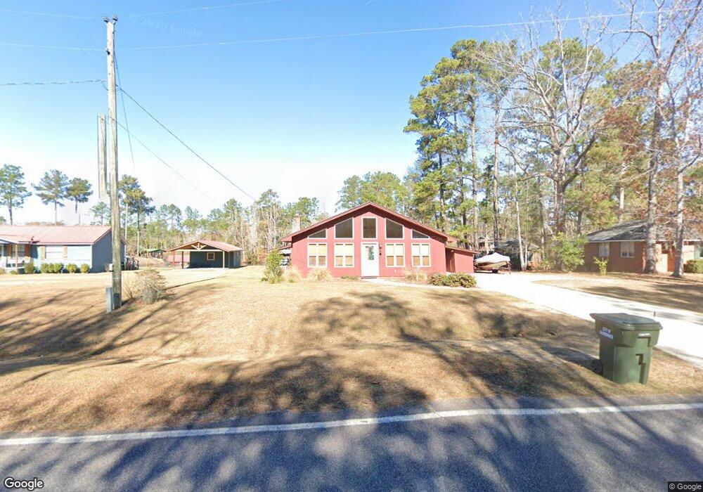
185 River Rd Bainbridge, GA 39819
Estimated Value: $205,540 - $295,000
4
Beds
2
Baths
1,456
Sq Ft
$167/Sq Ft
Est. Value
About This Home
This home is located at 185 River Rd, Bainbridge, GA 39819 and is currently estimated at $243,635, approximately $167 per square foot. 185 River Rd is a home located in Decatur County with nearby schools including Bainbridge High School.
Ownership History
Date
Name
Owned For
Owner Type
Purchase Details
Closed on
Feb 7, 2012
Sold by
Mcfarland Susan L
Bought by
Fenior Darrin and Fenior Kimberly
Current Estimated Value
Purchase Details
Closed on
Nov 9, 2011
Sold by
Rosenbury Robert
Bought by
Fenior Darrin and Fenior Kimberly
Home Financials for this Owner
Home Financials are based on the most recent Mortgage that was taken out on this home.
Original Mortgage
$100,000
Interest Rate
4.09%
Mortgage Type
New Conventional
Purchase Details
Closed on
Feb 10, 2011
Sold by
Mcfarland Susan L
Bought by
Pritchett Mary Jo and Sanders Beth
Create a Home Valuation Report for This Property
The Home Valuation Report is an in-depth analysis detailing your home's value as well as a comparison with similar homes in the area
Purchase History
| Date | Buyer | Sale Price | Title Company |
|---|---|---|---|
| Fenior Darrin | $200 | -- | |
| Fenior Darrin | $125,000 | -- | |
| Pritchett Mary Jo | $250 | -- |
Source: Public Records
Mortgage History
| Date | Status | Borrower | Loan Amount |
|---|---|---|---|
| Previous Owner | Fenior Darrin | $100,000 |
Source: Public Records
Tax History
| Year | Tax Paid | Tax Assessment Tax Assessment Total Assessment is a certain percentage of the fair market value that is determined by local assessors to be the total taxable value of land and additions on the property. | Land | Improvement |
|---|---|---|---|---|
| 2025 | $2,040 | $75,002 | $20,000 | $55,002 |
| 2024 | $2,052 | $70,136 | $20,000 | $50,136 |
| 2023 | $1,629 | $70,136 | $20,000 | $50,136 |
| 2022 | $2,000 | $70,741 | $20,000 | $50,741 |
| 2021 | $1,913 | $66,536 | $20,000 | $46,536 |
| 2020 | $1,860 | $61,556 | $20,000 | $41,556 |
| 2019 | $1,906 | $60,764 | $14,400 | $46,364 |
| 2018 | $1,882 | $60,764 | $14,400 | $46,364 |
| 2017 | $1,950 | $62,136 | $14,400 | $47,736 |
| 2016 | $1,702 | $56,235 | $14,400 | $41,835 |
| 2015 | $1,725 | $56,235 | $14,400 | $41,835 |
| 2014 | $1,505 | $56,235 | $14,400 | $41,835 |
| 2013 | -- | $56,235 | $14,400 | $41,835 |
Source: Public Records
Map
Nearby Homes
- 125 Dogwood Dr
- 258 Smithtown Rd
- LOT 5/6 Block A Mountain View Way
- LOT 5/6 Block A Mountain View Way Unit 5, 6
- Lot 19 A Hammock Cir Unit 22
- Lot 13 Block A Mountain View Way
- Lot 12 Block A Mountain View Way
- 0 Booster Club Rd Lots 17 & 18 Unit 15524
- 0 Booster Club Rd Unit 10721908
- 7877 Spring Creek Dr
- 7779 Spring Creek Dr
- 2175 John Thursby Rd
- 00 Pine Logging Rd
- 7583 Murkerson St
- 7570 Murkerson St
- 162 Fitzsimmons St
- Lot #4 Old Faceville Rd
- 145 Old Post Office Loop
- 0 Buddy Adams Pkwy
- 2328 John Thursby Rd
Your Personal Tour Guide
Ask me questions while you tour the home.