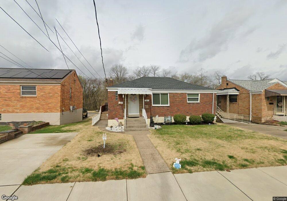
185 Roosevelt Ave Mc Kees Rocks, PA 15136
Stowe Township NeighborhoodEstimated Value: $149,000 - $188,000
3
Beds
2
Baths
948
Sq Ft
$172/Sq Ft
Est. Value
About This Home
This home is located at 185 Roosevelt Ave, Mc Kees Rocks, PA 15136 and is currently estimated at $162,586, approximately $171 per square foot. 185 Roosevelt Ave is a home located in Allegheny County with nearby schools including Sto-Rox Upper Elementary School, Sto-Rox Primary Center, and Sto-Rox Junior/Senior High School.
Ownership History
Date
Name
Owned For
Owner Type
Purchase Details
Closed on
Oct 6, 2010
Sold by
Finnegan Eileen K and Bialek Richard J
Bought by
Hughes Robert J
Current Estimated Value
Home Financials for this Owner
Home Financials are based on the most recent Mortgage that was taken out on this home.
Original Mortgage
$82,389
Outstanding Balance
$55,464
Interest Rate
4.75%
Mortgage Type
FHA
Estimated Equity
$107,122
Create a Home Valuation Report for This Property
The Home Valuation Report is an in-depth analysis detailing your home's value as well as a comparison with similar homes in the area
Home Values in the Area
Average Home Value in this Area
Purchase History
| Date | Buyer | Sale Price | Title Company |
|---|---|---|---|
| Hughes Robert J | $83,500 | -- |
Source: Public Records
Mortgage History
| Date | Status | Borrower | Loan Amount |
|---|---|---|---|
| Open | Hughes Robert J | $82,389 |
Source: Public Records
Tax History Compared to Growth
Tax History
| Year | Tax Paid | Tax Assessment Tax Assessment Total Assessment is a certain percentage of the fair market value that is determined by local assessors to be the total taxable value of land and additions on the property. | Land | Improvement |
|---|---|---|---|---|
| 2025 | $3,051 | $70,600 | $20,000 | $50,600 |
| 2024 | $3,051 | $70,600 | $20,000 | $50,600 |
| 2023 | $2,932 | $70,600 | $20,000 | $50,600 |
| 2022 | $2,839 | $70,600 | $20,000 | $50,600 |
| 2021 | $334 | $70,600 | $20,000 | $50,600 |
| 2020 | $2,775 | $70,600 | $20,000 | $50,600 |
| 2019 | $2,775 | $70,600 | $20,000 | $50,600 |
| 2018 | $334 | $70,600 | $20,000 | $50,600 |
| 2017 | $2,711 | $70,600 | $20,000 | $50,600 |
| 2016 | $334 | $70,600 | $20,000 | $50,600 |
| 2015 | $334 | $70,600 | $20,000 | $50,600 |
| 2014 | $2,711 | $70,600 | $20,000 | $50,600 |
Source: Public Records
Map
Nearby Homes
- 543 Elizabeth Ave
- 270 Wheeler Ave
- 425 Macarthur St
- 124 Pleasant Ridge Rd
- 86 Thorncrest Dr
- 601 Hillcrest Ave
- 1490 Island Ave
- 813 13th St
- 1421 Fleming Ave
- 104 Thorncrest Dr
- 1447 Fleming Ave
- 214 Barbara Dr
- 1212 Woodward Ave
- 230 Lenore Dr
- 802 10th St
- 1406 Broadway Ave
- 810 10th St
- 837 Benwood Ave
- 813 10th St
- 815 10th St
- 175 Roosevelt Ave
- 195 Roosevelt Ave
- 165 Roosevelt Ave
- 205 Roosevelt Ave
- 190 Roosevelt Ave
- 200 Roosevelt Ave
- 180 Roosevelt Ave
- 155 Roosevelt Ave
- 215 Roosevelt Ave
- 210 Roosevelt Ave
- 170 Roosevelt Ave
- 225 Roosevelt Ave
- 145 Roosevelt Ave
- 220 Roosevelt Ave
- 160 Roosevelt Ave
- 150 Roosevelt Ave
- 135 Roosevelt Ave
- 240 Roosevelt Ave
- 235 Roosevelt Ave
- 140 Roosevelt Ave