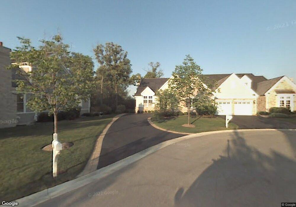
185 S Bradford Ct Lake Forest, IL 60045
Estimated Value: $868,000 - $941,000
--
Bed
3
Baths
2,276
Sq Ft
$392/Sq Ft
Est. Value
About This Home
This home is located at 185 S Bradford Ct, Lake Forest, IL 60045 and is currently estimated at $892,384, approximately $392 per square foot. 185 S Bradford Ct is a home located in Lake County with nearby schools including Deer Path Middle School East, Everett Elementary School, and Lake Forest High School.
Ownership History
Date
Name
Owned For
Owner Type
Purchase Details
Closed on
Dec 15, 2004
Sold by
Stonebridge At Conway Farms Llc
Bought by
Peterson Linda A and Linda A Peterson Trust
Current Estimated Value
Home Financials for this Owner
Home Financials are based on the most recent Mortgage that was taken out on this home.
Original Mortgage
$528,000
Interest Rate
5.83%
Mortgage Type
Unknown
Create a Home Valuation Report for This Property
The Home Valuation Report is an in-depth analysis detailing your home's value as well as a comparison with similar homes in the area
Home Values in the Area
Average Home Value in this Area
Purchase History
| Date | Buyer | Sale Price | Title Company |
|---|---|---|---|
| Peterson Linda A | $661,500 | Chicago Title Insurance Comp |
Source: Public Records
Mortgage History
| Date | Status | Borrower | Loan Amount |
|---|---|---|---|
| Closed | Peterson Linda A | $528,000 |
Source: Public Records
Tax History Compared to Growth
Tax History
| Year | Tax Paid | Tax Assessment Tax Assessment Total Assessment is a certain percentage of the fair market value that is determined by local assessors to be the total taxable value of land and additions on the property. | Land | Improvement |
|---|---|---|---|---|
| 2024 | $14,786 | $255,184 | $75,510 | $179,674 |
| 2023 | $12,733 | $240,785 | $71,249 | $169,536 |
| 2022 | $12,733 | $216,080 | $63,939 | $152,141 |
| 2021 | $12,355 | $213,751 | $63,250 | $150,501 |
| 2020 | $12,052 | $214,480 | $63,466 | $151,014 |
| 2019 | $11,632 | $213,689 | $63,232 | $150,457 |
| 2018 | $10,310 | $215,052 | $61,368 | $153,684 |
| 2017 | $10,706 | $210,033 | $59,936 | $150,097 |
| 2016 | $10,330 | $201,123 | $57,393 | $143,730 |
| 2015 | $10,131 | $188,088 | $53,673 | $134,415 |
| 2014 | $9,092 | $169,825 | $57,643 | $112,182 |
| 2012 | $8,937 | $170,166 | $57,759 | $112,407 |
Source: Public Records
Map
Nearby Homes
- 95 S Canterbury Ct
- 1745 W Newport Ct
- 1830 W North Pond Ln
- 1845 W North Pond Ln
- 289 S South Shore Ln
- 1515 Sage Ct
- 1775 Westbridge Cir
- 2150 W Saunders Rd
- 500 Andover Ct
- 2200 W Saunders Rd
- 1181 Gavin Ct
- 625 Leland Ct
- 1036 Barrys Ct
- 1130 Gavin Ct
- 1161 Gavin Ct
- 480 Saunders Rd
- 1031 Barrys Ct
- 1685 Cornell Ct
- 1761 Stanford Ct
- 660 S Buckingham Ct
- 195 S Bradford Ct
- 175 S Bradford Ct
- 165 S Bradford Ct
- 180 S Bradford Ct
- 190 S Bradford Ct
- 145 S Bradford Ct
- 170 S Bradford Ct
- 160 S Bradford Ct
- 135 S Bradford Ct
- 140 S Bradford Ct
- 1605 W Broadland Ln
- 1605 W Broadland Ln
- 130 S Bradford Ct
- 195 S Danbury Ct
- 185 S Danbury Ct
- 1615 W Broadland Ln
- 1585 W Broadland Ln
- 1625 W Broadland Ln
- 145 S Danbury Ct