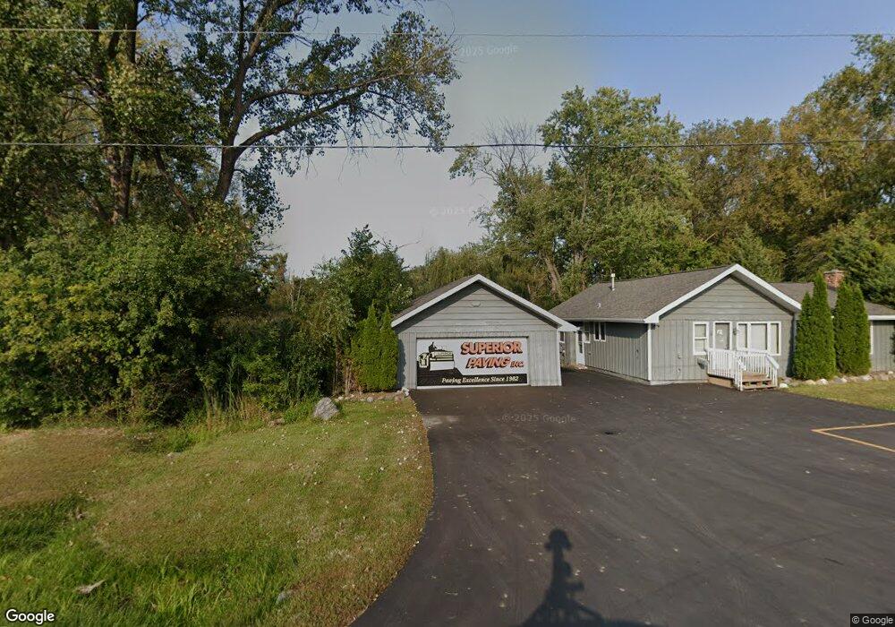
185 S Rt 12 Hwy Fox Lake, IL 60020
Estimated Value: $174,004
--
Bed
1
Bath
--
Sq Ft
0.74
Acres
About This Home
This home is located at 185 S Rt 12 Hwy, Fox Lake, IL 60020 and is currently estimated at $174,004. 185 S Rt 12 Hwy is a home located in Lake County with nearby schools including Big Hollow Primary School, Big Hollow Elementary School, and Big Hollow Middle School.
Ownership History
Date
Name
Owned For
Owner Type
Purchase Details
Closed on
Aug 15, 2012
Sold by
Cdbna Llc
Bought by
Barber Jay and Barber Jennifer
Current Estimated Value
Purchase Details
Closed on
May 2, 2012
Sold by
Lescher Michael Wm
Bought by
Cdbna Llc
Purchase Details
Closed on
Aug 12, 2005
Sold by
Lechner Jeanne
Bought by
Lescher Michael Wm
Home Financials for this Owner
Home Financials are based on the most recent Mortgage that was taken out on this home.
Original Mortgage
$178,000
Interest Rate
5.8%
Mortgage Type
Purchase Money Mortgage
Create a Home Valuation Report for This Property
The Home Valuation Report is an in-depth analysis detailing your home's value as well as a comparison with similar homes in the area
Home Values in the Area
Average Home Value in this Area
Purchase History
| Date | Buyer | Sale Price | Title Company |
|---|---|---|---|
| Barber Jay | $80,000 | Acquest Title Services Llc | |
| Cdbna Llc | $500 | Blackhawk Title Services | |
| Lescher Michael Wm | $237,500 | Multiple |
Source: Public Records
Mortgage History
| Date | Status | Borrower | Loan Amount |
|---|---|---|---|
| Previous Owner | Lescher Michael Wm | $178,000 |
Source: Public Records
Tax History Compared to Growth
Tax History
| Year | Tax Paid | Tax Assessment Tax Assessment Total Assessment is a certain percentage of the fair market value that is determined by local assessors to be the total taxable value of land and additions on the property. | Land | Improvement |
|---|---|---|---|---|
| 2024 | $4,686 | $61,280 | $14,443 | $46,837 |
| 2023 | $4,800 | $57,729 | $13,606 | $44,123 |
| 2022 | $4,800 | $51,772 | $7,230 | $44,542 |
| 2021 | $4,724 | $48,800 | $6,815 | $41,985 |
| 2020 | $4,712 | $48,103 | $6,718 | $41,385 |
| 2019 | $4,549 | $46,128 | $6,442 | $39,686 |
| 2018 | $3,248 | $31,890 | $6,660 | $25,230 |
| 2017 | $3,330 | $31,890 | $6,156 | $25,734 |
| 2016 | $3,353 | $29,166 | $5,630 | $23,536 |
| 2015 | $3,196 | $27,217 | $5,254 | $21,963 |
| 2014 | $4,063 | $30,661 | $4,608 | $26,053 |
| 2012 | $4,663 | $36,334 | $4,804 | $31,530 |
Source: Public Records
Map
Nearby Homes
- 35675 N Marine Dr
- 411 Kings Rd
- 532 Circle Dr
- 541 Foxridge Dr Unit 13D
- 616 Windsor Dr Unit D
- 649 Windsor Dr Unit 3D
- 37 Hillcrest Ave
- 35403 N 2nd Ave
- 38 S Maple Ave
- 21 Hillside Dr
- 17 Arlington Rd
- 29 S Hickory Ave
- 10 S Maple Ave
- 35 Medinah Ave
- 127 E Grand Ave
- 43 Fairfax Rd
- 8 S Lake Ave
- 9 Lakeside Ln
- 177 Eagle Point Rd
- 36 S Pistakee Lake Rd
- 185 S Us Highway 12
- 185 S Route 12 Hwy
- 495 S 12 Hwy
- 495 S Us Highway 12
- 500 S Us Highway 12
- 500 S Us Highway 12
- 498 S Us Highway 12
- 5 Alta Dr
- 4 Alta Dr
- 3 Alta Dr
- 6 Alta Dr
- 2 Alta Dr
- 7 Alta Dr
- 1 Alta Dr
- 11 Confidential Ave
- 8 Telluride Ln
- 1 Telluride Ln
- 999 Confidential Ave
- LOT#46 Hollow Way
- LOT 72 Spring Rd