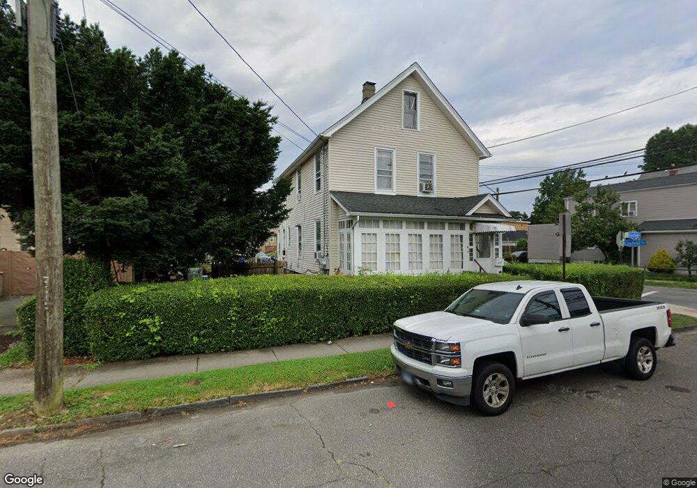
185 Scofield Ave Unit 187 Bridgeport, CT 06605
Black Rock NeighborhoodEstimated Value: $509,094 - $612,000
4
Beds
2
Baths
2,256
Sq Ft
$250/Sq Ft
Est. Value
About This Home
This home is located at 185 Scofield Ave Unit 187, Bridgeport, CT 06605 and is currently estimated at $563,524, approximately $249 per square foot. 185 Scofield Ave Unit 187 is a home located in Fairfield County with nearby schools including Black Rock School, Bassick High School, and Park City Prep Charter School.
Ownership History
Date
Name
Owned For
Owner Type
Purchase Details
Closed on
Jan 15, 2004
Sold by
Deacutis John
Bought by
Candini Vancier
Current Estimated Value
Home Financials for this Owner
Home Financials are based on the most recent Mortgage that was taken out on this home.
Original Mortgage
$199,500
Interest Rate
5.98%
Purchase Details
Closed on
Aug 14, 1997
Sold by
Geci Helen Est
Bought by
Gambino Arthur P
Create a Home Valuation Report for This Property
The Home Valuation Report is an in-depth analysis detailing your home's value as well as a comparison with similar homes in the area
Home Values in the Area
Average Home Value in this Area
Purchase History
| Date | Buyer | Sale Price | Title Company |
|---|---|---|---|
| Candini Vancier | $210,000 | -- | |
| Candini Vancier | $210,000 | -- | |
| Gambino Arthur P | $100,000 | -- | |
| Gambino Arthur P | $100,000 | -- |
Source: Public Records
Mortgage History
| Date | Status | Borrower | Loan Amount |
|---|---|---|---|
| Open | Gambino Arthur P | $270,000 | |
| Closed | Gambino Arthur P | $199,500 | |
| Previous Owner | Gambino Arthur P | $85,800 |
Source: Public Records
Tax History Compared to Growth
Tax History
| Year | Tax Paid | Tax Assessment Tax Assessment Total Assessment is a certain percentage of the fair market value that is determined by local assessors to be the total taxable value of land and additions on the property. | Land | Improvement |
|---|---|---|---|---|
| 2025 | $9,450 | $217,480 | $109,750 | $107,730 |
| 2024 | $9,450 | $217,480 | $109,750 | $107,730 |
| 2023 | $9,450 | $217,480 | $109,750 | $107,730 |
| 2022 | $9,450 | $217,480 | $109,750 | $107,730 |
| 2021 | $9,450 | $217,480 | $109,750 | $107,730 |
| 2020 | $8,352 | $154,700 | $71,250 | $83,450 |
| 2019 | $8,352 | $154,700 | $71,250 | $83,450 |
| 2018 | $8,411 | $154,700 | $71,250 | $83,450 |
| 2017 | $8,411 | $154,700 | $71,250 | $83,450 |
| 2016 | $8,411 | $154,700 | $71,250 | $83,450 |
| 2015 | $6,937 | $164,390 | $59,880 | $104,510 |
| 2014 | $6,937 | $164,390 | $59,880 | $104,510 |
Source: Public Records
Map
Nearby Homes
- 167 Scofield Ave
- 105 Scofield Ave
- 166 Alfred St
- 82 Waldorf Ave
- 51 Princeton St
- 135 Whittier St
- 144 Whittier St
- 855 Brewster St Unit 857
- 2773 Fairfield Ave Unit 3
- 26 Rowsley St Unit 3
- 185 Shell St
- 20 Haddon St Unit 5
- 20 Haddon St Unit 3
- 165 Bennett St
- 222 Ellsworth St
- 105 Fox St Unit 107
- 130 Brentwood Ave
- 118 Berwick Ave
- 39 Jetland Place Unit 41
- 450 Davidson St
- 175 Scofield Ave
- 193 Canfield Ave Unit 2nd fl
- 176 Canfield Ave
- 196 Canfield Ave
- 214 Canfield Ave
- 205 Scofield Ave
- 154 Canfield Ave Unit 156
- 161 Scofield Ave
- 171 Canfield Ave Unit 175
- 168 Canfield Ave Unit 3RD FLR
- 188 Scofield Ave
- 209 Scofield Ave
- 164 Canfield Ave
- 164 Canfield Ave Unit 1 rear
- 213 Scofield Ave
- 208 Scofield Ave
- 206 Scofield Ave
- 185 Canfield Ave Unit 189
- 174 Canfield Ave Unit 178
- 174 Canfield Ave Unit 3