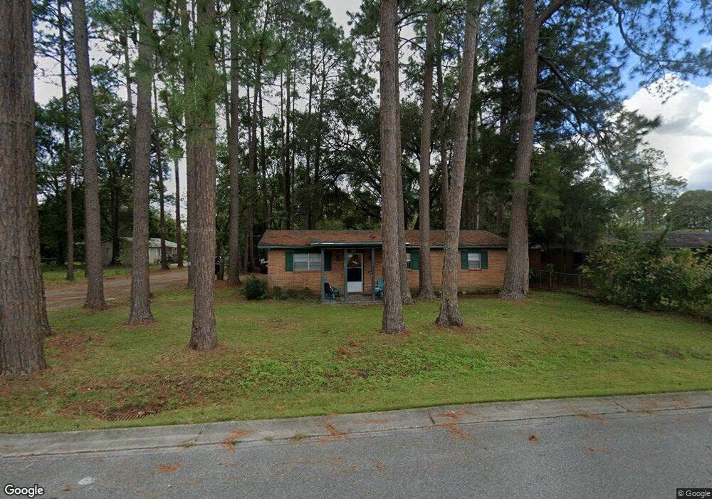
185 Speer St Baxley, GA 31513
Estimated Value: $73,000 - $90,000
--
Bed
1
Bath
1,100
Sq Ft
$73/Sq Ft
Est. Value
About This Home
This home is located at 185 Speer St, Baxley, GA 31513 and is currently estimated at $80,516, approximately $73 per square foot. 185 Speer St is a home located in Appling County with nearby schools including Appling Christian Academy.
Ownership History
Date
Name
Owned For
Owner Type
Purchase Details
Closed on
Jan 13, 2025
Sold by
Davis Barbara A
Bought by
Odom Wade Michael
Current Estimated Value
Purchase Details
Closed on
Oct 23, 2015
Sold by
Freeman Oran
Bought by
Spikes Gary and Spikes Barbara
Home Financials for this Owner
Home Financials are based on the most recent Mortgage that was taken out on this home.
Original Mortgage
$28,192
Interest Rate
3.89%
Mortgage Type
New Conventional
Create a Home Valuation Report for This Property
The Home Valuation Report is an in-depth analysis detailing your home's value as well as a comparison with similar homes in the area
Home Values in the Area
Average Home Value in this Area
Purchase History
| Date | Buyer | Sale Price | Title Company |
|---|---|---|---|
| Odom Wade Michael | -- | -- | |
| Spikes Gary | $30,000 | -- |
Source: Public Records
Mortgage History
| Date | Status | Borrower | Loan Amount |
|---|---|---|---|
| Previous Owner | Spikes Gary | $28,192 |
Source: Public Records
Tax History Compared to Growth
Tax History
| Year | Tax Paid | Tax Assessment Tax Assessment Total Assessment is a certain percentage of the fair market value that is determined by local assessors to be the total taxable value of land and additions on the property. | Land | Improvement |
|---|---|---|---|---|
| 2024 | $295 | $15,066 | $1,026 | $14,040 |
| 2023 | $295 | $15,066 | $1,026 | $14,040 |
| 2022 | $248 | $12,746 | $1,026 | $11,720 |
| 2021 | $246 | $12,746 | $1,026 | $11,720 |
| 2020 | $256 | $12,746 | $1,026 | $11,720 |
| 2019 | $262 | $12,746 | $1,026 | $11,720 |
| 2018 | $267 | $12,746 | $1,026 | $11,720 |
| 2017 | $267 | $12,746 | $1,026 | $11,720 |
| 2016 | $267 | $12,746 | $1,026 | $11,720 |
| 2015 | $356 | $12,746 | $1,026 | $11,720 |
| 2014 | $356 | $12,746 | $1,026 | $11,720 |
| 2013 | -- | $12,746 | $1,026 | $11,720 |
Source: Public Records
Map
Nearby Homes
- 298 S Main St
- 213 Fair St
- 0 Off Doc McTier Rd Unit 10656659
- 655 Beach Rd
- 260 Central St
- 199 Anthony St
- 198 Holmesville Ave
- 0 U S Route 1
- 0 W Parker St
- 0 W Parker St Unit 10547390
- 0 W Parker St Unit 22975
- 0 Hwy 341 Unit 23738
- 0 Hwy 341 Unit 10628717
- 30 S McCrorie St
- 273 Holmesville Ave
- 464 W Parker St
- 66 Weaver St
- 0 Golden Isle W Unit 10595385
- 155 Peach Ln
- 144 Yardley Ave