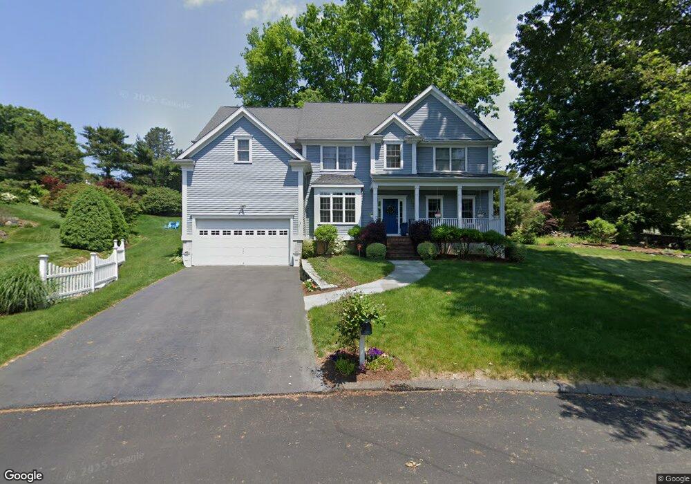
185 Split Rock Rd Southport, CT 06890
Estimated Value: $1,284,000 - $1,754,000
4
Beds
3
Baths
3,023
Sq Ft
$479/Sq Ft
Est. Value
About This Home
This home is located at 185 Split Rock Rd, Southport, CT 06890 and is currently estimated at $1,446,734, approximately $478 per square foot. 185 Split Rock Rd is a home located in Fairfield County with nearby schools including Mill Hill School, Roger Ludlowe Middle School, and Fairfield Ludlowe High School.
Ownership History
Date
Name
Owned For
Owner Type
Purchase Details
Closed on
Aug 22, 2003
Sold by
Split Rock Assoc Llc
Bought by
Kinasewitz Mark and Kinascwitz Melissa
Current Estimated Value
Home Financials for this Owner
Home Financials are based on the most recent Mortgage that was taken out on this home.
Original Mortgage
$602,800
Outstanding Balance
$263,515
Interest Rate
5.52%
Estimated Equity
$1,183,219
Create a Home Valuation Report for This Property
The Home Valuation Report is an in-depth analysis detailing your home's value as well as a comparison with similar homes in the area
Home Values in the Area
Average Home Value in this Area
Purchase History
| Date | Buyer | Sale Price | Title Company |
|---|---|---|---|
| Kinasewitz Mark | $753,500 | -- | |
| Kinasewitz Mark | $753,500 | -- |
Source: Public Records
Mortgage History
| Date | Status | Borrower | Loan Amount |
|---|---|---|---|
| Open | Kinasewitz Mark | $602,800 | |
| Closed | Kinasewitz Mark | $602,800 |
Source: Public Records
Tax History Compared to Growth
Tax History
| Year | Tax Paid | Tax Assessment Tax Assessment Total Assessment is a certain percentage of the fair market value that is determined by local assessors to be the total taxable value of land and additions on the property. | Land | Improvement |
|---|---|---|---|---|
| 2025 | $15,984 | $563,010 | $286,580 | $276,430 |
| 2024 | $15,708 | $563,010 | $286,580 | $276,430 |
| 2023 | $15,488 | $563,010 | $286,580 | $276,430 |
| 2022 | $15,336 | $563,010 | $286,580 | $276,430 |
| 2021 | $15,190 | $563,010 | $286,580 | $276,430 |
| 2020 | $16,373 | $611,170 | $284,130 | $327,040 |
| 2019 | $16,373 | $611,170 | $284,130 | $327,040 |
| 2018 | $16,110 | $611,170 | $284,130 | $327,040 |
| 2017 | $15,780 | $611,170 | $284,130 | $327,040 |
| 2016 | $15,554 | $611,170 | $284,130 | $327,040 |
| 2015 | $16,470 | $664,370 | $331,380 | $332,990 |
| 2014 | $16,211 | $664,370 | $331,380 | $332,990 |
Source: Public Records
Map
Nearby Homes
- 53 Hilltop Dr
- 28 Mill Hill Rd Unit 28
- 844 Mill Hill Terrace
- 476 Mill Hill Terrace
- 647 Bronson Rd
- 153 Pease Ave
- 100 Overhill Rd
- 88 Overhill Rd
- 2 Elmwood Dr Unit 2
- 209 S Pine Creek Rd
- 21 Beaumont St
- 85 Patrick Dr
- 57 Beaumont Place
- 1135 Mill Hill Rd
- 43 Helen St
- 65 Thorpe St Unit 65
- 226 Ruane St
- 775 Sasco Hill Rd
- 245 Unquowa Rd Unit 34
- 245 Unquowa Rd Unit 11
- 181 Split Rock Rd
- 189 Split Rock Rd
- 73 Rockview Rd
- 59 Rockview Rd
- 23 Hilltop Dr
- 37 Hilltop Dr
- 43 Rockview Rd
- 193 Split Rock Rd
- 70 Rockview Rd
- 111 Split Rock Rd
- 107 Split Rock Rd
- 29 Rockview Rd
- 199 Bronson Rd
- 52 Rockview Rd
- 61 Hilltop Dr
- 38 Rockview Rd
- 217 Bronson Rd
- 66 Hilltop Dr
- 22 Rockview Rd
- 257 Bronson Rd