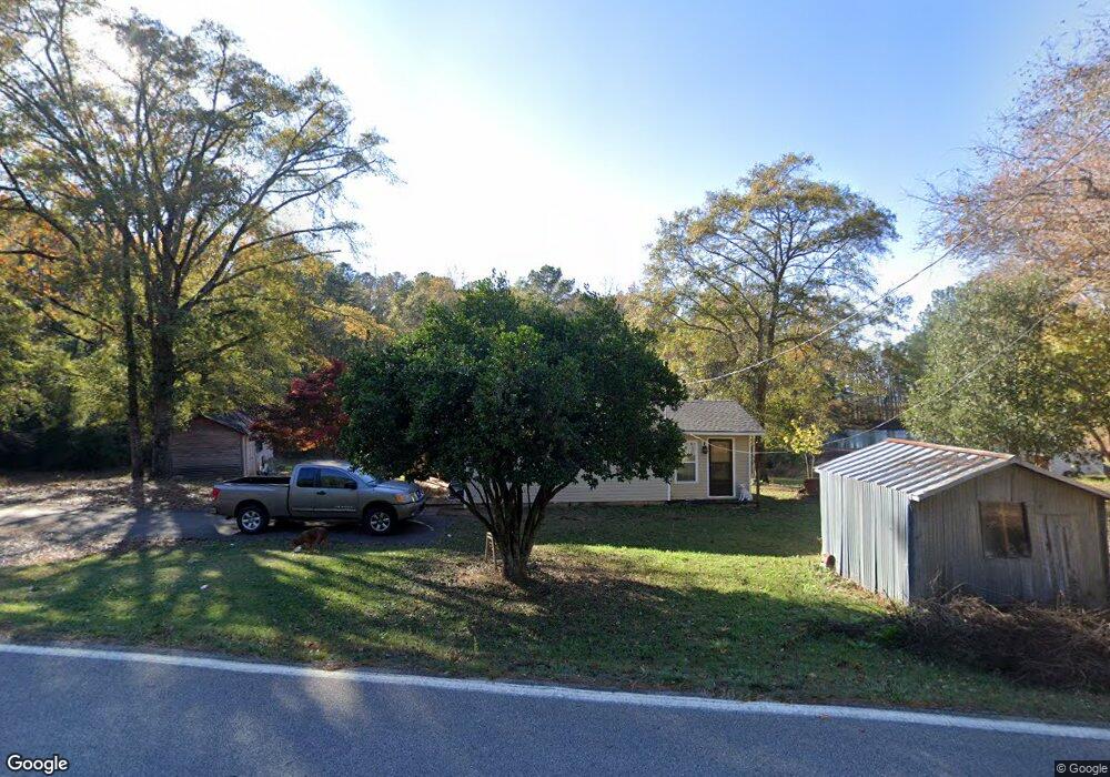
185 Warner Rd West Point, GA 31833
Estimated Value: $203,620 - $440,000
2
Beds
1
Bath
1,506
Sq Ft
$189/Sq Ft
Est. Value
About This Home
This home is located at 185 Warner Rd, West Point, GA 31833 and is currently estimated at $285,155, approximately $189 per square foot. 185 Warner Rd is a home located in Troup County with nearby schools including Long Cane Elementary School, West Point Elementary School, and Whitesville Road Elementary School.
Ownership History
Date
Name
Owned For
Owner Type
Purchase Details
Closed on
Mar 20, 2007
Sold by
Brisky Randy D
Bought by
Department Of Transportation
Current Estimated Value
Purchase Details
Closed on
Aug 31, 1994
Sold by
Tricia Tricia T and Tricia B
Purchase Details
Closed on
Feb 24, 1992
Sold by
Randy L Browning
Bought by
Tricia Tricia T and Tricia B
Purchase Details
Closed on
May 1, 1989
Sold by
Clinton C Smith
Bought by
Randy L Browning
Purchase Details
Closed on
Nov 9, 1981
Bought by
Clinton C Smith
Purchase Details
Closed on
Jan 1, 1946
Sold by
Tyler D G
Create a Home Valuation Report for This Property
The Home Valuation Report is an in-depth analysis detailing your home's value as well as a comparison with similar homes in the area
Home Values in the Area
Average Home Value in this Area
Purchase History
| Date | Buyer | Sale Price | Title Company |
|---|---|---|---|
| Department Of Transportation | -- | -- | |
| -- | $72,000 | -- | |
| Tricia Tricia T | -- | -- | |
| Randy L Browning | $45,000 | -- | |
| Clinton C Smith | $6,200 | -- | |
| -- | -- | -- |
Source: Public Records
Tax History
| Year | Tax Paid | Tax Assessment Tax Assessment Total Assessment is a certain percentage of the fair market value that is determined by local assessors to be the total taxable value of land and additions on the property. | Land | Improvement |
|---|---|---|---|---|
| 2025 | $1,591 | $70,980 | $22,440 | $48,540 |
| 2024 | $1,456 | $63,348 | $22,440 | $40,908 |
| 2023 | $1,355 | $59,632 | $22,440 | $37,192 |
| 2022 | $1,273 | $55,552 | $22,440 | $33,112 |
| 2021 | $968 | $42,028 | $18,760 | $23,268 |
| 2020 | $968 | $42,028 | $18,760 | $23,268 |
| 2019 | $957 | $41,684 | $18,760 | $22,924 |
| 2018 | $979 | $42,412 | $18,760 | $23,652 |
| 2017 | $979 | $42,412 | $18,760 | $23,652 |
| 2016 | $849 | $38,069 | $18,788 | $19,280 |
| 2015 | $852 | $38,069 | $18,788 | $19,280 |
| 2014 | $823 | $37,064 | $18,788 | $18,275 |
| 2013 | -- | $38,588 | $18,788 | $19,800 |
Source: Public Records
Map
Nearby Homes
- 648 Warner Rd
- 0 Warner Rd Unit 10686116
- 4172 Bartley Rd
- 107 Amhurst Dr
- 101 Garden Walk
- 0 Johns Rd Unit 10615130
- 0 Sandtown Rd Unit 10255987
- Sandtown Road Unit: 1 2+ - Acre
- 0 Lambert Rd
- 209 Harris Walk
- 211 Harris Walk
- 215 Harris Walk
- 223 Harris Walk
- 225 Harris Walk
- 221 Harris Walk
- 1015 Adams Rd
- 5714 W Point Rd
- 90 Hickory Ln
- 206 Ann Murphy Rd
- 4517 Georgia 18
- 203 Warner Rd
- 164 Old Gabbettville Rd
- 287 Warner Rd
- 188 Old Gabbettville Rd
- 210 Old Gabbettville Rd
- 214 Webbs Way Dr
- 51 Warner Rd
- 194 Webbs Way Dr
- 0-A 0-B Warner Rd
- 184 Webbs Way Dr
- 162 Webbs Way Dr
- 171 Webb's Way Dr
- 171 Webbs Way Dr
- 50 Warner Rd
- 148 Webbs Way Dr
- 299 Warner Rd
- 157 Webb's Way Dr
- 157 Webbs Way Dr
- 30 Warner Rd
- 134 Webbs Way Dr
Your Personal Tour Guide
Ask me questions while you tour the home.