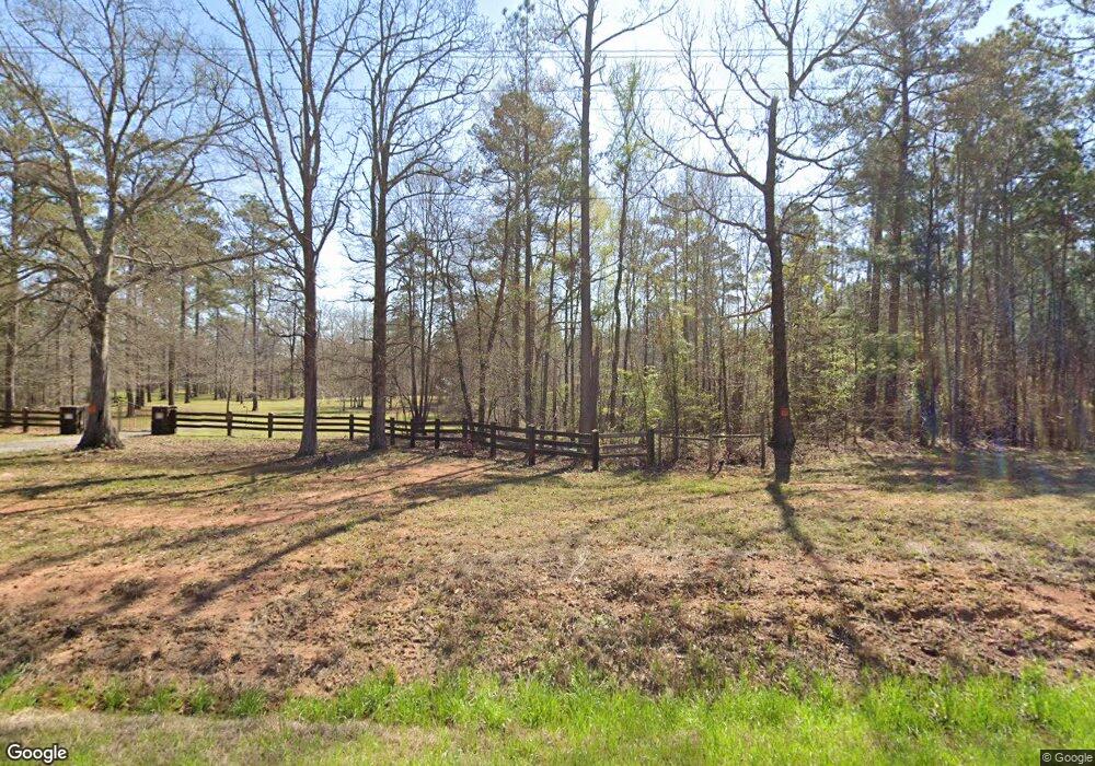
1850 Eatonton Hwy Haddock, GA 31033
Estimated Value: $231,000 - $1,094,702
--
Bed
1
Bath
816
Sq Ft
$812/Sq Ft
Est. Value
About This Home
This home is located at 1850 Eatonton Hwy, Haddock, GA 31033 and is currently estimated at $662,851, approximately $812 per square foot. 1850 Eatonton Hwy is a home with nearby schools including Gray Elementary School, Gray Station Middle School, and Jones County High School.
Ownership History
Date
Name
Owned For
Owner Type
Purchase Details
Closed on
Mar 21, 2014
Sold by
State Bank & Trust Co
Bought by
Beers Barry L and Beers Naomi N
Current Estimated Value
Purchase Details
Closed on
Oct 30, 2013
Sold by
Southern Vision Llc
Bought by
State Bank & Trust Co
Purchase Details
Closed on
Dec 12, 2006
Sold by
Not Provided
Bought by
Southern Vision Llc
Home Financials for this Owner
Home Financials are based on the most recent Mortgage that was taken out on this home.
Original Mortgage
$815,086
Interest Rate
6.29%
Mortgage Type
New Conventional
Purchase Details
Closed on
Sep 2, 2004
Sold by
Weyerhaeuser Co
Bought by
Edwards Lanier J
Create a Home Valuation Report for This Property
The Home Valuation Report is an in-depth analysis detailing your home's value as well as a comparison with similar homes in the area
Home Values in the Area
Average Home Value in this Area
Purchase History
| Date | Buyer | Sale Price | Title Company |
|---|---|---|---|
| Beers Barry L | $465,100 | -- | |
| State Bank & Trust Co | -- | -- | |
| Southern Vision Llc | $903,500 | -- | |
| Edwards Lanier J | $5,171,000 | -- |
Source: Public Records
Mortgage History
| Date | Status | Borrower | Loan Amount |
|---|---|---|---|
| Previous Owner | Southern Vision Llc | $815,086 |
Source: Public Records
Tax History Compared to Growth
Tax History
| Year | Tax Paid | Tax Assessment Tax Assessment Total Assessment is a certain percentage of the fair market value that is determined by local assessors to be the total taxable value of land and additions on the property. | Land | Improvement |
|---|---|---|---|---|
| 2023 | $3,470 | $245,534 | $209,802 | $35,732 |
| 2022 | $3,408 | $245,534 | $209,802 | $35,732 |
| 2021 | $3,350 | $245,534 | $209,802 | $35,732 |
| 2020 | $3,294 | $245,534 | $209,802 | $35,732 |
| 2019 | $3,237 | $245,534 | $209,802 | $35,732 |
| 2018 | $3,182 | $245,534 | $209,802 | $35,732 |
| 2017 | $2,516 | $229,208 | $210,586 | $18,622 |
| 2016 | $2,252 | $221,876 | $210,586 | $11,290 |
| 2015 | $2,081 | $221,875 | $210,586 | $11,290 |
| 2014 | -- | $110,912 | $110,912 | $0 |
Source: Public Records
Map
Nearby Homes
- 185 Old Eatonton Rd
- 0 Stallings Rd Unit 10492745
- 0 Ethridge Rd Unit 10602065
- 0 Ethridge Rd Unit 24714035
- 136 Fortville Rd
- 386 Nelson Rd NW
- 653 Parham Rd NW
- 673 Parham Rd NW
- 777 Parham Rd NW
- 642 Parham Rd NW
- 708 Parham Rd NW
- 315 Nelson Rd NW
- 114 Allens Aly
- 2231 Fox Creek Dr Unit 6
- 2231 Fox Creek Dr
- 125 Bentley Dr NW
- 155 Honeysuckle Rd NW
- 0 Phillips Rd Unit 10307410
- 116 N Oak St
- 121 E Montego Ct NW
- 1935 Eatonton Hwy
- 1839 Eatonton Hwy
- 1843 Eatonton Hwy
- 324 Blounts Chapel Rd
- 1893 Eatonton Hwy
- 325 Blounts Chapel Rd
- 274 Blounts Chapel Rd
- 337 Blounts Chapel Rd
- 254 Blounts Chapel Rd
- 269 Blounts Chapel Rd
- 1921 Eatonton Hwy
- 1927 Eatonton Hwy
- 0 Norman Rd Unit 7511301
- 0 Norman Rd Unit 8253958
- 000 Blounts Chapel Rd
- 1936 Eatonton Hwy
- 239 Blounts Chapel Rd
- 115 Norman Rd
- 116 Norman Rd
- 150 Norman Rd
