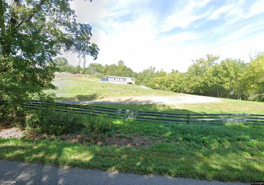
1850 Forge Rd Lexington, VA 24450
Estimated Value: $329,011 - $468,000
3
Beds
2
Baths
1,539
Sq Ft
$242/Sq Ft
Est. Value
About This Home
This home is located at 1850 Forge Rd, Lexington, VA 24450 and is currently estimated at $372,253, approximately $241 per square foot. 1850 Forge Rd is a home with nearby schools including Rockbridge County High School.
Ownership History
Date
Name
Owned For
Owner Type
Purchase Details
Closed on
Jul 10, 2023
Sold by
Forren Michael D
Bought by
Williams Alexandra Raye
Current Estimated Value
Home Financials for this Owner
Home Financials are based on the most recent Mortgage that was taken out on this home.
Original Mortgage
$289,366
Outstanding Balance
$280,102
Interest Rate
5.16%
Mortgage Type
New Conventional
Estimated Equity
$92,151
Purchase Details
Closed on
Nov 21, 2012
Sold by
Branch Banking & Trust Co
Bought by
Forren Michael and Forren Mandy
Purchase Details
Closed on
Jul 17, 2006
Sold by
Rolling Meadows Llc
Bought by
Garrett Kirk N and Garrett Brenda A
Purchase Details
Closed on
Sep 26, 2005
Sold by
Mason R A
Bought by
Forren Michael D and Forren Mandy M
Home Financials for this Owner
Home Financials are based on the most recent Mortgage that was taken out on this home.
Original Mortgage
$47,520
Interest Rate
5.81%
Mortgage Type
Unknown
Purchase Details
Closed on
Mar 24, 2005
Sold by
Rolling Meadows Llc
Bought by
Mason R A and R A Mason Construction Company Llc
Create a Home Valuation Report for This Property
The Home Valuation Report is an in-depth analysis detailing your home's value as well as a comparison with similar homes in the area
Home Values in the Area
Average Home Value in this Area
Purchase History
| Date | Buyer | Sale Price | Title Company |
|---|---|---|---|
| Williams Alexandra Raye | $38,000 | None Listed On Document | |
| Forren Michael | $8,900 | None Available | |
| Garrett Kirk N | -- | None Available | |
| Forren Michael D | -- | None Available | |
| Mason R A | -- | None Available |
Source: Public Records
Mortgage History
| Date | Status | Borrower | Loan Amount |
|---|---|---|---|
| Open | Williams Alexandra Raye | $289,366 | |
| Previous Owner | Forren Michael D | $47,520 | |
| Previous Owner | Forren Michael D | $190,080 |
Source: Public Records
Tax History
| Year | Tax Paid | Tax Assessment Tax Assessment Total Assessment is a certain percentage of the fair market value that is determined by local assessors to be the total taxable value of land and additions on the property. | Land | Improvement |
|---|---|---|---|---|
| 2025 | $1,393 | $217,600 | $34,100 | $183,500 |
| 2024 | $2 | $217,600 | $34,100 | $183,500 |
| 2023 | $208 | $34,100 | $34,100 | $0 |
| 2022 | $326 | $44,100 | $44,100 | $0 |
| 2021 | $326 | $44,100 | $44,100 | $0 |
| 2020 | $326 | $44,100 | $44,100 | $0 |
| 2019 | $322 | $44,100 | $44,100 | $0 |
| 2018 | $309 | $44,100 | $44,100 | $0 |
| 2017 | $309 | $44,100 | $44,100 | $0 |
| 2016 | $331 | $45,100 | $45,100 | $0 |
| 2015 | -- | $0 | $0 | $0 |
| 2014 | -- | $0 | $0 | $0 |
| 2013 | -- | $0 | $0 | $0 |
Source: Public Records
Map
Nearby Homes
- 587 Bunker Hill Mill Rd
- lot 9 A Maury Ridge Dr
- 41 Twin Rivers Ln
- 00 Bennetts Run Rd
- 364 Elm Ave
- 114 Dickinson Dr
- 301 Forge Rd
- 6.03 Acres Woodland Ave
- 61 Emerald Ln
- Lots 7-8-9 Cresthill Dr
- .785 acres Cresthill Dr
- Lot 2-3-4 Cresthill Dr
- 7 Pathfinder Dr
- Lots 3-4-5 Pathfinder Dr
- 1202 S Lee Hwy
- 1369 Maple Ave
- 1215 Oak Ave
- 1534 Maple Ave
- 1796 Forest Ave
- 1746 Walnut Ave
- 1880 Forge Rd
- 39 Crescent Ln
- 90 Meadow Heights Ln
- 80 Meadow Heights Ln
- 78 Breezy Ridge Ln
- 5 Crescent Ln
- 65 Meadow Heights Ln
- 113 Alloway Ln
- 70 Meadow Heights Ln
- 53 Breezy Ridge Ln
- 50 Rolling Meadow Dr
- 20 Rolling Meadow Dr
- 20 Rolling Meadow Dr Unit 608
- 10 Willowbrook Ln
- 24 Willowbrook Ln
- 55 Meadow Heights Ln
- 30 Rolling Meadow Dr
- Lot 1 Rolling Meadow Dr
- 1734 Forge Rd
- 1805 Forge Rd
Your Personal Tour Guide
Ask me questions while you tour the home.