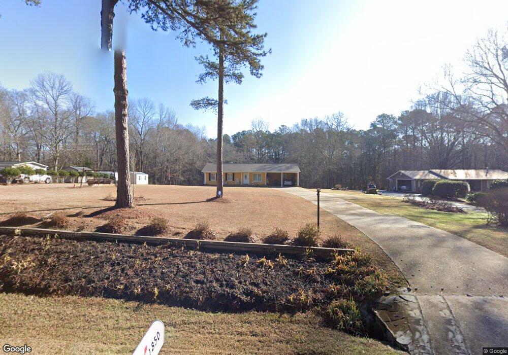
1850 McNutt Creek Rd Bogart, GA 30622
Estimated Value: $316,192 - $375,000
--
Bed
--
Bath
1,253
Sq Ft
$279/Sq Ft
Est. Value
About This Home
This home is located at 1850 McNutt Creek Rd, Bogart, GA 30622 and is currently estimated at $350,048, approximately $279 per square foot. 1850 McNutt Creek Rd is a home located in Oconee County with nearby schools including Malcom Bridge Elementary School, Malcom Bridge Middle School, and North Oconee High School.
Ownership History
Date
Name
Owned For
Owner Type
Purchase Details
Closed on
Apr 1, 2010
Sold by
Branch Banking
Bought by
Richards Dell
Current Estimated Value
Create a Home Valuation Report for This Property
The Home Valuation Report is an in-depth analysis detailing your home's value as well as a comparison with similar homes in the area
Home Values in the Area
Average Home Value in this Area
Purchase History
| Date | Buyer | Sale Price | Title Company |
|---|---|---|---|
| Richards Dell | $28,000 | -- |
Source: Public Records
Tax History Compared to Growth
Tax History
| Year | Tax Paid | Tax Assessment Tax Assessment Total Assessment is a certain percentage of the fair market value that is determined by local assessors to be the total taxable value of land and additions on the property. | Land | Improvement |
|---|---|---|---|---|
| 2024 | $277 | $103,786 | $40,656 | $63,130 |
| 2023 | $1,659 | $96,678 | $37,644 | $59,034 |
| 2022 | $1,394 | $79,990 | $30,116 | $49,874 |
| 2021 | $1,317 | $71,876 | $27,378 | $44,498 |
| 2020 | $1,186 | $66,171 | $24,889 | $41,282 |
| 2019 | $1,081 | $61,638 | $21,642 | $39,996 |
| 2018 | $925 | $54,032 | $19,675 | $34,357 |
| 2017 | $770 | $47,494 | $16,396 | $31,098 |
| 2016 | $729 | $45,781 | $14,906 | $30,875 |
| 2015 | $1,089 | $45,889 | $14,906 | $30,984 |
| 2014 | $1,049 | $43,175 | $13,550 | $29,625 |
| 2013 | -- | $41,684 | $13,174 | $28,510 |
Source: Public Records
Map
Nearby Homes
- 1811 McNutt Creek Rd
- 1851 McNutt Creek Rd
- 2188 Day Dr
- 2130 Keeneland Dr
- 119 S Church St
- 2130 Keeneland Dr
- 1715 Whistling Creek Crossing Unit Lot 21
- 1060 Cobblestone Ln
- 1216 Ray's River Run
- 3451 Clayton Dr
- 3377 Clayton Dr
- 325 Twin Oaks Cir
- 1250 Pete Dickens Rd
- 1120 Pearl Way
- 159 Pine Valley Rd
- 1060 Fox Hollow Ct
- 1840 McNutt Creek Rd
- 1870 McNutt Creek Rd
- 1820 McNutt Creek Rd
- 1871 McNutt Creek Rd
- 1940 McNutt Creek Rd
- 5099 Mars Hill Rd
- 1881 McNutt Creek Rd
- 5081 Mars Hill Rd
- 5051 Mars Hill Rd
- 1960 McNutt Creek Rd
- 5033 Mars Hill Rd
- 1761 McNutt Creek Rd
- 4990 Mars Hill Rd
- 1040 Aiken Rd
- LOT 2 Mars Hill Rd
- 363 S Burson Ave
- 1710 McNutt Creek Rd
- 1041 Aiken Rd
- 1050 Aiken Rd
- 1011 Osceola Ct