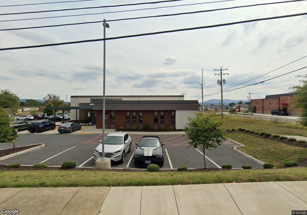
1850 Rosser Ave Waynesboro, VA 22980
Estimated Value: $1,650,380
--
Bed
--
Bath
6,831
Sq Ft
$242/Sq Ft
Est. Value
About This Home
This home is located at 1850 Rosser Ave, Waynesboro, VA 22980 and is currently estimated at $1,650,380, approximately $241 per square foot. 1850 Rosser Ave is a home located in Waynesboro City with nearby schools including Westwood Hills Elementary School, Kate Collins Middle School, and Waynesboro High School.
Ownership History
Date
Name
Owned For
Owner Type
Purchase Details
Closed on
Jun 12, 2018
Sold by
Ptap Investments Llc A Virginia Limited
Bought by
University Of Virginia Physicians Group
Current Estimated Value
Purchase Details
Closed on
Sep 7, 2016
Sold by
Applied Industrial Technologies & Dixie In
Bought by
Tap Investments Llc A Virginia Limited L and Pkw Llc A Virginia Limited Liability Com
Create a Home Valuation Report for This Property
The Home Valuation Report is an in-depth analysis detailing your home's value as well as a comparison with similar homes in the area
Home Values in the Area
Average Home Value in this Area
Purchase History
| Date | Buyer | Sale Price | Title Company |
|---|---|---|---|
| University Of Virginia Physicians Group | $917,500 | Attorney | |
| Ptap Investments Llc A Virginia Limited | -- | None Available | |
| Tap Investments Llc A Virginia Limited L | $575,000 | Attorney |
Source: Public Records
Tax History Compared to Growth
Tax History
| Year | Tax Paid | Tax Assessment Tax Assessment Total Assessment is a certain percentage of the fair market value that is determined by local assessors to be the total taxable value of land and additions on the property. | Land | Improvement |
|---|---|---|---|---|
| 2025 | $11,679 | $1,424,300 | $534,700 | $889,600 |
| 2024 | $10,748 | $1,395,800 | $515,200 | $880,600 |
| 2023 | $10,748 | $1,395,800 | $515,200 | $880,600 |
| 2022 | $12,188 | $1,354,200 | $495,200 | $859,000 |
| 2021 | $12,188 | $1,354,200 | $495,200 | $859,000 |
| 2020 | $12,487 | $1,387,400 | $490,900 | $896,500 |
| 2019 | $6,192 | $688,000 | $490,900 | $197,100 |
| 2018 | $5,561 | $617,900 | $420,800 | $197,100 |
| 2017 | $5,376 | $617,900 | $420,800 | $197,100 |
| 2016 | $6,008 | $751,000 | $490,900 | $260,100 |
| 2015 | $6,008 | $751,000 | $490,900 | $260,100 |
| 2014 | -- | $754,800 | $490,900 | $263,900 |
| 2013 | -- | $0 | $0 | $0 |
Source: Public Records
Map
Nearby Homes
- 141 Lucy Ln
- 71 Sunbird Ln
- 120 Tiffany Dr
- 840 Hawthorne Ln
- 225 Springdale Rd
- 209 Springdale Rd
- 79 Springdale Rd
- 49 Ridgeline Dr
- 63 Springdale Rd
- 1229 Rosser Ave
- 129 Springdale Rd
- 204 Sunbird Ln
- 208 Sunbird Ln
- 313 Springdale Rd
- 217 Springdale Rd
- 94A Sunbird Ln
- 144 Sunbird Ln
- 73A Sunbird Ln
- 58 Sunbird Ln
- 244 Ridgeline Dr
- 1801 Rosser Ave
- 325 Tiffany Dr
- 1750 Rosser Ave Unit 23 BRANDON LADD CIRC
- 1750 Rosser Ave Unit 44 BRANDON LADD CIRC
- 1750 Rosser Ave Unit 144A Brandon Ladd Ci
- 1750 Rosser Ave Unit 22 BRANDON LADD CIRC
- 1750 Rosser Ave Unit 146B BRANDON LADD CI
- 1750 Rosser Ave Unit 70 BRANDON LADD CIRC
- 1750 Rosser Ave Unit 120B BRANDON LADD CI
- 1750 Rosser Ave Unit 136B BRANDON LADD CI
- 1750 Rosser Ave Unit 21 BRANDON LADD CIRC
- 1750 Rosser Ave Unit 14 BRANDON LADD CIRC
- 1750 Rosser Ave Unit 52 BRANDON LADD CIRC
- 1750 Rosser Ave Unit 128A Brandon Ladd Ci
- 1750 Rosser Ave Unit 6 Brandon Ladd Circl
- 1750 Rosser Ave Unit 5A Brandon Ladd Circ
- 1750 Rosser Ave Unit 2 Brandon Ladd Circl
- 1750 Rosser Ave Unit 4 Brandon Ladd Circl
- 1750 Rosser Ave Unit 53 Brandon Ladd Circ
- 1750 Rosser Ave Unit 89 Brandon Ladd Circ