Estimated Value: $656,048 - $906,000
4
Beds
3
Baths
3,761
Sq Ft
$214/Sq Ft
Est. Value
About This Home
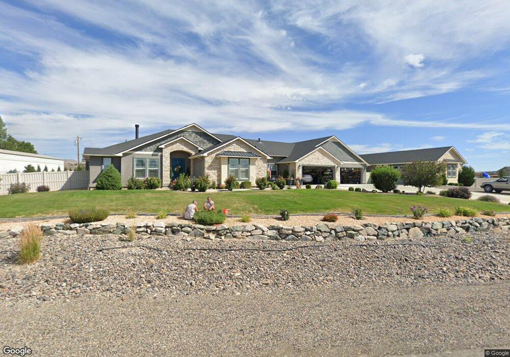
This home is located at 1850 Royal Crest Dr, Elko, NV 89801 and is currently estimated at $804,262, approximately $213 per square foot. 1850 Royal Crest Dr is a home with nearby schools including Mountain View Elementary School, Adobe Middle School, and Flagview Intermediate School.
Ownership History
Date
Name
Owned For
Owner Type
Purchase Details
Closed on
Mar 20, 2019
Sold by
Colon Robert A and Colon Patricia A
Bought by
Colon Robert A and Colon Patricia A
Current Estimated Value
Purchase Details
Closed on
Aug 27, 2018
Sold by
Ehrmann Steve L and Ehrmann Summer C
Bought by
Colon Robert A and Colon Patricia A
Home Financials for this Owner
Home Financials are based on the most recent Mortgage that was taken out on this home.
Original Mortgage
$300,000
Outstanding Balance
$261,642
Interest Rate
4.6%
Mortgage Type
New Conventional
Estimated Equity
$542,620
Purchase Details
Closed on
Mar 21, 2013
Sold by
Sandoval Domingo and Sandoval Sheila G
Bought by
Ehrmann Steven L and Ehrmann Summer C
Purchase Details
Closed on
Nov 22, 2006
Sold by
M & P Development Llc
Bought by
Sandoval Domingo and Sandoval Sheila G
Create a Home Valuation Report for This Property
The Home Valuation Report is an in-depth analysis detailing your home's value as well as a comparison with similar homes in the area
Home Values in the Area
Average Home Value in this Area
Purchase History
| Date | Buyer | Sale Price | Title Company |
|---|---|---|---|
| Colon Robert A | -- | None Available | |
| Colon Robert A | $698,000 | Stewart Title Elko | |
| Ehrmann Steven L | $134,000 | Stewart Title Elko | |
| Sandoval Domingo | $90,000 | Stewart Title |
Source: Public Records
Mortgage History
| Date | Status | Borrower | Loan Amount |
|---|---|---|---|
| Open | Colon Robert A | $300,000 |
Source: Public Records
Tax History Compared to Growth
Tax History
| Year | Tax Paid | Tax Assessment Tax Assessment Total Assessment is a certain percentage of the fair market value that is determined by local assessors to be the total taxable value of land and additions on the property. | Land | Improvement |
|---|---|---|---|---|
| 2025 | $9,327 | $296,352 | $41,300 | $255,052 |
| 2024 | $9,327 | $284,092 | $29,750 | $254,342 |
| 2023 | $8,504 | $266,694 | $29,750 | $236,944 |
| 2022 | $8,256 | $230,188 | $29,750 | $200,438 |
| 2021 | $8,016 | $223,580 | $29,750 | $193,830 |
| 2020 | $7,922 | $227,467 | $29,750 | $197,717 |
| 2019 | $6,872 | $197,298 | $29,750 | $167,548 |
| 2018 | $6,876 | $197,428 | $29,750 | $167,678 |
| 2017 | $6,754 | $193,929 | $29,750 | $164,179 |
| 2016 | $6,465 | $181,950 | $29,750 | $152,200 |
| 2015 | $6,336 | $178,670 | $29,750 | $148,920 |
| 2014 | $6,223 | $29,750 | $29,750 | $0 |
Source: Public Records
Map
Nearby Homes
- 3733 Autumn Colors Dr
- 3634 Boulder Creek
- TBD Mountain City Hwy
- 3050 Mountain City Hwy
- 3320 Mountain City Hwy
- 3221 Jennings Way
- 2908 Aria Way
- 2939 Aria Way
- 2943 Aria Way
- 2910 Aria Way
- 2953 Aria Way
- 2912 Aria Way
- 2963 Aria Way
- 2911 Aria Way
- 2914 Aria Way
- 2918 Aria Way
- 2966 Aria Way
- 2970 Aria Way
- 2057 Eagle Ridge Loop
- 2045 Eagle Ridge Loop Unit 12
- 1820 Royal Crest Dr
- 1880 Royal Crest Dr
- 1831 Royal Crest Dr
- 3713 Sundance Dr
- 1815 Royal Crest Dr
- 3711 Sundance Dr
- 3721 Sundance Dr
- 1845 Royal Crest Dr
- 1628 Royal Crest Dr
- 1875 Royal Crest Dr
- 1910 Royal Crest Dr
- 1910 Royal Crest Dr
- 1905 Royal Crest Dr
- 1940 Royal Crest Dr
- 1628 Tamarack Rd
- 1515 Tamarack Rd
- 1970 Royal Crest Dr
- 1588 Royal Crest Dr
- 3483 Sundance Dr
- 2000 Royal Crest Dr