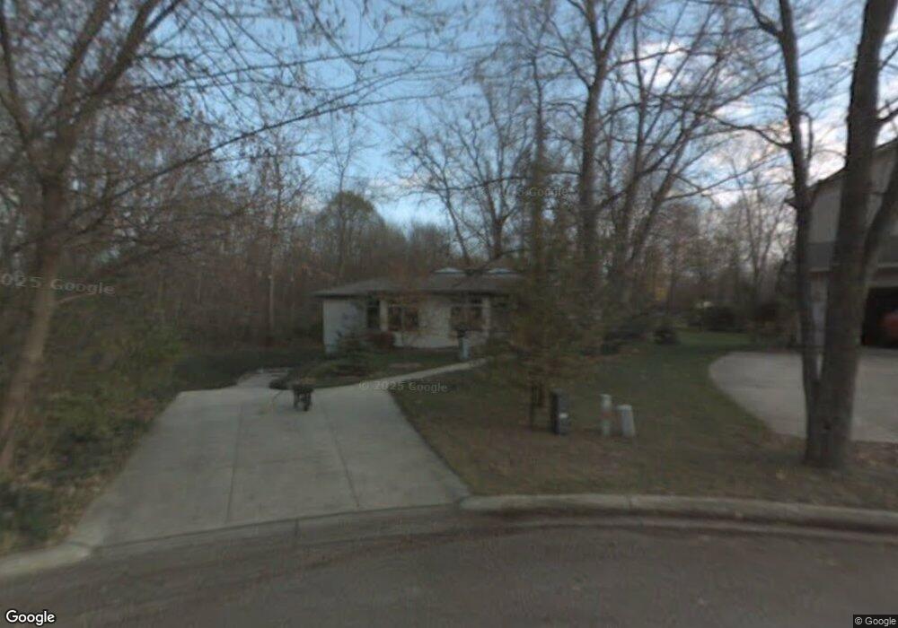
1850 Snyder Rd East Lansing, MI 48823
Estimated Value: $381,000 - $476,000
2
Beds
2
Baths
2,159
Sq Ft
$200/Sq Ft
Est. Value
About This Home
This home is located at 1850 Snyder Rd, East Lansing, MI 48823 and is currently estimated at $431,689, approximately $199 per square foot. 1850 Snyder Rd is a home located in Ingham County with nearby schools including Marble Elementary School, MacDonald Middle School, and East Lansing High School.
Ownership History
Date
Name
Owned For
Owner Type
Purchase Details
Closed on
Oct 6, 1999
Sold by
Sayers Vernon L and Sayers Shirley A
Bought by
Fox Timothy
Current Estimated Value
Create a Home Valuation Report for This Property
The Home Valuation Report is an in-depth analysis detailing your home's value as well as a comparison with similar homes in the area
Home Values in the Area
Average Home Value in this Area
Purchase History
| Date | Buyer | Sale Price | Title Company |
|---|---|---|---|
| Fox Timothy | $45,000 | Midstate Title Company |
Source: Public Records
Tax History Compared to Growth
Tax History
| Year | Tax Paid | Tax Assessment Tax Assessment Total Assessment is a certain percentage of the fair market value that is determined by local assessors to be the total taxable value of land and additions on the property. | Land | Improvement |
|---|---|---|---|---|
| 2025 | $9,129 | $291,200 | $26,600 | $264,600 |
| 2024 | -- | $259,600 | $26,600 | $233,000 |
| 2023 | $8,526 | $224,200 | $22,700 | $201,500 |
| 2022 | $8,169 | $197,900 | $19,700 | $178,200 |
| 2021 | $8,028 | $184,200 | $18,700 | $165,500 |
| 2020 | $7,940 | $169,000 | $18,700 | $150,300 |
| 2019 | $7,615 | $150,200 | $20,200 | $130,000 |
| 2018 | $8,327 | $152,200 | $14,700 | $137,500 |
| 2017 | $7,994 | $150,800 | $14,900 | $135,900 |
| 2016 | -- | $149,700 | $14,300 | $135,400 |
| 2015 | -- | $139,100 | $26,362 | $112,738 |
| 2014 | -- | $130,000 | $26,362 | $103,638 |
Source: Public Records
Map
Nearby Homes
- 692 Moorland Dr Unit 10
- 1653 Ann St
- 5435 Blue Haven Dr
- 5420 Park Lake Rd
- 1542 Ann St
- 5189 E Brookfield Dr
- 586 Lexington Ave
- 2545 Koala Dr
- 562 Virginia Ave
- 5120 Wardcliff Dr
- 5604 Deville Ct
- 657 Spartan Ave
- 5403 Wild Oak Dr
- 5680 Deville Ct Unit 61
- 2617 Greencliff Dr
- 1105 Robb St
- 1608 Haslett Rd
- 2462 Burcham Dr
- 5359 Wild Oak Dr Unit 54
- 5724 Lebaron Ct
- 1844 Snyder Rd
- 1838 Snyder Rd
- 1832 Snyder Rd
- 1857 Melrose Ave
- 1865 Melrose Ave
- 1851 Melrose Ave
- 1843 Melrose Ave
- 1826 Snyder Rd
- 1837 Melrose Ave
- 1831 Snyder Rd
- 1820 Snyder Rd
- 1829 Melrose Ave
- 1821 Melrose Ave
- 1895 Melrose Ave
- 536 Moorland Dr
- 530 Moorland Dr
- 1860 Burrwood Cir Unit 40
- 1864 Burrwood Cir Unit 41
- 1856 Burrwood Cir Unit 39