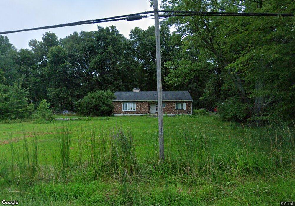
1850 State Route 131 Milford, OH 45150
Estimated Value: $289,000 - $318,000
3
Beds
2
Baths
1,698
Sq Ft
$175/Sq Ft
Est. Value
About This Home
This home is located at 1850 State Route 131, Milford, OH 45150 and is currently estimated at $297,237, approximately $175 per square foot. 1850 State Route 131 is a home located in Clermont County with nearby schools including Clermont Northeastern Elementary School, Clermont Northeastern Middle School, and Clermont Northeastern High School.
Ownership History
Date
Name
Owned For
Owner Type
Purchase Details
Closed on
Oct 14, 2004
Sold by
Walton Tammi
Bought by
Abbott Brian R
Current Estimated Value
Purchase Details
Closed on
Dec 23, 2002
Sold by
Natl City Home Loan Serv
Bought by
Walton Brian R Abbott Tammi
Home Financials for this Owner
Home Financials are based on the most recent Mortgage that was taken out on this home.
Original Mortgage
$102,500
Interest Rate
6.23%
Mortgage Type
New Conventional
Purchase Details
Closed on
Nov 25, 2002
Sold by
Shrf Debra Bronson Pr
Bought by
Altegra Credit Co
Home Financials for this Owner
Home Financials are based on the most recent Mortgage that was taken out on this home.
Original Mortgage
$102,500
Interest Rate
6.23%
Mortgage Type
New Conventional
Purchase Details
Closed on
Jan 2, 1984
Create a Home Valuation Report for This Property
The Home Valuation Report is an in-depth analysis detailing your home's value as well as a comparison with similar homes in the area
Home Values in the Area
Average Home Value in this Area
Purchase History
| Date | Buyer | Sale Price | Title Company |
|---|---|---|---|
| Abbott Brian R | $100,000 | -- | |
| Walton Brian R Abbott Tammi | $102,500 | -- | |
| Altegra Credit Co | $95,000 | -- | |
| -- | $57,000 | -- |
Source: Public Records
Mortgage History
| Date | Status | Borrower | Loan Amount |
|---|---|---|---|
| Previous Owner | Walton Brian R Abbott Tammi | $102,500 |
Source: Public Records
Tax History Compared to Growth
Tax History
| Year | Tax Paid | Tax Assessment Tax Assessment Total Assessment is a certain percentage of the fair market value that is determined by local assessors to be the total taxable value of land and additions on the property. | Land | Improvement |
|---|---|---|---|---|
| 2024 | $2,585 | $65,700 | $22,300 | $43,400 |
| 2023 | $2,587 | $65,700 | $22,300 | $43,400 |
| 2022 | $2,280 | $53,590 | $18,200 | $35,390 |
| 2021 | $2,147 | $53,590 | $18,200 | $35,390 |
| 2020 | $2,145 | $53,590 | $18,200 | $35,390 |
| 2019 | $2,513 | $61,820 | $21,740 | $40,080 |
| 2018 | $2,513 | $61,820 | $21,740 | $40,080 |
| 2017 | $2,515 | $61,820 | $21,740 | $40,080 |
| 2016 | $2,162 | $50,270 | $17,680 | $32,590 |
| 2015 | $1,913 | $50,270 | $17,680 | $32,590 |
| 2014 | $1,913 | $50,270 | $17,680 | $32,590 |
| 2013 | $1,848 | $46,420 | $18,730 | $27,690 |
Source: Public Records
Map
Nearby Homes
- 1847 Ohio 131
- 1860 Grove Park Dr
- Hampton Plan at Grove Park
- Cooke Plan at Grove Park
- Windsor II Plan at Grove Park
- Barrett Plan at Grove Park
- Morrison Plan at Grove Park
- Serenity Plan at Grove Park
- Nicholas Plan at Grove Park
- 1897 Grove Park Dr
- Ellison Plan at Grove Park
- Fairview Plan at Grove Park
- Inglewood Plan at Grove Park
- Dillon Plan at Grove Park
- Dawson Plan at Grove Park
- Faulkner Plan at Grove Park
- Cheswicke Plan at Grove Park
- Ainsley II Plan at Grove Park
- Clayton Plan at Grove Park
- Wallace Plan at Grove Park
- 1848 St Rt 131
- 1848 State Route 131
- 5699 Chestnut View Ln
- 1864 State Route 131
- 1840 State Route 131
- 5698 Chestnut View Ln
- 5697 Chestnut View Ln
- 1868 State Route 131
- 5741 Deerfield Rd
- 5696 Chestnut View Ln
- 1847 State Route 131
- 5695 Chestnut View Ln
- 5753 Deerfield Rd
- 5757 Deerfield Rd
- 5694 Chestnut View Ln
- 5736 Deerfield Rd
- 1838 State Route 131
- 1875 State Route 131
- 1875 State Route 131
- 5693 Chestnut View Ln