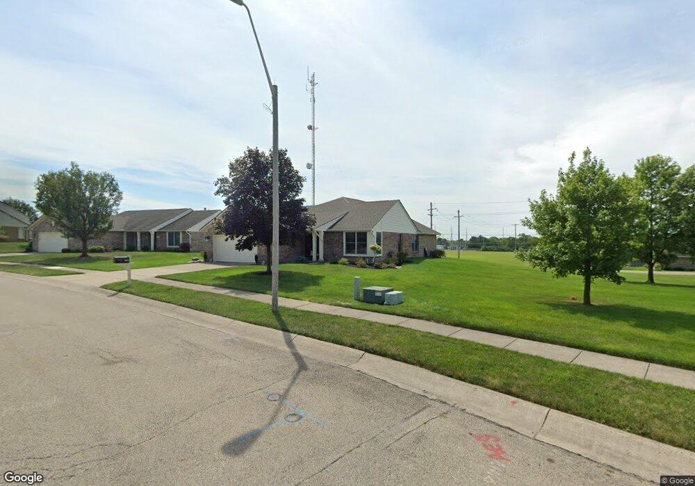
1850 Sulky Trail Miamisburg, OH 45342
Estimated Value: $310,000 - $332,000
3
Beds
2
Baths
1,853
Sq Ft
$173/Sq Ft
Est. Value
About This Home
This home is located at 1850 Sulky Trail, Miamisburg, OH 45342 and is currently estimated at $321,352, approximately $173 per square foot. 1850 Sulky Trail is a home located in Montgomery County with nearby schools including Miamisburg High School and Bethel Baptist School.
Ownership History
Date
Name
Owned For
Owner Type
Purchase Details
Closed on
Apr 16, 2024
Sold by
Flinn Preservation Trust
Bought by
Odonnel Karin D and Odonnel Kevin P
Current Estimated Value
Purchase Details
Closed on
Dec 29, 2020
Sold by
Thomas Flinn E and Thomas Flinn E
Bought by
Odonnel Karin D and The Flinn Preservation Trust
Purchase Details
Closed on
Mar 17, 2010
Sold by
Jennings Kenneth A
Bought by
Flinn E Thomas and The E Thomas Flinn Revocable Living Trus
Purchase Details
Closed on
Jun 29, 2000
Sold by
Brandonhall Development Inc
Bought by
Jennings Paul R and Jennings Betty G
Create a Home Valuation Report for This Property
The Home Valuation Report is an in-depth analysis detailing your home's value as well as a comparison with similar homes in the area
Home Values in the Area
Average Home Value in this Area
Purchase History
| Date | Buyer | Sale Price | Title Company |
|---|---|---|---|
| Odonnel Karin D | $250,000 | None Listed On Document | |
| Odonnel Karin D | -- | None Available | |
| Flinn E Thomas | $170,000 | Attorney | |
| Jennings Paul R | $144,200 | -- |
Source: Public Records
Tax History Compared to Growth
Tax History
| Year | Tax Paid | Tax Assessment Tax Assessment Total Assessment is a certain percentage of the fair market value that is determined by local assessors to be the total taxable value of land and additions on the property. | Land | Improvement |
|---|---|---|---|---|
| 2024 | $4,819 | $85,110 | $12,810 | $72,300 |
| 2023 | $4,819 | $85,110 | $12,810 | $72,300 |
| 2022 | $4,594 | $69,760 | $10,500 | $59,260 |
| 2021 | $4,062 | $69,760 | $10,500 | $59,260 |
| 2020 | $4,053 | $69,760 | $10,500 | $59,260 |
| 2019 | $4,126 | $65,750 | $10,500 | $55,250 |
| 2018 | $4,140 | $65,750 | $10,500 | $55,250 |
| 2017 | $4,112 | $65,750 | $10,500 | $55,250 |
| 2016 | $3,187 | $51,270 | $10,500 | $40,770 |
| 2015 | $3,125 | $51,270 | $10,500 | $40,770 |
| 2014 | $3,125 | $51,270 | $10,500 | $40,770 |
| 2012 | -- | $54,340 | $12,250 | $42,090 |
Source: Public Records
Map
Nearby Homes
- 2127 Carrington Ln
- 1734 Rosina Dr
- 2141 Rosina Dr
- 00 Benner Rd
- 1157 Bonniebrook Dr
- 736 Decker Dr
- 712 Decker Dr
- 628 Jamestown Dr
- 2279 Rosina Dr
- 1 Pendle Point
- 1035 Woods View Ct
- 1808 Burnside Dr
- 902 Althea Dr
- 807 Dunaway St
- 766 Dunaway St
- 1013 S Heincke Rd
- 1984 Cruden Bay Way
- 1045 S Linden Ave
- 615 Burnside Dr
- 2054 Prestwick Bend
- 1856 Sulky Trail
- 1294 Rosalind Dr
- 1284 Rosalind Dr
- 1851 Sulky Trail
- 1261 Sherwat Cir
- 1304 Rosalind Dr
- 1845 Sulky Trail
- 1277 Sherwat Cir
- 1863 Sulky Trail
- 1314 Rosalind Dr
- 1839 Sulky Trail
- 1227 Mals Way
- 1838 Sulky Trail
- 1297 Rosalind Dr
- 1219 Mals Way
- 1833 Sulky Trail
- 1293 Sherwat Cir
- 1868 Sulky Trail
- 1324 Rosalind Dr
- 1232 Mals Way