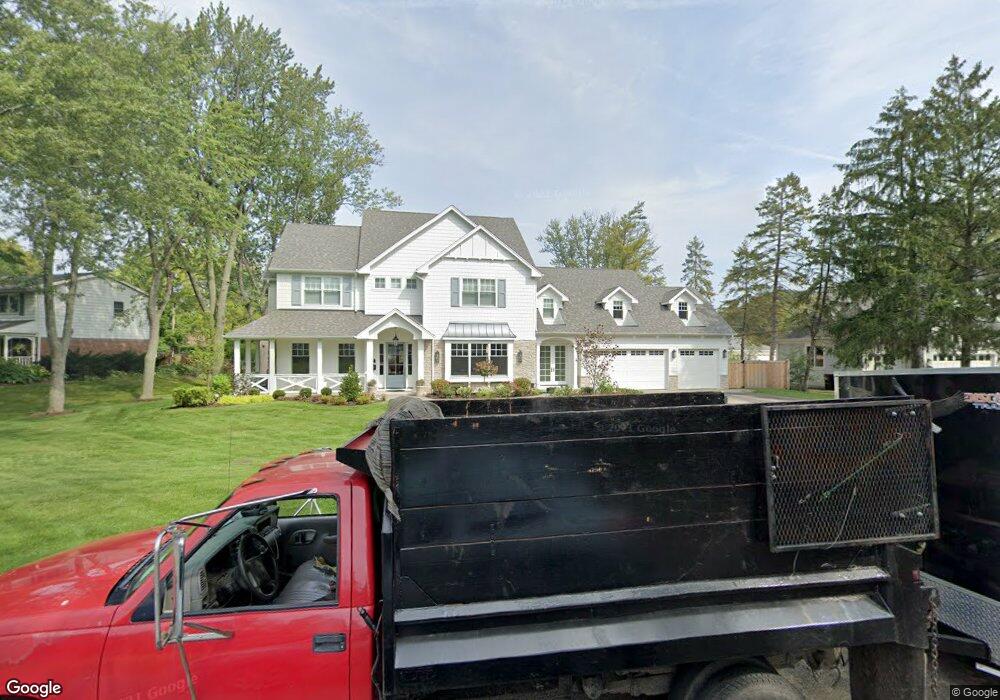
1850 Walnut Cir Northbrook, IL 60062
Glenbrook Countryside NeighborhoodEstimated Value: $570,089 - $2,000,000
4
Beds
5
Baths
3,963
Sq Ft
$241/Sq Ft
Est. Value
About This Home
This home is located at 1850 Walnut Cir, Northbrook, IL 60062 and is currently estimated at $956,272, approximately $241 per square foot. 1850 Walnut Cir is a home located in Cook County with nearby schools including Westmoor Elementary School, Northbrook Junior High School, and Glenbrook North High School.
Ownership History
Date
Name
Owned For
Owner Type
Purchase Details
Closed on
Oct 10, 2019
Sold by
Levin Daniel J and Levin Amy R
Bought by
Levin Amy R and Levin Daniel J
Current Estimated Value
Purchase Details
Closed on
Apr 21, 2014
Sold by
Ockerlund Robert N and Ockerlund Sharon
Bought by
Levin Daniel J and Levin Amy R
Home Financials for this Owner
Home Financials are based on the most recent Mortgage that was taken out on this home.
Original Mortgage
$182,500
Outstanding Balance
$114,015
Interest Rate
0.15%
Mortgage Type
Unknown
Estimated Equity
$842,257
Create a Home Valuation Report for This Property
The Home Valuation Report is an in-depth analysis detailing your home's value as well as a comparison with similar homes in the area
Home Values in the Area
Average Home Value in this Area
Purchase History
| Date | Buyer | Sale Price | Title Company |
|---|---|---|---|
| Levin Amy R | -- | Attorney | |
| Levin Daniel J | $365,000 | Premier Title |
Source: Public Records
Mortgage History
| Date | Status | Borrower | Loan Amount |
|---|---|---|---|
| Open | Levin Daniel J | $182,500 |
Source: Public Records
Tax History
| Year | Tax Paid | Tax Assessment Tax Assessment Total Assessment is a certain percentage of the fair market value that is determined by local assessors to be the total taxable value of land and additions on the property. | Land | Improvement |
|---|---|---|---|---|
| 2025 | $7,643 | $110,000 | $16,380 | $93,620 |
| 2024 | $7,643 | $61,000 | $13,650 | $47,350 |
| 2023 | $7,383 | $38,000 | $13,650 | $24,350 |
| 2022 | $7,383 | $38,000 | $13,650 | $24,350 |
| 2021 | $7,229 | $33,582 | $32,760 | $822 |
| 2020 | $7,121 | $33,582 | $32,760 | $822 |
| 2019 | $6,186 | $33,582 | $32,760 | $822 |
| 2018 | $8,389 | $40,740 | $28,665 | $12,075 |
| 2017 | $8,221 | $40,740 | $28,665 | $12,075 |
| 2016 | $8,515 | $40,740 | $28,665 | $12,075 |
| 2015 | $9,056 | $39,038 | $23,205 | $15,833 |
| 2014 | $8,149 | $39,038 | $23,205 | $15,833 |
| 2013 | $7,879 | $39,038 | $23,205 | $15,833 |
Source: Public Records
Map
Nearby Homes
- 1744 Walnut Cir
- 2055 Walnut Cir
- 1851 Oakwood Rd
- 2065 Walnut Cir
- 31 Mulberry East Rd
- 1803 Koehling Rd
- 2140 Beechnut Rd
- 50 Red Oak Ln
- 2009 Skyelar Ct
- 1380 Rosemary Ln
- 326 Briar Ln
- 1280 Rudolph Rd Unit 5K
- 1220 Rudolph Rd Unit 3H
- 1220 Rudolph Rd Unit 1B
- 440 Lee Rd
- 520 Standish Dr
- 1 Morrison Rd
- 309 Ridge Rd
- 2535 Stonebridge Ln
- 1795 Lake Cook Rd Unit 207
- 1834 Walnut Cir
- 1900 Walnut Cir
- 1910 Walnut Cir
- 210 Cottonwood Rd
- 1849 Walnut Cir
- 230 Cottonwood Rd
- 1920 Walnut Cir
- 1835 Beechnut Rd
- 1831 Walnut Cir
- 225 Spruce Rd
- 204 Spruce Rd
- 1845 Beechnut Rd
- 232 Cottonwood Rd
- 211 Cottonwood Rd
- 1909 Walnut Cir
- 1851 Beechnut Rd
- 1926 Walnut Cir
- 233 Spruce Rd
- 151 Cottonwood Rd
Your Personal Tour Guide
Ask me questions while you tour the home.